Mille Lacs Kathio State Park near Onamia in Mille Lacs County, Minnesota — The American Midwest (Upper Plains)
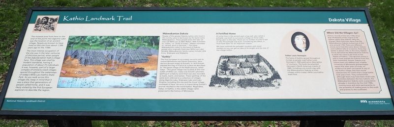
Dakota Village
Kathio Landmark Trail
| — | National Historic Landmark District | — |
Photographed by McGhiever, May 29, 2025
1. Dakota Village Marker
The mowed area from here to the end of the point into Ogechie Lake was the location of an ancient village. People are known to have lived on this site from about 1,500 years ago to the 1700s.
The most intense occupation of the site was in the later centuries of this time period, when people of the Dakota nation had a village here. This village was small by modern standards, having a population of about 75 individuals. It was, however, part of a larger complex of similarly-sized villages spaced throughout the waterways of today's Mille Lacs Kathio State Park. As you walk across this village site, keep in mind that it was a place that generations of people called home, and it was likely visited by the first European explorers to describe the region.
Mdewakanton Dakota
People of the greater Dakota nation who lived in this vicinity came to be known by the band name Mdewakanton. These people knew the lake we now call Mille Lacs as Mde Wakan. Mde translates to "water," or "body of water." Wakan translates to "sacred, spirit or spiritual." The name Mdewakanton refers to the band of Dakota people who originally lived near
this page online
"Kathio"
The first European to accurately record a visit to central Minnesota was Daniel Greysolon, Sieur duLhut (known today as Duluth). In 1679 Duluth planted the flag of France at a place he described as "the great village of the Nadouesioux, called Izatys." This great village was located at the river outlet of Mille Lacs. Izatys was Duluth's phonetic spelling of a Dakota word that was also recorded as Issatis, Isanti, and Santee. These spellings of the same term referred to a collection of villages along Ogechie Lake, Shakopee Lake and Lake Onamia, including this site and the Great Village northeast of here. An error in transcribing Duluth's journal resulted in the word Kathio. Regardless, Izatys, or Kathio, is the oldest village name preserved in the history of Minnesota.
A Fortified Home
At some time in the ancient past a log wall, also called a palisade, was built to surround a village on three sides, being open to the lake. There are no written records to tell us why the palisade was built. Considering the effort, it must have
Photographed by McGhiever, May 29, 2025
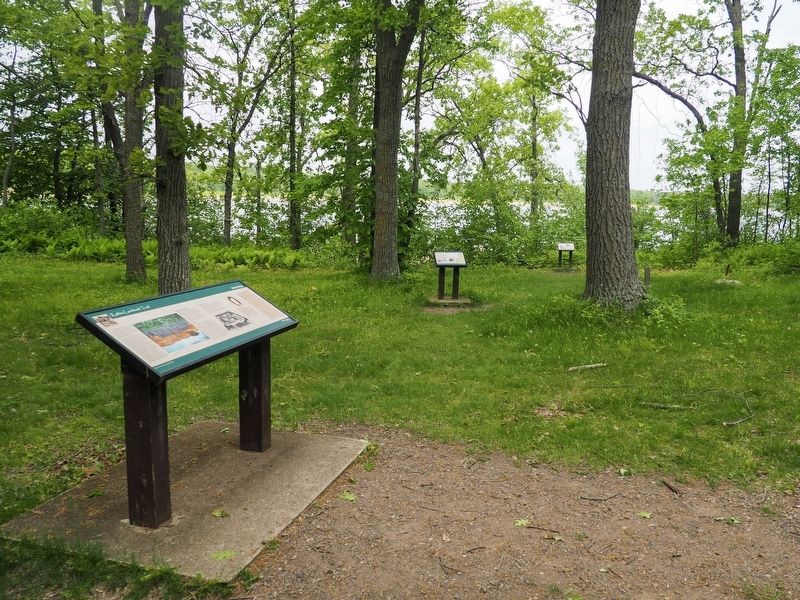
2. Dakota Village Marker at the Cooper Site on the Kathio Landmark Trail
We have outlined the palisade's location with small markers so you can get an idea of its length and the size of the village within.
Father Louis Hennepin
The fame of Kathio spread throughout Europe as people read Father Louis Hennepin's 1683 publication Description of Louisiana. The book documented Hennepin's North American travels of 1680, including a six-month stay with the Mdewakanton Dakota at their villages within today's Mille Lacs Kathio State Park.
Where Did the Villagers Go?
Historic records of the late 1700s show that inhabitants of this region to be Ojibwe rather than Dakota. Why the change? Most historians agree that the Mdewakanton Dakota moved out of this area around 1750. There are different stories as to how this came to about. Ojibwe oral tradition tells of a massive, three-day battle in about 1745. In this story, Ojibwe forces defeated the Mdewakanton Dakota in what has come to be know [sic] as the "Battle of Kathio." This decisive victory is said to have pushed the Dakota from this, their homeland, forever. Dakota oral history does not address such a battle. University of Minnesota archaeologists report that after years of study, no evidence has been uncovered at any of the Kathio village sites that would substantiate the claims that a large battle took place here. They contend that although there may have been small-scale skirmishes between the two nations, the Mdewakanton Dakota were a population already in transition by the mid-1700s, moving more and more permanently to the proximity of trading posts to the south and the prairies to the southwest.
Erected by Minnesota State Parks and Trails.
Topics. This historical marker is listed in these topic lists: Anthropology & Archaeology • Exploration • Indigenous Peoples and Communities • Wars, Non-US.
Location. 46° 8.725′ N, 93° 46.513′ W. Marker is near Onamia, Minnesota, in Mille Lacs County. It is in Mille Lacs Kathio State Park. It can be reached from the road to Ogechie Campground. The marker is at the Cooper Site on the Kathio Landmark Trail. Touch for map. Marker is at or near this postal address: 15066 Kathio State Park Road, Onamia MN 56359, United States of America. Touch for directions.

Regionally, this marker is in Central Minnesota. It is also in the American Midwest and in the Corn Belt. Globally, it is in North America, the Western Hemisphere, the Western World, and the Anglosphere. Historically, it finds itself in what was once Rupert’s Land, the territory of the Mississippian Culture, and the Northwest Territory.
Other nearby markers. At least 8 other markers are within walking distance of this marker: Archaeology Uncovers the Unwritten Past (a few steps from this marker); Ojibwe Wild Rice Harvest (within shouting distance of this marker); House & Home (within shouting distance of this marker); A Wealth of History (within shouting distance of this marker); Resources for the "Good Life" (within shouting distance of this marker); A Wealth of Resources (about 300 feet away, measured in a direct line); Ogechie Wetlands (about 600 feet away); Kathio Landmark Trail (about 600 feet away). Touch for a list and map of all markers in Onamia.
Credits. This page was last revised on September 19, 2026. It was originally submitted on September 19, 2026, by McGhiever of Minneapolis, Minnesota. This page has been viewed 4 times since then. Photos: 1, 2. submitted on September 19, 2026, by McGhiever of Minneapolis, Minnesota.
