Quaboag Plantation in West Brookfield in Worcester County, Massachusetts — The American Northeast (New England)
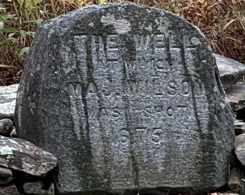
The Well
Photographed by G.W.Bartlett, September 20, 2026
1. The Well Marker
at which
Maj. Wilson
was shot
1675
Topics and series. This memorial is listed in these topic lists: Colonial Era • Forts and Castles • Indigenous Peoples and Communities • Wars, US Indian. In addition, it is included in the King Philip's War 1675-1676 series list. A significant historical month for this entry is August 1675.
Location. 42° 13.749′ N, 72° 7.423′ W. Memorial is in West Brookfield, Massachusetts, in Worcester County. It is in Quaboag Plantation. It is on Foster Hill Road just west of George Allen Road, on the left when traveling west. The marker is on private property, but is visible from the stone wall, where the fortified house marker is situated. Touch for map. Memorial is at or near this postal address: 80 Foster Hill Road, West Brookfield MA 01585, United States of America. Touch for directions.

Regionally, this memorial is in the Quiet Corner and in Greater Worcester. It is also in the American Northeast and in New England. Globally, it is in North America, the Western Hemisphere, the Western World, and the Anglosphere. Historically, it finds itself in what was once one of the original
this page online
Other nearby markers. At least 8 other markers are within walking distance of this marker: The Fortified House (a few steps from this marker); John Ayres (within shouting distance of this marker); The First and Second Meeting Houses (about 300 feet away, measured in a direct line); Thomas and Mary Millett’s Home Site (about 600 feet away); First Burial Ground (about 700 feet away); Boston Post Road (approx. 0.2 miles away); George Whitefield (approx. ¼ mile away); Judge Jebediah Foster (approx. 0.3 miles away). Touch for a list and map of all markers in West Brookfield.
Related marker. Click here for another marker that is related to this marker. The Fortified House marker
Also see . . .
1. Retreat from the Ambush & The Siege of Brookfield.
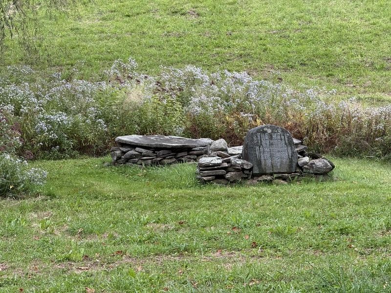
Tuesday, August 3, 1675 - The Indian attack continued throughout the day and night. Several attempts were made to ignite the house by fire arrows, combustible material on the roof and sides and by a fireball thrown into the garret. All failed because of quick action on the part of the besieged. Thomas Wilson, while attempting to obtain water from the well in(Submitted on September 21, 2026, by G.W.Bartlett of Hingham, Massachusetts.)the tavern yard, was shot in the jaw and neck, but his wounds were not severe, and he recovered.Photographed by G.W.Bartlett, September 20, 20262. The Well Marker
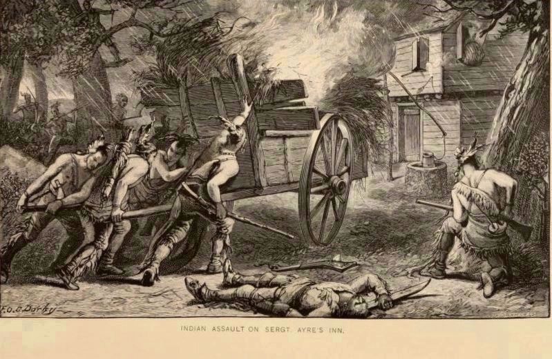
2. Indian Assault on Sergt. Ayres Inn - History of North Brookfield, Pub. 1887, pg. 84.
Excerpt from Capt. Thomas Wheeler's Narrative: They also devised other stratagems, to fire our house, on the night following, namely, they took a cart, and filled it with flax, hay and candlewood, and other combustible matter, and set up planks, fastened to the cart, to save themselves from the danger of our shot.(Submitted on September 24, 2026, by G.W.Bartlett of Hingham, Massachusetts.)
Photographed by G.W.Bartlett, September 20, 2026
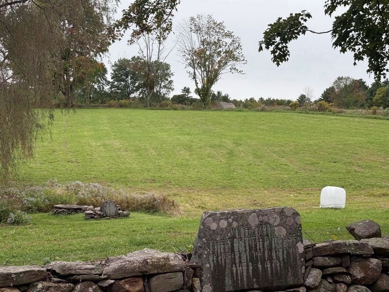
3. The Well Marker
In this photo, the fortified house marker is at the stone wall, the well is visible below the willow tree, and Indian Rock is visible at the top of the hill in the background directly above the fortified house marker.
Photographed by G.W.Bartlett, September 20, 2026
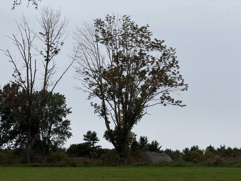
4. Indian Rock
Indian Rock atop the hill behind the well and the fortified house was a sheltering place for the attacking Nipmuck Indians during the siege. Inscription: “Indian Rock”
Photographed by G.W.Bartlett, September 23, 2026
5. Illustration of the Attack on the Fortified House
From the History of North Brookfield,
pg. 84. This perspective pictures the well and fortified house (aka Sgt. Ayres’ Tavern) from Indian Rock (left) as the rain begins to fall)
Credits. This page was last revised on September 25, 2026. It was originally submitted on September 21, 2026, by G.W.Bartlett of Hingham, Massachusetts. This page has been viewed 15 times since then. Photos: 1, 2, 3, 4. submitted on September 21, 2026, by G.W.Bartlett of Hingham, Massachusetts. 5. submitted on September 23, 2026, by G.W.Bartlett of Hingham, Massachusetts. • Michael Herrick was the editor who published this page.
