Newtown in Bucks County, Pennsylvania — The American Northeast (Mid-Atlantic)
The First Weather Satellite
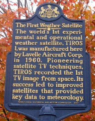
Photographed by William Fischer, Jr., October 15, 2009
1. The First Weather Satellite Marker
Erected 2001 by Pennsylvania Historical and Museum Commission.
Topics and series. This historical marker is listed in these topic lists: Air & Space • Communications • Environment • Exploration • Science & Medicine. In addition, it is included in the Pennsylvania Historical and Museum Commission (PHMC) series list. A significant historical year for this entry is 1960.
Location. 40° 13.443′ N, 74° 56.161′ W. Marker is in Newtown, Pennsylvania, in Bucks County. It is at the intersection of State Street and Sterling Street, on the right when traveling north on State Street. Marker is near the Stocking Works. Touch for map. Marker is at or near this postal address: 301 S State Street, Newtown PA 18940, United States of America. Touch for directions.

Regionally, this marker is in Southeast Pennsylvania and in Greater
this page online
Other nearby markers. At least 8 other markers are within walking distance of this marker: Stocking Works (here, next to this marker); The Fenton House (about 500 feet away, measured in a direct line); Newtown Cannery & China Company (about 600 feet away); Friends Meeting (about 700 feet away); Edward Hicks House (approx. 0.2 miles away); Edward Hicks (approx. 0.2 miles away); White Hall (approx. 0.2 miles away); Whitehall (approx. 0.2 miles away). Touch for a list and map of all markers in Newtown.
Also see . . .
1. TIROS 1 Photos & Images. (Submitted on May 25, 2010, by William Fischer, Jr. of Reynoldsburg, Ohio.)
2. The First Weather Satellite - Behind the Marker. ExplorePAHistory.com (Submitted on July 14, 2011, by Mike Wintermantel of Pittsburgh, Pennsylvania.)
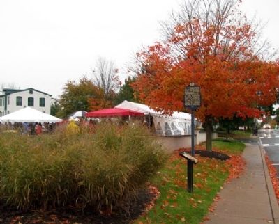
Photographed by William Fischer, Jr., October 15, 2009
2. The First Weather Satellite Marker
Looking south along State Street, with the Stocking Works at far left distance.
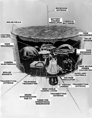
Photographed by NOAA Satellite and Information Service, April 1, 1960
3. Instruments and equipment of the TIROS I
The main sensors that provided the cloud pictures were television cameras. The TIROS cameras were slow-scan devices that take snapshots of the scene below; one "snapshot" was taken every ten seconds. These were rugged, lightweight devices weighing only about 4.5 pounds (2 kg) including the camera lense. TIROS I was equipped with two cameras. One had a wide angle lense providing views that were approximately 750 miles (1207 km) on a side (with the satellite looking straight down), and a narrow angle camera with a view that was about 80 miles (129 km) on a side.
Credits. This page was last revised on January 22, 2020. It was originally submitted on May 25, 2010, by William Fischer, Jr. of Reynoldsburg, Ohio. This page has been viewed 1,378 times since then and 67 times this year. Photos: 1, 2. submitted on May 25, 2010, by William Fischer, Jr. of Reynoldsburg, Ohio. 3. submitted on July 14, 2011, by Mike Wintermantel of Pittsburgh, Pennsylvania.
