Perry near Washtucna in Franklin County, Washington — The American West (Northwest)
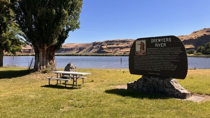
Drewyers River
Lewis and Clark Trail

Photographed by Barry Swackhamer, June 14, 2026
1. Drewyers River Marker
Erected by Washington State Department of Transportation (and co-operating agencies). (Marker Number 34.)
Topics. This historical marker is listed in these topic lists: Exploration • Indigenous Peoples and Communities • Natural Features • Waterways & Vessels. A significant historical date for this entry is October 13, 1805.
Location. 46° 35.725′ N, 118° 13.149′ W. Marker is near Washtucna, Washington,
this page online

Regionally, this marker is in the Columbia Basin. It is also in the American Mountain West and in the Lewis & Clark Corridor. Globally, it is in North America, on the Pacific Rim, in the Western Hemisphere, in the Western World, and in the Anglosphere.
Other nearby markers. At least 8 other markers are within 5 miles of this marker, measured as the crow flies: M-R Military Wagon Road (here, next to this marker); M - R Military Road (within shouting distance of this marker); Cataclysmic Floods (within shouting distance of this marker); Floods Reveal the Past (within shouting distance of this marker); Small Town, Big Voice (approx. 4.7 miles away); Overwhelming Proof for an "Outrageous" Theory (approx. 4.7 miles away); Setting the Stage (approx. 4.7 miles
Photographed by Barry Swackhamer, June 14, 2026
2. Drewyers River Marker
Credits. This page was last revised on September 26, 2026. It was originally submitted on September 24, 2026, by Barry Swackhamer of Brentwood, California. This page has been viewed 9 times since then. Photos: 1, 2. submitted on September 24, 2026, by Barry Swackhamer of Brentwood, California.
