Near Niobrara in Knox County, Nebraska — The American Midwest (Upper Plains)
The Peaceful Ponca
Photographed by William Fischer, Jr., September 17, 2026
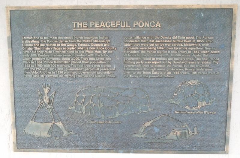
1. The Peaceful Ponca Marker
Termed one of the most developed North American Indian civilizations, the Poncas derive from the Middle Mississippi Culture and are related to the Osage, Kansas, Quapaw and Omaha. Their main villages occupied what is now Knox County. Never did they raise a warlike hand to the White Man. By the early 18th Century, traders came in contact with the tribe, which probably numbered about 3,000. They met Lewis and Clark in 1804, Prince Maximillian placed their population in 1822 at 1,750 with 300 warriors. The first treaty was signed with the Ponca in 1817 and "guaranteed" perpetual peace and friendship. Another in 1826 promised government protection. Ponce land lay between the warring Pawnee and Dakota tribes, but an alliance with the Dakota did little good.
The Poncas conducted their last successful buffalo hunt in 1855, after which they were cut off by war parties. Meanwhile, their croplands were being taken over by white squatters. Nearing starvation, the Ponca signed a new treaty in 1858 which ceded all lands to the U.S. except for 96,000 acres. Again, the government failed to protect the friendly tribe.
this page online
[Illustrations, left to right, of Ponca shelters]
Tipi · Elongated Hide Lodge · Round Earth Lodge
Hemispherical Hide Wigwam
Erected by Nebraska State Parks.
Topics. This historical marker is listed in these topic lists: Civil Rights • Disasters • Environment • Indigenous Peoples and Communities. A significant historical year for this entry is 1804.
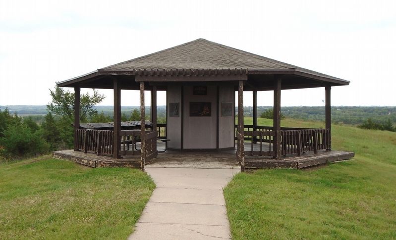
Location. 42° 45.953′ N, 98° 3.082′ W. Marker is near Niobrara, Nebraska, in Knox County. Marker is under the J. Alan Cramer Interpretive Shelter in Niobrara State Park. Touch for map. Marker is at or near this postal address: 89261 522 Avenue, Niobrara NE 68760, United States of America. Touch for directions.

Regionally, this marker is in Eastern Nebraska. It is also in the American Midwest, in the Corn Belt, and on the prairies. Globally, it is in North America, the Western
Photographed by William Fischer, Jr., September 17, 2026
2. J. Alan Cramer Interpretive Shelter Markers
Other nearby markers. At least 8 other markers are within walking distance of this marker: J. Alan Cramer Interpretive Shelter (here, next to this marker); Lewis and Clark Expedition (here, next to this marker); They Opened The West (here, next to this marker); 1846-47 Mormon Winter Camp (here, next to this marker); The Forced Removal (here, next to this marker); "We Proceeded On" (here, next to this marker); Niobrara (here, next to this marker); Early Fur Trade and Fort Mitchell (here, next to this marker). Touch for a list and map of all markers in Niobrara.
More about this marker. Nebraska State Parks entrance fee required.
Credits. This page was last revised on September 27, 2026. It was originally submitted on September 27, 2026, by William Fischer, Jr. of Reynoldsburg, Ohio. This page has been viewed 4 times since then. Photos: 1, 2. submitted on September 27, 2026, by William Fischer, Jr. of Reynoldsburg, Ohio.
