Wantirna South in Knox, Victoria, Australia — Oceania
Welcome to Shepherds Bush
Photographed by Dean Barton-Ancliffe, August 30, 2026
1. Welcome to Shepherds Bush Marker
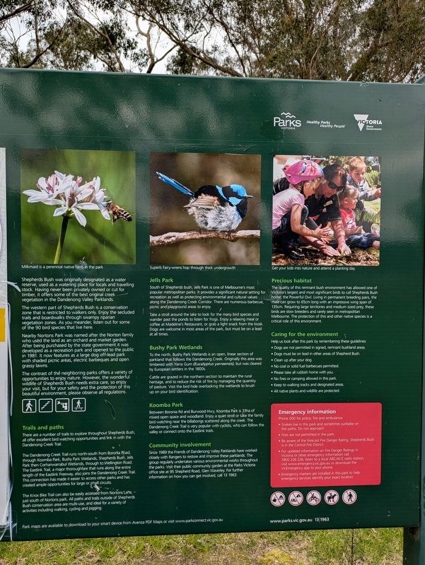
The western part of Shepherds Bush is a conservation zone that is restricted to walkers only. Enjoy the secluded trails and boardwalks through swampy riparian vegetation zones. As you meander, listen out for some of the 90 bird species that live here.
Nearby Nortons Park was named after the Norton family who used the land as an orchard and market garden. After being purchased by the state government it was developed as a recreation park and opened to the public in 1981. It now features as a large dog off-lead park with shaded picnic areas, electric barbeques and open grassy lawns.
The contrast of the neighbouring parks offers a variety of opportunities to enjoy nature. However, the wonderful wildlife of Shepherds Bush needs extra care, so enjoy your visit, but for your safety and the protection of this beautiful environment, please observe all regulations.
Trails and paths
There
this page online
The Dandenong Creek Trail runs north-south from Boronla Road, through Koomba Park, Bushy Park Wetlands, Shepherds Bush, Jells Park then Corhanwarrabul Wetlands, through to Wellington Road. The Eastlink Trail, a major thoroughfare that runs along the entire length of the Eastlink Freeway, also joins the Dandenong Creek Trail. This connection has made it easier to access other parks and has created ample opportunities for large or small circuits.
The Knox Bike Trail can also be easily accessed from Nortons Lane, just south of Nortons park. All paths and trails outside of Shepherds Bush conservation area are multi-use, and ideal for a variety of activities including walking, cycling and jogging.
Jells Park
South of Shepherds bush, Jells Park is one of Melbourne's most popular metropolitan parks: It provides a significant natural setting for recreation as well as protecting environmental and cultural values along the Dandenong Creek Corridor. There are numerous barbecue, picnic
Photographed by Dean Barton-Ancliffe, August 30, 2026
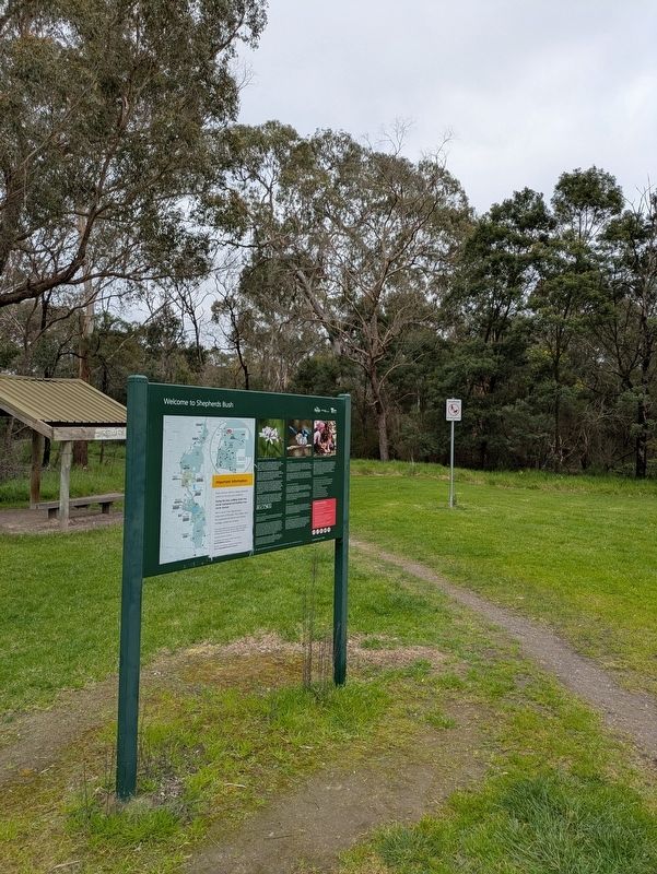
2. Welcome to Shepherds Bush Marker at the entrance to the Park
Take a stroll around the lake to look for the many bird species and wander past the ponds to listen for frogs. Enjoy a relaxing meal or coffee at Madeline's Restaurant, or grab a light snack from the kiosk. Dogs are welcome in most areas of the park, but must be on a lead at all times.
Bushy Park Wetlands
To the north, Bushy Park Wetlands is an open, linear section of parkland that follows the Dandenong Creek. Originally this area was timbered with Yarra Gum (Eucalyptus yarraensis), but was cleared by European settlers in the 1800s.
Cattle are grazed in the northern section to maintain the rural heritage, and to reduce the risk of fire by managing the quantity of pasture. Visit the bird hide overlooking the wetlands to brush up on your bird identification.
Koomba Park
Between Boronia Rd and Burwood Hwy, Koomba Park is 33ha of mixed open space and woodland. Enjoy a quiet stroll or take the family bird watching near the billabongs scattered along the creek. The Dandenong Creek Trail is very popular with cyclists, who can follow the valley or connect onto the Eastlink trails.
Community involvement
Since 1989 the Friends of Dandenong Valley Parklands have worked closely with Rangers to restore and improve these parklands. The group regularly undertakes various environmental works throughout the parks. Visit their public community garden at the Parks Victoria office site at 95 Shepherd Road, Glen Waverley. For further information on how you can get involved, call 13 1963.
Precious habitat
The quality of this remnant bush environment has allowed one of Victoria's largest and most significant birds to call Shepherds Bush home; the Powerful Owl. Living in permanent breeding pairs, the male can grow to 65cm long with an impressive wing span of 135cm. Requiring large territories and medium sized prey, these birds are slow breeders and rarely seen in metropolitan Melbourne. The protection of this and other native species is a critical role of this environment.
Erected by Parks Victoria.
Topics. This historical marker is listed in these topic lists: Agriculture • Environment • Horticulture & Forestry • Parks & Recreational Areas. A significant historical year for this entry is 1981.
Location. 37° 52.63′ S, 145° 11.536′ E. Marker is in Wantirna South, Victoria, in Knox. It is on High Street Road (Victoria Route 24) 0.3 kilometers east of Almray Place, on the left when traveling west. Touch for map. Marker is at or near this postal address: 1030 High Street Road, Wantirna South VIC 3152, Australia. Touch for directions.

Regionally, it is in Oceania, in Australasia, in the Pacific Ocean, in South Pacific, on the Pacific Rim, in the Western World, and in the Anglosphere. Historically, it finds itself in what was once a British colony.
Other nearby markers. At least 8 other markers are within 5 kilometers of this marker, measured as the crow flies: Honour Roll World War I (approx. 2.6 kilometers away); Honour Roll World War II (approx. 2.6 kilometers away); Shire of Mulgrave Honour Roll Cenotaph (approx. 2.6 kilometers away); Glen Waverley Uniting Church (approx. 2.6 kilometers away); Scoresby Wesleyan Church (approx. 4.2 kilometers away); Original Scoresby School (approx. 4.2 kilometers away); The Opperman Trails (approx. 4.4 kilometers away); Indigenous History and Mapping the Past (approx. 4.9 kilometers away).
Credits. This page was last revised on September 28, 2026. It was originally submitted on September 27, 2026, by Dean Barton-Ancliffe of Rowville, Victoria. This page has been viewed 4 times since then. Photos: 1, 2. submitted on September 27, 2026, by Dean Barton-Ancliffe of Rowville, Victoria. • Andrew Ruppenstein was the editor who published this page.
