Near Danbury in Burnett County, Wisconsin — The American Midwest (Great Lakes)
Namekagon Barrens
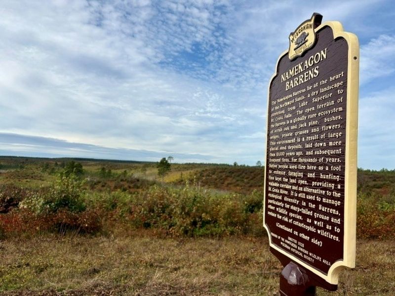
Photographed by Mallory Hanson
1. Namekagon Barrens Marker
The Namekagon Barrens lie at the heart of the Northwest Sands, a dry landscape stretching from Lake Superior to St. Croix Falls. The open terrain of the Barrens is a globally rare ecosystem of scrub oak and jack pine, bushes, sedges, prairie grasses and flowers. This environment is a result of large glacial sand deposits, laid down more than 10,000 years ago, and subsequent frequent fires. For thousands of years, Native people used fire here as a tool to enhance foraging and hunting. Fire kept the land open, providing a walkable corridor and an alternative to the St. Croix River. It is still used to manage ecological diversity in the Barrens, particularly for sharp-tailed grouse and other wildlife species, as well as to reduce the risk of catastrophic wildfires.
By the 1850s, a road from St. Paul to Bayfield passed near this spot. The route followed long-established Native American trails and aided settlement in the region. This was among the first recognized vehicular roads in Northwest Wisconsin. By the 1860s, it carried regular stagecoach traffic. A bridge built over the Namekagon River a mile north of here served
this page online
Erected 2026 by Friends of the Namekagon Barrens Wildlife Area, Wisconsin Historical Society. (Marker Number 645.)
Topics. This historical marker is listed in these topic lists: Bridges & Viaducts • Environment • Indigenous Peoples and Communities • Roads & Vehicles. A significant historical year for this entry is 1863.
Location. 46° 4.5′ N, 92° 7.15′ W. Marker is near Danbury, Wisconsin, in Burnett County. It can be reached from the intersection of Namekagon Trail and West Adams Lake Road, on the right when traveling east. About 3 miles north of Hwy 77, on Namekagon Trail just north of its intersection with Springbrook Trail on the South Unit. Touch for map. Marker is at or near this postal address: 32102 Namekagon Trail, Danbury WI 54830, United States of America. Touch for directions.

Regionally, this marker is in Western Wisconsin. It is also in the American Midwest and in the Corn Belt. Globally, it is in North America, the Great North Woods, the Western Hemisphere, the Western World, and the Anglosphere. Historically, it finds itself in what was once the territory of the Mississippian Culture and also the Northwest Territory.
Credits. This page was last revised on October 14, 2026. It was originally submitted on October 5, 2026, by Mallory Hanson of Madison, Wisconsin. This page has been viewed 6 times since then. Photo 1. submitted on October 5, 2026, by Mallory Hanson of Madison, Wisconsin. • Devry Becker Jones was the editor who published this page.
Editor’s want-list for this marker. Clearer photo of the marker. • Photo of the reverse of the marker. • Wide shot of the marker in context. • Can you help?
