La Junta in Otero County, Colorado — The American Mountains (Southwest)
The Purgatoire River Region
Higbee
Photographed by Leslie Eudy, October 3, 2026
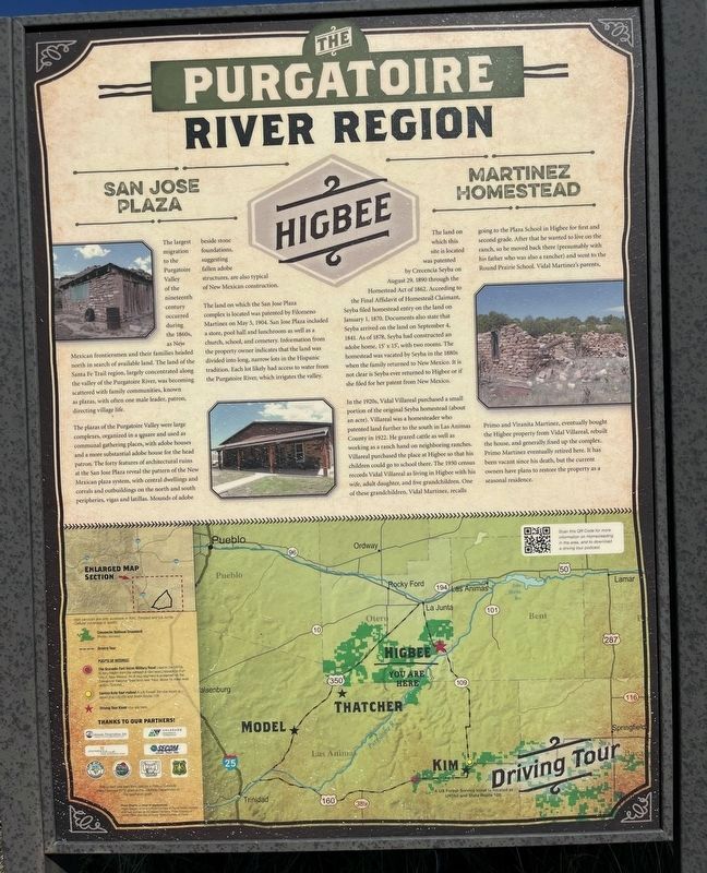
1. The Purgatoire River Region Marker - Left Panel
The Purgatoire River Region
San Jose Plaza
The largest migration to the Purgatoire Valley of the nineteenth century occurred during the 1860s, as New Mexican frontiersmen and their families headed north in search of available land. The land of the Santa Fe Trail region, largely concentrated along the valley of the Purgatoire River, was becoming scattered with family communities, known as plazas, with often one male leader, patron, directing village life.
The plazas of the Purgatoire Valley were large complexes, organized in a square and used as communal gathering places, with adobe houses and a more substantial adobe house for the head patron. The forty features of architectural ruins at the San Jose Plaza reveal the pattern of the New Mexican plaza system, with central dwellings and corrals and outbuildings on the north and south peripheries, vigas and latillas. Mounds of adobe beside stone foundations, suggesting fallen adobe structures, are also typical of New Mexican construction. The land on which the San Jose Plaza complex is located was patented by Filomeno Martinez on May 5, 1904. San Jose Plaza included
this page online
Martinez Homestead
The land on which this site is located was patented by Crecencia Seyba on August 29, 1890 through the Homestead Act of 1862. According to the Final Affidavit of Homestead Claimant, Seyba filed homestead entry on the land on January 1, 1870. Documents also state that Seyba arrived on the land on September 4, 1841. As of 1878, Seyba had constructed an adobe home, 15’ by 15’, with two rooms. The homestead was vacated by Seyba in the 1880s when the family returned to New Mexico. It is not clear if Seyba ever returned to Higbee or if she filed for her patent from New Mexico.
In the 1920s, Vidal Villareal purchased a small portion of the original Seyba homestead (about an acre). Villareal was a homesteader who patented land further to the south in Las Animas County in 1922. He grazed cattle as well as working as a ranch hand on
Photographed by Leslie Eudy, October 3, 2026
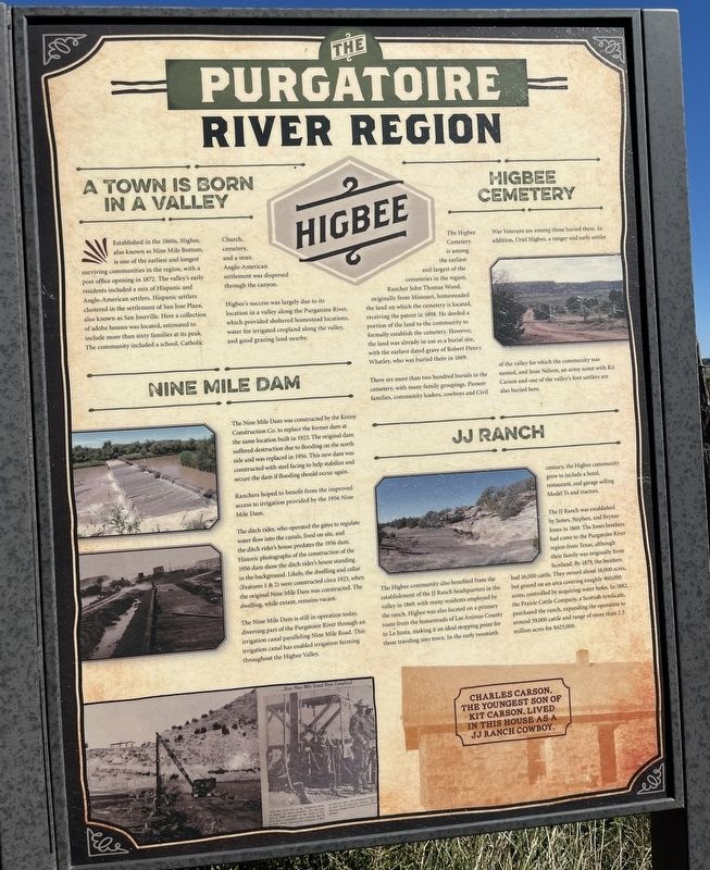
2. The Purgatoire River Region Marker - Right Panel
Panel 2 – (right side)
A Town is Born in a Valley
Established in the 1860s, Higbee, also known as Nine Mile Bottom, is one of the earliest and longest surviving communities in the region, with a post office opening in 1872. The valley’s early residents included a mix of Hispanic and Anglo-American settlers. Hispanic
Photographed by Leslie Eudy, October 3, 2026
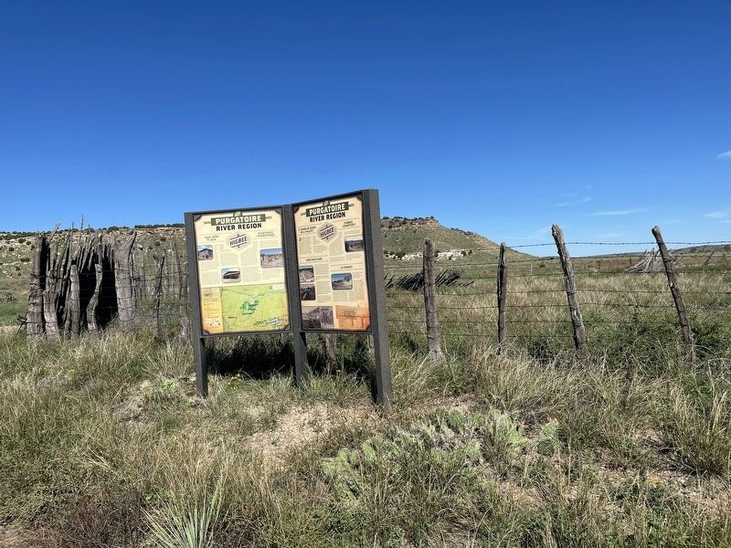
3. The Purgatoire River Region Marker Wide View
Higbee’s success was largely due to its location in a valley along the Purgatoire River, which provided sheltered homestead locations, water for irrigated cropland along the valley, and good grazing land nearby.
Nine Mile Dam
The Nine Mile Dam was constructed by the Kenny Construction Co. to replace the former dam at the same location built in 1923. The original dam suffered destruction due to flooding on the north side and was replaced in 1956. This new dam was constructed with steel facing to help stabilize and secure the dam if flooding should occur again.
Ranchers hoped to benefit from improved access to irrigation provided by the 1956 Nine Mile Dam.
The ditch rider, who operated the gates to regulate water flow into the canals, lived on site, and the ditch rider’s house predates the 1956 dam. Historic
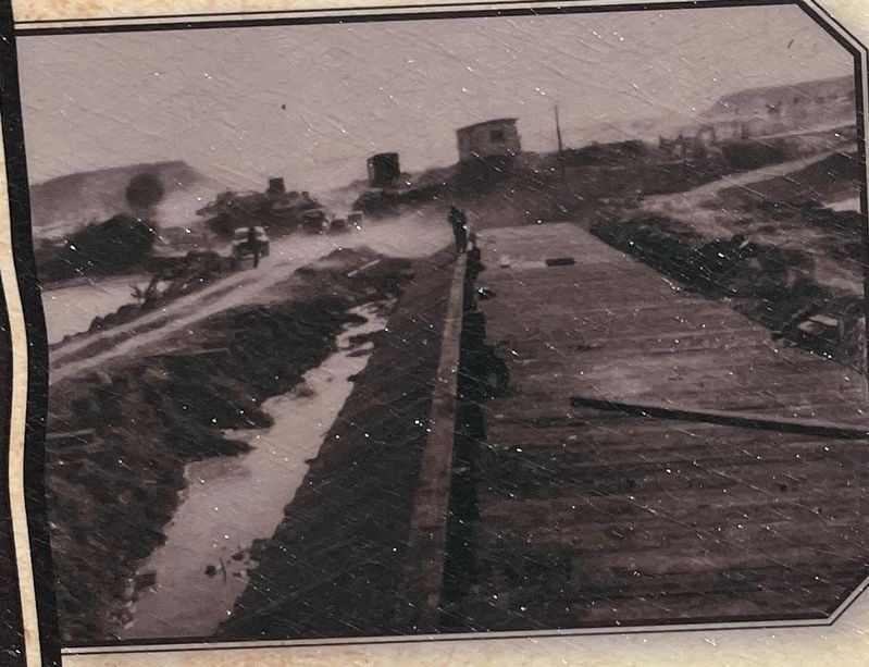
4. Historic Photo of Nine Mile Dam up close
The Nine Mile Dam is still in operation today, diverting part of the Purgatoire River through an irrigation canal paralleling Nine Mile Road. This irrigation canal has enabled irrigation farming throughout the Higbee Valley.
Higbee Cemetery
The Higbee Cemetery is among the earliest and largest of the cemeteries in the region. Rancher John Thomas Wood, originally from Missouri, homesteaded the land on which the cemetery is located, receiving the patent in 1898. He deeded a portion of the land to the community to formally establish the cemetery. However, the land was already in use as a burial site, with the earliest dated grave of Robert Henry Whatley, who was buried there in 1869.
There are more than two hundred burials in the cemetery, with many family groupings. Pioneer families, community leaders, cowboys, and Civil War Veterans are among those buried
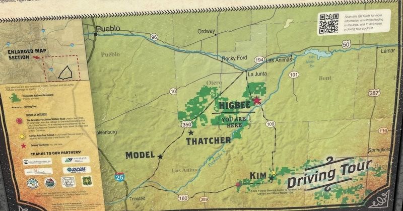
Photographed by Leslie Eudy, October 3, 2026
5. Map Detail
JJ Ranch
The Higbee community also benefited from the establishment of the JJ Ranch headquarters in the valley in 1869, with many residents employed by the ranch. Higbee was also located on a primary route from the homesteads of Las Animas County to La Junta, making it an ideal stopping point for those traveling into town. In the early twentieth century, the Higbee community grew to include a hotel, restaurant, and garage selling Model Ts and tractors.
The JJ Ranch was established by James, Stephen, and Peyton Jones in 1869. The Jones brothers had come to the Purgatoire River region from Texas, although their family was originally from Scotland. By 1879, the brothers had 16,000 cattle. They owned about 18,000 acres, but grazed on an area covering roughly 960,000 acres, controlled by acquiring water holes. In 1882, the Prairie Cattle Company, a Scottish syndicate, purchased the ranch, expanding the operation to around 59,000 cattle and range of more than 2.5 million acres for $625,000.
Topics. This historical marker is listed in these topic lists: Agriculture • Cemeteries & Burial Sites • Hispanic Americans • Settlements & Settlers.
Location. 37° 46.505′ N, 103° 26.215′ W. Marker is in La Junta, Colorado, in Otero County. It is on Spring Valley Road. Touch for map. Marker is in this post office area: La Junta CO 81050, United States of America. Touch for directions.

Regionally, this marker is in the Arkansas River Valley and in the Eastern Plains. It is also in the American Mountain West, on the Great Plains, on the Southern Plains, on the High Plains, and on the Santa Fe Trail Corridor. Globally, it is in North America, the Western Hemisphere, the Western World, and the Anglosphere. Historically, it finds itself in what was once the Comanchería, the Dust Bowl, and the Republic of Texas.
Other nearby markers. At least 7 other markers are within 17 miles of this marker, measured as the crow flies: Dolores Mission and Cemetery (approx. 12.6 miles away); Dinosaur Shoulder Blade From An Apatosaurus (approx. 13½ miles away); The Largest Tracksite in North America (approx. 13.9 miles away); Life at Dinosaur Lake (approx. 14 miles away); The Site from the Sky (approx. 14 miles away); Rourke Ranch Historic District 1900-1971 (approx. 16.7 miles away); History of the Rourke Family and Wineglass Ranch, 1871-1900 (approx. 16.7 miles away).
Credits. This page was last revised on October 13, 2026. It was originally submitted on October 12, 2026, by Leslie Eudy of Golden, Colorado. This page has been viewed 5 times since then. Photos: 1, 2, 3, 4, 5. submitted on October 12, 2026, by Leslie Eudy of Golden, Colorado. • Andrew Ruppenstein was the editor who published this page.
