Norwell in Plymouth County, Massachusetts — The American Northeast (New England)
Jacobs Pond
Photographed by G.W.Bartlett, October 16, 2026
1. Jacobs Pond Marker
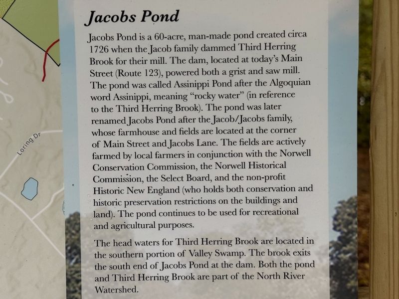
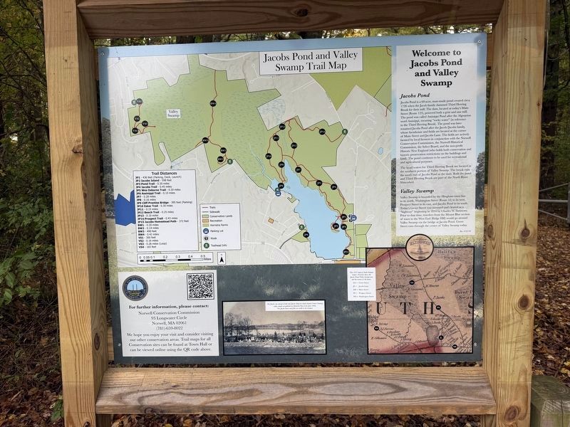
Jacobs Pond is a 60-acre, man-made pond created circa 1726 when the Jacob family dammed Third Herring Brook for their mill. The dam, located at today's Main Street (Route 123), powered both a grist and saw mill. The pond was called Assinippi Pond after the Algoquian word Assinippi, meaning "rocky water" (in reference to the Third Herring Brook). The pond was later renamed Jacobs Pond after the Jacob/Jacobs family, whose farmhouse and fields are located at the corner of Main Street and Jacobs Lane. The fields are actively farmed by local farmers in conjunction with the Norwell Conservation Commission, the Norwell Historical Commission, the Select Board, and the non-profit Historic New England (who holds both conservation and historic preservation restrictions on the buildings and land). The pond continues to be used for recreational and agricultural purposes.
The head waters for Third Herring Brook are located in the southern portion of Valley Swamp. The brook exits the south end of Jacobs Pond at the dam. Both the pond and Third Herring Brook are part of the North River Watershed.
Valley Swamp
Valley Swamp is
this page online
Today’s Grove Street was surveyed and cleared as a “highway” beginning in 1834 by Charles W. Simmons. Prior to that time travelers from the Mount Blue section of town to the West End (Ridge Hill) would go around Valley Swamp via the bridge at Jacobs Pond. Grove Street runs through the center of Valley Swamp today.
Erected 2026 by Norwell Conservation Commission.
Topics. This historical marker is listed in these topic lists: Colonial Era • Parks & Recreational Areas • Settlements & Settlers • Waterways & Vessels. A significant historical year for this entry is 1726.
Location. 42° 9.716′ N, 70° 50.7′ W. Marker is in Norwell, Massachusetts, in Plymouth County. It is at the intersection of Jacobs Lane and Laura’s Lane, on the left when traveling north on Jacobs Lane. Touch for map. Marker is in this post office area: Norwell MA 02061, United States of America. Touch for directions.

Regionally, this marker is on the South Shore. It is also in the American Northeast,
Photographed by G.W.Bartlett, October 16, 2026
2. Jacobs Pond Marker
Other nearby markers. At least 8 other markers are within 5 miles of this marker, measured as the crow flies: Jacobs Homestead Property History (within shouting distance of this marker); Nathan Cushing (approx. 2 miles away); The “Columbia” (approx. 2.7 miles away); General History (approx. 3.8 miles away); US Military History (approx. 3.9 miles away); Hingham Second Parish Church (approx. 3.9 miles away); Chief Wompatuck (approx. 4.1 miles away); On North River (approx. 4.2 miles away). Touch for a list and map of all markers in Norwell.
Related marker. Click here for another marker that is related to this marker.
Also see . . .
1. Jacobs Pond and Valley Swamp Trail Map.
Map of the trails at Jacobs Pond Conservation Area.(Submitted on October 16, 2026, by G.W.Bartlett of Hingham, Massachusetts.)
2. Norwell Conservation Commission.
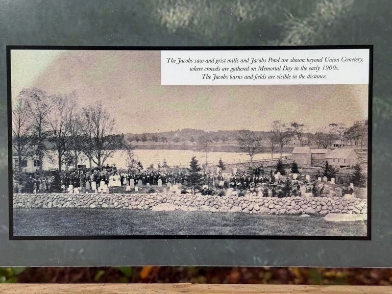
The(Submitted on October 18, 2026, by G.W.Bartlett of Hingham, Massachusetts.)Conservation Commission is responsible for the stewardship of Norwell's Conservation lands, and the regulatory administration and enforcement of the Massachusetts Wetlands Protection Act, the Norwell Wetland Bylaw, and the Norwell Stormwater Management Bylaw.Photographed by G.W.Bartlett, October 16, 20263. Jacobs Saw and Grist Mills on Jacobs PondThe Jacobs’ saw and grist mills and Jacobs Pond are shown beyond Union Cemetery, where crowds are gathered for Memorial Day in the early 1900s.
The Jacobs barns and fields are visible in the distance.
3. North and South Rivers Watershed Association.
Healthy rivers and waters don’t happen on their own. It takes education, advocacy, action, and a community that cares to protect our waters.(Submitted on October 18, 2026, by G.W.Bartlett of Hingham, Massachusetts.)
Photographed by G.W.Bartlett, October 16, 2026
4. Jacobs Pond Marker
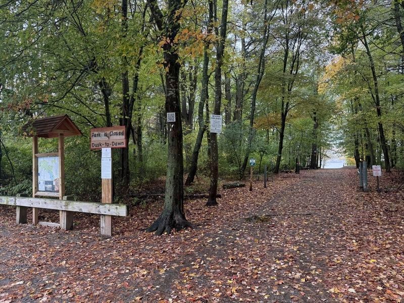
In addition to walking trails, Jacobs Pond Conservation Area includes vehicle access via a boat launch for recreational canoes and kayaks (check rules).
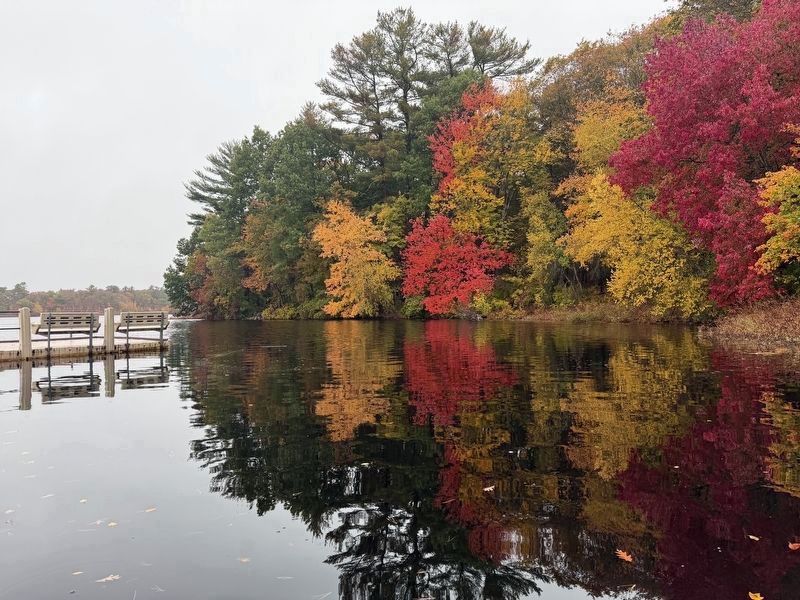
Photographed by G.W.Bartlett, October 16, 2026
5. Jacobs Pond Boat Launch Dock
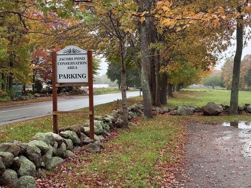
Photographed by G.W.Bartlett, October 16, 2026
6. Jacobs Pond Conservation Area
Credits. This page was last revised on October 22, 2026. It was originally submitted on October 16, 2026, by G.W.Bartlett of Hingham, Massachusetts. This page has been viewed 15 times since then. Photos: 1, 2, 3, 4, 5, 6. submitted on October 16, 2026, by G.W.Bartlett of Hingham, Massachusetts. • Michael Herrick was the editor who published this page.
