Bandelier National Monument near White Rock in Los Alamos County, New Mexico — The American Mountains (Southwest)
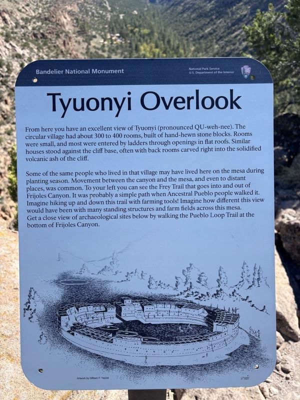
Tyuonyi Overlook
| — | Bandelier National Monument | — |
Photographed by Benjamin Rubin, October 16, 2026
1. Tyuonyi Overlook Marker
Some of the same people who lived in that village may have lived here on the mesa during planting season. Movement between the canyon and the mesa, and even to distant places, was common. To your left you can see the Frey Trail that goes into and out of Frijoles Canyon. It was probably a simple path when Ancestral Pueblo people walked it. Imagine hiking up and down this trail with farming tools! Imagine how different this view would have been with many standing structures and farm fields across this mesa. Get a close view of archaeological sites below by walking the Pueblo Loop Trail at the bottom of Frijoles Canyon.
Erected by National Park Service, U.S. Department of the Interior.
Topics. This historical marker is listed in these topic lists: Anthropology & Archaeology
this page online
Location. 35° 47.123′ N, 106° 16.585′ W. Marker is near White Rock, New Mexico, in Los Alamos County. It is in Bandelier National Monument. It can be reached from State Highway 4, on the right when traveling east. This marker is at the end of the Tyuonyi Overlook Trail, in Bandelier National Monument. Touch for map. Marker is in this post office area: Los Alamos NM 87544, United States of America. Touch for directions.

Regionally, this marker is in Northern New Mexico. It is also in the American Southwest. Globally, it is in North America, the Rocky Mountains, the Western Hemisphere, the Western World, and the Anglosphere. Historically, it finds itself in what was once New Spain and also the territory of the Ancestral Puebloans.
Other nearby markers. At least 8 other markers are within 7 miles of this marker, measured as the crow flies: Sacred Spaces (about 400 feet away, measured in a direct line); The Role of Fire (about 500 feet away); Plants (approx. 0.2 miles away);
Horace Swartley Poley (courtesy Denver Public Library), 1915
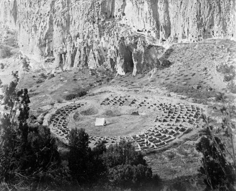
2. Tyuonyi- excavation complete
“View of Tyuonyi ruins, Native American (Anasazi) pueblo ruins, near Frijoles Canyon, Bandelier National Monument, New Mexico. The ruins stand, after excavation, in a circular formation. Three kiva holes and a tent are in the middle. A section of Frijoles Canyon is visible in the background.”
Also see . . . Tyuonyi (National Park Service). (Submitted on November 3, 2026.)
Credits. This page was last revised on November 3, 2026. It was originally submitted on October 18, 2026, by Benjamin Rubin of Columbia, South Carolina. This page has been viewed 19 times since then. Photos: 1. submitted on October 18, 2026, by Benjamin Rubin of Columbia, South Carolina. 2. submitted on November 3, 2026. • Andrew Ruppenstein was the editor who published this page.
