Near Great Falls in Cascade County, Montana — The American West (Mountains)
The Portage Route
Ancient Landscapes Ancient Obstacles
Photographed by Barry Swackhamer, June 23, 2026
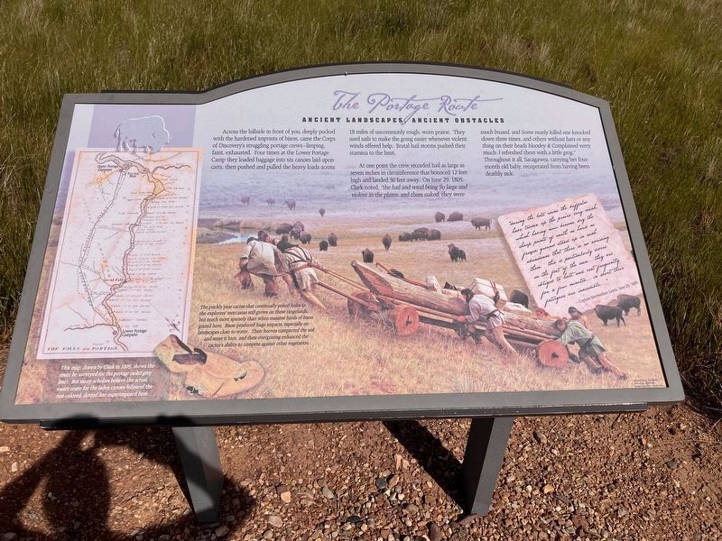
1. The Portage Route Marker
Caption: (lower left-of-center) The prickly pear cactus that continually poked holes in the explorers moccasins will grow on these rangelands, but much more sparsely than when massive herds of bison grazed here. Bison produced huge impacts, especially on landscapes closer to water. Their hooves compacted the soil and wore it bare, and their overgrazing enhanced the cactus's ability to compete against other vegetation.
At one point the crew recorded hail as large as seven inches in circumference that bounced 12 feet high and landed 30 feet away. On June 29, 1805, Clark noted, "the hail and wind being So large and violent in the plains and them naked, they were much brused, and Some nearly killed one knocked down three times, and others without hats or any thing on their heads bloodey & Complained verry much; I refreshed them with a little grog."
Throughout it all, Sacagawea, carrying her four-month old baby, recuperated from having been deathly sick.
"during the late rains the buffaloe have trodden up the prairie very much, which having now become dry the sharp points of the earth as hard as frozen ground and up in such abundance that there is no avoiding them. this is particularly sever on the feet of the men... they are obliged to halt and rest frequently for a few minutes... in short their fatigues are incredible... "
this page online
Captain Meriwether Lewis, June 23, 1805.
Erected by Montana State University, Bozeman; U.S. Dept. of the Interior; Montana Stock Growers Association.
Topics and series. This historical marker is listed in these topic lists: Environment • Exploration • Roads & Vehicles • Women. In addition, it is included in the Lewis & Clark Expedition series list. A significant historical date for this entry is June 23, 1805.
Location. 47° 27.868′ N, 111° 17.614′ W. Marker is near Great Falls, Montana, in Cascade County. It can be reached from 40th Avenue South near 13th Street South, on the left when traveling west. Touch for map. Marker is at or near this postal address: 700 40th Avenue South, Great Falls MT 59405, United States of America. Touch for directions.

Regionally, this marker is in andspecifically entral Montana in Russell Country. It is also in the American Mountain West and in the Lewis & Clark Corridor. Globally, it is in North America, the Rocky Mountains, the Western Hemisphere, the Western World, and the Anglosphere. Historically, it finds itself in what was once Rupert’s Land and also the Louisiana Purchase.
Photographed by Barry Swackhamer, June 23, 2026
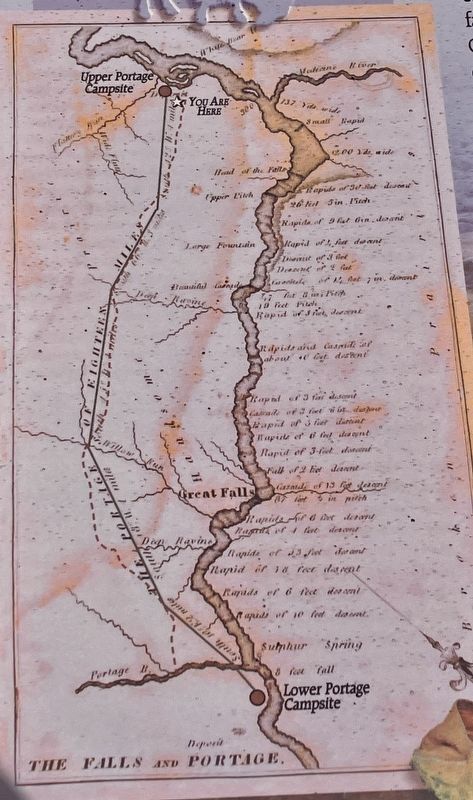
2. The Portage Route Marker, detail on the left
This map, drawn by Clark in 1805, shows the route he surveyed for the portage (solid grey line). But many scholars believe the actual, easier route for the laden canoes followed the rust-colored dotted line superimposed here.
Other nearby markers. At least 8 other markers are within 2 miles of this marker, measured as the crow flies: Upper Portage Camp (a few steps from this marker); Welcome to the Upper Portage Overlook (a few steps from this marker); Lewis's Grand Experiment (a few steps from this marker); White Bear Islands (within shouting distance of this marker); Commissary of the Plains (approx. 2 miles away); The Falls: Obstacle or Opportunity (approx. 2 miles away); The Portage Around the Falls (approx. 2 miles away); Explorers at the Portage (approx. 2 miles away). Touch for a list and map of all markers in Great Falls.
Photographed by Barry Swackhamer, June 23, 2026
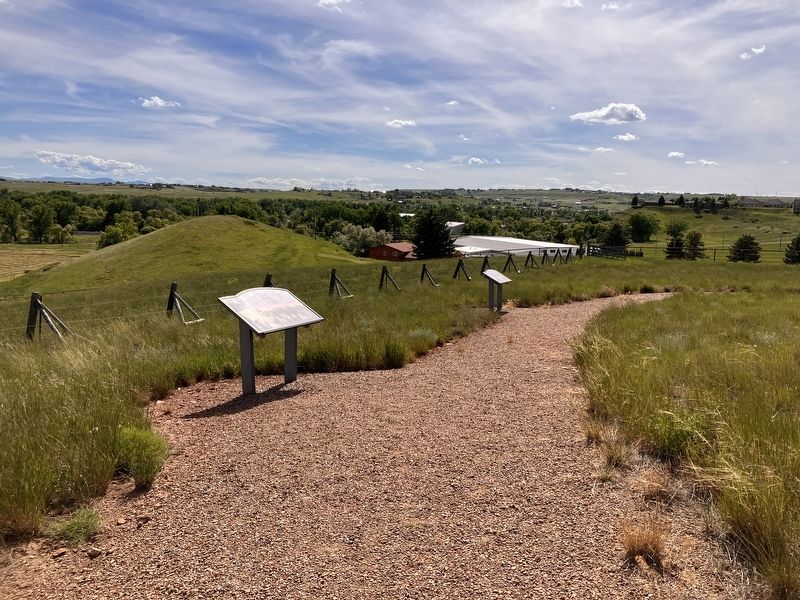
3. The Portage Route Marker
Credits. This page was last revised on October 18, 2026. It was originally submitted on October 18, 2026, by Barry Swackhamer of Brentwood, California. This page has been viewed 8 times since then. Photos: 1, 2, 3. submitted on October 18, 2026, by Barry Swackhamer of Brentwood, California.
