Valley Park in St. Louis County, Missouri — The American Midwest (Upper Plains)
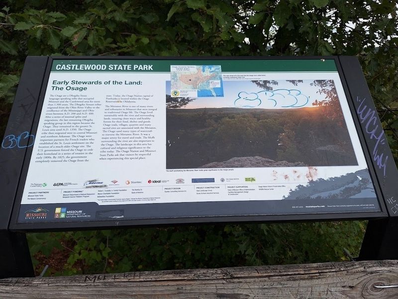
Early Stewards of the Land: The Osage
Castlewood State Park
Photographed by Jason Voigt, September 26, 2026
1. Early Stewards of the Land: The Osage Marker
The Osage are a Dhegiha Sioux language-speaking tribe that occupied Missouri and the Castlewood area for more than 1,500 years. The Dhegiha Siouan tribes migrated from the Ohio River Valley to the confluence of the Mississippi and Ohio rivers between A.D. 200 and A.D. 400. After a series of internal splits and migrations, the last remaining Dhegiha speaking group in this region became the Osage. They remained in the greater St. Louis area until A.D. 1350. The Osage tribe then migrated west to central Missouri and northern Arkansas. The Osage were important partners for French traders who established the St. Louis settlement on the location of a much older Osage site. The U.S. government forced the Osage to cede their homeland in a series of treaties in the early 1800s. By 1825, the government completely removed the Osage from the state. Today, the Osage Nation capital of Pawhuska is located within the Osage Reservation in Oklahoma.
The Meramec River is one of many rivers and tributaries in Missouri that were integral to traditional Osage life. The Osage lived sustainably with the river and surrounding lands, ensuring
this page online
Erected by Missouri Department of Natural Resources and Missouri State Parks.
Topics. This historical marker is listed in these topic lists: Indigenous Peoples and Communities • Parks & Recreational Areas • Settlements & Settlers • Waterways & Vessels. A significant historical year for this entry is 1350.
Location. 38° 32.88′ N, 90° 32.518′ W. Marker is in Valley Park, Missouri, in St. Louis County. It can be reached from Kiefer Creek Road east of Ries Road. Marker is located off a nature trail at Castlewood State Park. Touch for map. Marker is at or near this postal address: 1503 Kiefer
Photographed by Jason Voigt, September 26, 2026
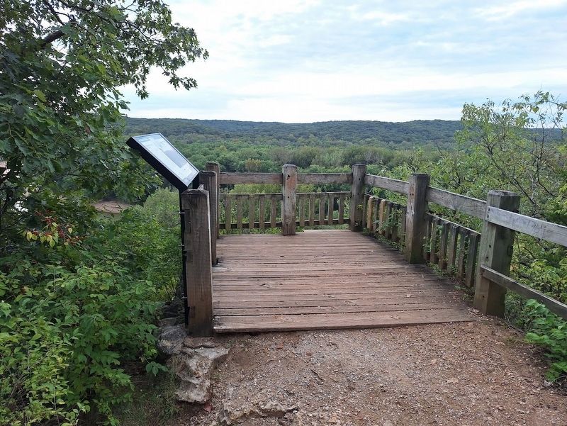
2. Early Stewards of the Land: The Osage Marker
Located off a viewing point on the Lone Wolf trail at Castlewood State Park

Regionally, this marker is in Greater St. Louis. It is also in the American Midwest, in the Lewis & Clark Corridor, in the Corn Belt, and in the Great River Road Region. Globally, it is in North America, the Western Hemisphere, the Western World, and the Anglosphere. Historically, it finds itself in what was once the Viceroyalty of New France, the territory of the Mississippian Culture, the Louisiana Purchase, and the Antebellum South.
Other nearby markers. At least 8 other markers are within 4 miles of this marker, measured as the crow flies: 20th Century History of Castlewood (approx. 0.4 miles away); 1935 Frisco Caboose (approx. 2.7 miles away); Planters (approx. 2.8 miles away); Veterans Memorial (approx. 3 miles away); Site of John Ball Homestead (approx. 3.1 miles away); Harugari Cemetery (approx. 3.3 miles away); Dedicated to World Peace (approx. 3.3 miles away); Medium Towed Howitzer, 155mm (approx. 3.4 miles away). Touch for a list and map of all markers in Valley Park.
Regarding Early Stewards of the Land: The Osage. Accessing the marker requires hiking up a steep, unpaved trail. It is on the Lone Wolf trail, not far from the Lone Wolf parking lot. At the time of my visit, part of the River Scene trail was closed off for various reasons.
Also see . . . Castlewood State Park (Missouri State Parks). General information about the park and the trails. (Submitted on October 23, 2026, by Jason Voigt of Glen Carbon, Illinois.)
Credits. This page was last revised on October 23, 2026. It was originally submitted on October 23, 2026, by Jason Voigt of Glen Carbon, Illinois. This page has been viewed 6 times since then. Photos: 1, 2. submitted on October 23, 2026, by Jason Voigt of Glen Carbon, Illinois.
