Near Guernsey in Platte County, Wyoming — The American West (Mountains)
In the Path of History
Photographed by William Fischer, Jr., September 27, 2026
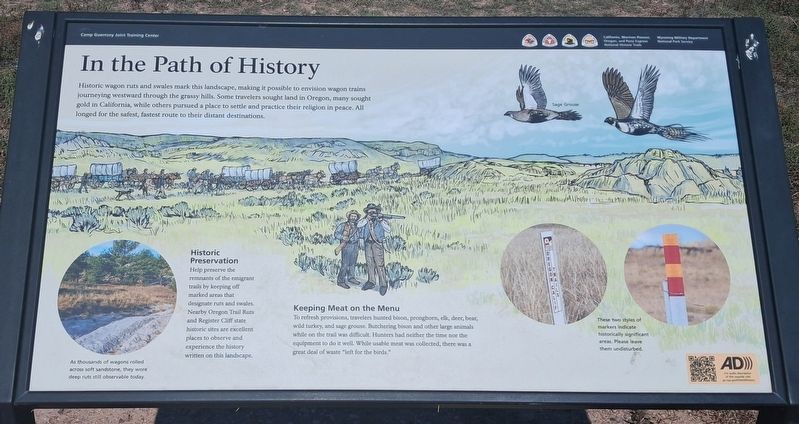
1. In the Path of History Marker
Historic wagon ruts and swales mark this landscape, making it possible to envision wagon trains journeying westward through the grassy hills. Some travelers sought land in Oregon, many sought gold in California, while others pursued a place to settle and practice their religion in peace. All longed for the safest, fastest route to their distant destinations.
[Bottom left inset photo caption reads]
As thousands of wagons rolled across soft sandstone, they wore deep ruts still observable today.
Historic Preservation
Help preserve the remnants of the emigrant trails by keeping off marked areas that designate ruts and swales. Nearby Oregon Trail Ruts and Register Cliff state historic sites are excellent places to observe and experience the history written on this landscape.
Keeping Meat on the Menu
To refresh provisions, travelers hunted bison, pronghorn, elk, deer, bear, wild turkey, and sage grouse. Butchering bison and other large animals while on the trail was difficult. Hunters had neither the time nor the equipment to do it well. While usable meat was collected, there was a great deal of waste "left
this page online
[Bottom right inset photos caption reads]
These two styles of markers indicate historically significant areas. Please leave them undisturbed.
Erected by National Park Service and the Wyoming Military Department.
Topics and series. This historical marker is listed in these topic lists: Environment • Immigration • Roads & Vehicles • Settlements & Settlers. In addition, it is included in the California Trail, and the Oregon Trail series lists.
Location. 42° 13.912′ N, 104° 43.632′ W. Marker is near Guernsey, Wyoming, in Platte County. It is on Guernsey Road north of Tank Farm Road, on the right when traveling south. Marker is adjacent to the Wyoming National Guard's Camp Guernsey Firing Range (a restricted area). Touch for map. Marker is at or near this postal address: 716 S Guernsey Rd, Guernsey WY 82214, United States of America. Touch for directions.

Regionally, this marker is in the Laramie Basin and in the Westward Expansion Trails Region. It is also in the American Mountain West, on the Great Plains, and specifically on the High Plains.
Photographed by William Fischer, Jr., September 27, 2026
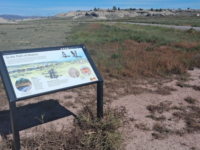
2. In the Path of History Marker
Looking north
Other nearby markers. At least 8 other markers are within 2 miles of this marker, measured as the crow flies: Centre Star Station (approx. 1.2 miles away); Register Cliff State Historic Site (approx. 1.4 miles away); Register Cliff (approx. 1.4 miles away); Oregon Trail Memorial (approx. 1.4 miles away); Oregon Trail Ruts (approx. 2 miles away); The US Army’s Role in Protecting the Oregon Trail is Best Described by the Soldiers (approx. 2 miles away); Merle Atchison Clouser (approx. 2 miles away); Forts, Stations, and Camps (approx. 2.1 miles away). Touch for a list and map of all markers in Guernsey.
Credits. This page was last revised on November 1, 2026. It was originally submitted on October 23, 2026, by William Fischer, Jr. of Reynoldsburg, Ohio. This page has been viewed 12 times since then. Photos: 1, 2. submitted on October 23, 2026, by William Fischer, Jr. of Reynoldsburg, Ohio.
