Henrico in Henrico County, Virginia — The American South (Mid-Atlantic)
Wilton Farm
Wilton's Silenced Majority
Photographed by Evan Dwyer, July 25, 2026
1. Wilton Farm Marker
Native Americans
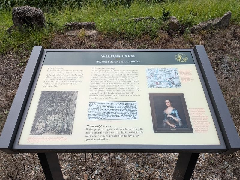
From the earliest nomadic bands who would seasonally visit to take advantage of the rich natural resources to the small villages that settled in the areathat would become the heart of the Powhatan Chiefdom, the land that would become Wilton was an integral part of early indigenous life.
Image Caption:
Detail from John Smith's map of Virginia, published in 1612. Illustration of paramount chief, Powhatan and other chieftains.
(Library of Congress)
The enslaved community
At any given point in Wilton's pre-emancipation history, the number of enslaved Africans and people of African descent far outnumbered their white owners. Industries including tobacco, wheat, and later sand mining, required a large labor force to make the land profitable. While existing documents reduce the lives of these hundreds of individuals to names, occupations and valuations, it was the enslaved men, women and children of Wilton who had the greatest impact on this land. In nearly 100 years of Randolph family ownership, the only recorded emancipation of an enslaved man was in 1784, his name was Warwick.
Image Caption:
Runaway slave advertisement, 1861 (Library of Virginia)
The Randolph women
While
this page online
Image Captions:
Anne Harrison Randolph (c.1723-) wife of William Randolph III, hosted both George Washington after the Second Virginia Convention and the Marquis de Lafayette while Colonial troops camped at Wilton during the Revolutionary War. Outliving her husband and all her children, Anne Randolph presided over Wilton for over 30 years. (Virginia Museum of History and Culture)
Map detail showing the Wilton Farm during the American Civil War when the property was owned by Col. William C. Knight. Knight purchased the property in 1859 from the Randolph family. (Atlas of the War of the Rebellion)
Erected by County of Henrico.
Topics. This historical marker is listed in these topic lists: African Americans • Colonial Era • Indigenous Peoples and Communities • Women. A significant historical year for this entry is 1784.
Location. 37° 26.68′ N, 77° 24.269′ W. Marker is in Henrico, Virginia, in Henrico County. It is at the intersection of Wilton Road and Wilton
Photographed by Evan Dwyer, July 25, 2026
2. Wilton Farm Marker
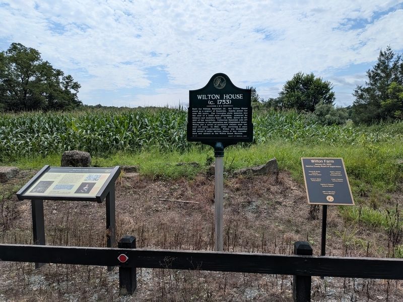
The metal tablet at far right is a list of the Henrico County Board of Supervisors from when the county acquired the property in 2020.

Regionally, this marker is in the Piedmont, in Central Virginia, and in the Richmond Metropolitan Area. It is also in the American South, specifically in the Upper South, and on the Eastern Seaboard. Globally, it is in the North Atlantic Region, North America, the Western Hemisphere, the Western World, and the Anglosphere. Historically, it finds itself in what was once the territory of the Mississippian Culture, one of the original Thirteen Colonies, one of the Confederate States of America, and the Antebellum South.
Other nearby markers. At least 8 other markers are within 2 miles of this marker, measured as the crow flies: Wilton House (here, next to this marker); Richmond Defences (approx. 1.3 miles away); Fort Gilmer (approx. 1.3 miles away); Hopeless Attacks (approx. 1.3 miles away); Fort Johnson (approx. 1.6 miles away); St. James School (approx. 1.7 miles away); St. James Hall and Cemetery
Photographed by Evan Dwyer
3. Wilton House Site
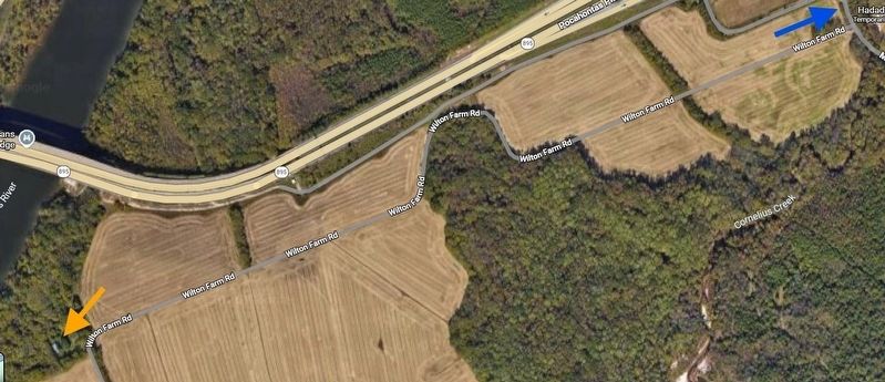
The blue arrow shows the marker's location. The orange arrow shows where Wilton House stood before it was moved to Richmond. The house visible within the tree cover was built on top of Wilton's original foundation after the historic home was relocated.
Other markers no longer nearby. Black Troops Attack at Chaffin’s Farm (was approx. 1.3 miles away but has been replaced with another marker now near it); Richmond Battlefields (was approx. 1.3 miles away but has been replaced with another marker now near it); Confederate Bulwark (was approx. 1.6 miles away but has been replaced with another marker now near it).
Photographed by Evan Dwyer, August 16, 2025
4. Wilton House Museum
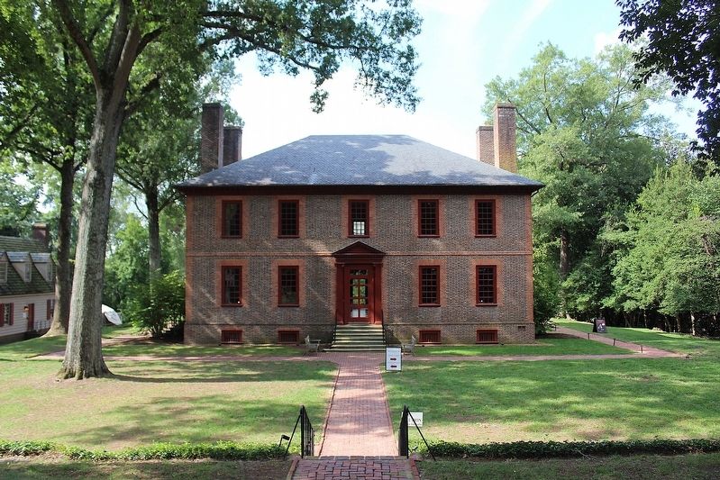
The historic Wilton House as it stands in Richmond, where it serves as a house museum. Pieces were numbered, photographed, dismantled, transported, and re-assembled using the photos and numbers as reference.
Credits. This page was last revised on October 26, 2026. It was originally submitted on October 26, 2026, by Evan Dwyer of Richmond, Virginia. This page has been viewed 4 times since then. Photos: 1, 2, 3, 4. submitted on October 26, 2026, by Evan Dwyer of Richmond, Virginia.
