Mathews in Mathews County, Virginia — The American South (Mid-Atlantic)
Williams Wharf Landing
Photographed by Evan Dwyer, August 29, 2026
1. Williams Wharf Landing Marker
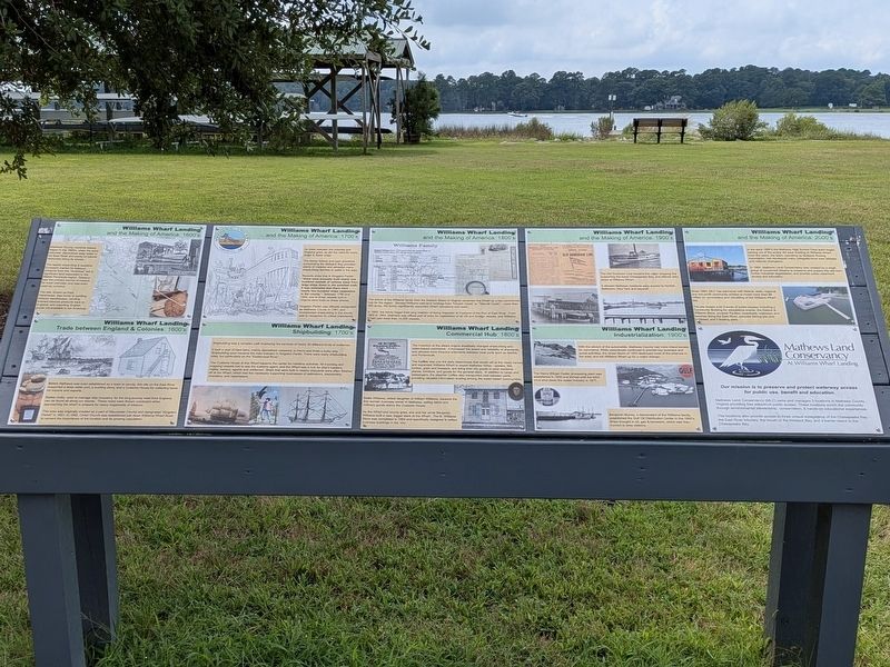
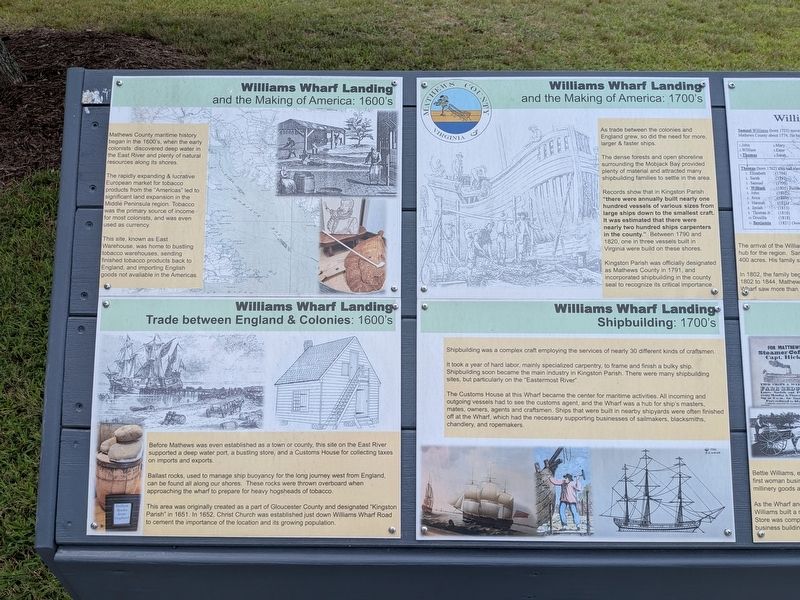
Williams Wharf Landing and the Making of America: 1600's
Mathews County maritime history began in the 1600's, when the early colonists discovered deep water in the East River and plenty of natural resources along its shores.
The rapidly expanding & lucrative European market for tobacco products from the "Americas" led to significant land expansion in the Middle Peninsula region. Tobacco was the primary source of income for most colonists, and was even used as currency.
This site, known as East Warehouse, was home to bustling tobacco warehouses, sending finished tobacco products back to England, and importing English goods not available in the Americas.
Williams Wharf Landing Trade between England & Colonies: 1600's
Before Mathews was even established as a town or county, this site on the East River supported a deep water port, a bustling store, and a Customs House for collecting taxes on imports and exports.
Ballast rocks, used to manage ship buoyancy for the long journey west from England, can be found all along our shores. These rocks were thrown overboard when approaching the wharf to prepare for heavy hogsheads
this page online
This area was originally created as part of Gloucester County and designated "Kingston Parish" in 1651. In 1652, Christ Church was established just down Williams Wharf Road to cement the importance of the location and its growing population.
Williams Wharf Landing and the Making of America: 1700's
As trade between the colonies and England grew, so did the need for more, larger & faster ships.
The dense forests and open shoreline surrounding the Mobjack Bay provided plenty of material and attracted many shipbuilding families to settle in the area.
Records show that in Kingston Parish "there were annually built nearly one hundred vessels of various sizes from large ships down to the smallest craft. It was estimated that there were nearly two hundred ships carpenters in the county." Between 1790 and 1820, one in three vessels built in Virginia were build on these shores.
Kingston Parish was officially designated as Mathews County in 1781, and incorporated shipbuilding in the county seal to recognize its critical importance.
Williams Wharf Landing Shipbuilding: 1700's
Shipbuilding was a complex craft employing the services
Photographed by Evan Dwyer, August 29, 2026
2. Williams Wharf Landing Marker
It took a year of hard labor, mainly specialized carpentry, to frame and finish a bulky ship. Shipbuilding soon became the main industry in Kingston Parish. There were many shipbuilding sites, but particularly on the "Eastermost River".
The Customs House at this Wharf became the center for maritime activities. All incoming and outgoing vessels had to see the customs agent, and the Wharf was a hub for ship's masters, maters, owners, agents, and craftsmen. Ships that were built in nearby shipyards were often finished off at the Wharf, which had the necessary supporting businesses of sailmakers, blacksmiths, chandlery, and ropemakers.
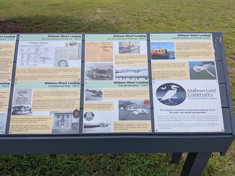
Williams Wharf Landing and the Making of America: 1800's
Williams Family
Samuel Williams (born 1725) moved from the Eastern Shore to Mathews County about 1774. He had eleven children:
1. John 2. William 3. Thomas 4. Mary 5. Ester 6. Sarah 7. Elizabeth 8. Hannah 9. Margaret 10. Susan 11. Mary F.
Thomas (born 1762) also had eleven children:
1. Elizabeth (1794) 2. Sarah (1797) 3. Samuel (1799) 4. William (1805) Builder of the wharf 5. John (1807) 6. Joice (1809)
Photographed by Evan Dwyer, August 29, 2026
3. Williams Wharf Landing Marker
William had five girls:
1. Elizabeth (Bettie of the store) 2. Columbia 3. Eugenia 4. Mary 5. Cordelia
The arrival of the Williams Family from the Eastern Shore of Virginia cemented the Wharf as a key commercial hub for the region. Samuel Williams held land holdings from "Church Creek" to "Tidemill Creek" - more than 400 acres. His family significantly expanded Wharf Operations and reach.
In 1802, the family began their long tradition of being Inspector of Customs of the Port of East River. From 1802 to 1844, Mathews was official port of entry for registration of all US and foreign vessels, and Williams Wharf saw more than 10,000 vessels.
Williams Wharf Landing Commercial Hub: 1800's
The invention of the steam engine drastically changed shipbuilding and water-based commerce. It increased the speed and reliability of shipments, and allowed more frequent shipments between local ports such as Norfolk and Portsmouth.
The Coffee was one of the early steamboats that would call at the newly named and expanded Williams Wharf
Photographed by Evan Dwyer, August 29, 2026
4. Williams Wharf Landing Marker
Bettie Williams, eldest daughter of William Williams, became the first woman business owner in Mathews, selling fabric and millinery goods above the Customs House.
As the Wharf and county grew, she and her uncle Benjamin Williams built a new, bigger store at the Wharf. The B. Williams Store was completed in 1869 and specifically designed to reflect business buildings in the 'city'.
Williams Wharf Landing and the Making of America: 1900's
The Old Dominion Line became the major shipping line supporting the lower Chesapeake Bay, and offered daily stops at Williams Wharf.
It allowed Mathews residents easy access to Norfolk, Baltimore, New York and beyond!
Williams Wharf Landing Industrialization: 1900's
With the advent of the automobile, Mathews County had more inland access for commerce. While steamboats
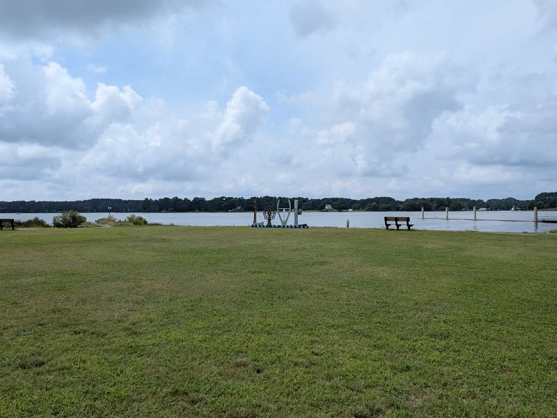
Photographed by Evan Dwyer, August 29, 2026
5. Williams Wharf Landing
View of the East River from the short trail by the landing parking area.
The Henry Billups Oyster processing plant was established in 1935 and thrived until the MSX virus shut down the oyster industry in 1977.
Benjamin Murray, a descendant of the Williams family, established the Gulf Oil Distribution Center in the 1940's. Ships brought in oil, gas & kerosene, which was then trucked to area stations.
Williams Wharf Landing and the Making of America: 2000's
In the early 1990's the Mathews High School Crew team began training out of the empty old dock building at Williams Wharf. Over the years, the team, operating as Mobjack Rowing Association, has developed many collegiate-level crew athletes and national champions.
Since 1994, MLC has partnered with federal, state, regional and non-profit community entities to invest more than $8 million on remediation and rebuilding of the Williams Wharf site.
The site boats over 5 acres of public access, including a Community Building for educational events, the historic B. Williams Store, covered Pavilion, boardwalk, walkways and benches along the East River, concrete fishing pier and bulkhead, and 3 floating piers.
Mathews Land Conservancy At Williams Wharf Landing
Our mission is to preserve and protect waterway access for public use, benefit and education.
Mathews Land Conservancy (MLC) owns and manages 3 locations in Mathews County, Virginia providing free waterfront public access. These locations enrich the community through environmental stewardship, conservation, & hands-on educational experiences.
The locations also provide access to three unique ecosystems of the Chesapeake Bay - the East River tributary, the mouth of the Mobjack Bay, and a barrier island to the Chesapeake Bay.
Erected by Mathews Land Conservancy.
Topics. This historical marker is listed in these topic lists: Colonial Era • Industry & Commerce • Parks & Recreational Areas • Waterways & Vessels.
Location. 37° 24.206′ N, 76° 20.711′ W. Marker is in Mathews, Virginia, in Mathews County. It is on Williams Wharf Road (Virginia Route 614) 0.4 miles west of Bertschy Lane, on the left when traveling west. Marker is at the Williams Wharf Landing public boat landing. Touch for map. Marker is at or near this postal address: 1039 Williams Wharf Road, Mathews VA 23109, United States of America. Touch for directions.

Regionally, this marker is on the Middle Peninsula and in the Hampton Roads Metropolitan Area. It is also in the American South, specifically in the Upper South, in the Tidewater, in the Chesapeake Bay Region, and on the Eastern Seaboard. Globally, it is in the North Atlantic Region, North America, the Western Hemisphere, the Western World, and the Anglosphere. Historically, it finds itself in what was once the territory of the Mississippian Culture, one of the original Thirteen Colonies, one of the Confederate States of America, and the Antebellum South.
Other nearby markers. At least 8 other markers are within 3 miles of this marker, measured as the crow flies: Highlights of the History of Oysters in the Chesapeake Bay (here, next to this marker); Kingston Parish (approx. 0.7 miles away); Captain Sally L. Tompkins, C.S.A. Monument (approx. 0.7 miles away); Tompkins Cottage, circa 1820 (approx. 2.4 miles away); Fort Cricket Hill (approx. 2.4 miles away); Civil War In Mathews County (approx. 2.4 miles away); Mathews County Courthouse Square (approx. 2½ miles away); Mathews County Confederate Monument (approx. 2½ miles away). Touch for a list and map of all markers in Mathews.
Credits. This page was last revised on October 30, 2026. It was originally submitted on October 28, 2026, by Evan Dwyer of Richmond, Virginia. This page has been viewed 11 times since then. Photos: 1, 2, 3, 4, 5. submitted on October 28, 2026, by Evan Dwyer of Richmond, Virginia.
