Roanoke, Virginia — The American South (Mid-Atlantic)
Early Settlements of the Tutelo
Photographed by Bernard Fisher
1. Early Settlements of the Tutelo Marker
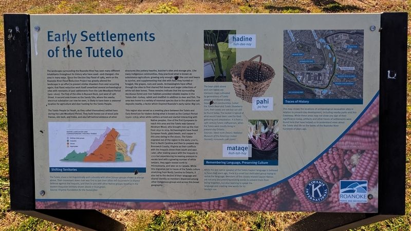
The Tutelo People (or Yesah, as they called themselves) settled here during the Late Woodland Period. They built homes out of wood pole frames, elm bark, and hides, and also left behind evidence of other structures like pottery hearths, butcher's sites and storage pits. Like many Indigenous communities, they practiced what is known as subsistence agriculture: growing only enough crops
this page online
This region also served as a meeting place between the Tutelo and Euro-American fur traders during what is known as the Contact Period (1500-1763), when white settlers arrived and started interacting with Native peoples. One of the first Europeans to reach this area and the Tutelo was General Abraham Wood, who brought men up the river from 1650 to 1674. Archaeologists have found European foods, glass beads, and copper in this area dating to the 1600s. The Tutelo migrated out of the region in the early 1700's, first to North Carolina and then to present-day Brunswick
Photographed by Bernard Fisher, November 3, 2026
2. Roanoke River Greenway
(captions)
Shifting Territories
The Tutelo share a lot linguistically and culturally with other Siouan groups shown in orange above. Their movement down river was first to join their allies the Occaneechi in shared defense against the Iroquois, and then to join with other Native groups residing in the eastern Iroquoian territory shown above in blue-green. Source: Virginia Foundation for the Humanities
Hadine hah-dee-nay Pahi pa-hee Mataqe mah-tah-hay
The bean plant above and corn below are hierloom crops cultivated by generations of Tutelo people and shared widely beyond their communities. Called the Tutelo Bean and Tutelo Strawberry Corn, their seeds are rare but can still be found today. The basket is typical of what would have been used for food gathering and preparation. It is from a 19th century Tutelo craftsperson, when the Tutelo were mostly living in present-day Ontario. Sources: Steve Isom (bean); National Museum of the American Indian (basket); rareseeds.com (corn)
Remembering Language, Preserving Culture
While the last native speaker of the Tutelo-Saponi language is believed to have died years ago, there is a small but dedicated group trying to revive the language. Members of the closely related Saponi Nation are not only documenting existing words to prevent them from being forgotten, but also learning to speak the language and creating new words for its modern use.
Traces of History
This map shows the locations of archaeological excavation sites in relation to present-day development, including nearby parks and this Greenway. While these areas may not show any sign of their significance today, artifacts and other traces of settlements were found here that have helped us to understand more about the Tutelo and life on the banks of the Roanoke River hundreds of years ago.
Erected by Kiwanis International and Roanoke Parks and Recreation Roanoke Parks and Recreation Kiwanis International Roanoke Parks and Recreation.
Topics. This historical marker is listed in these topic lists: Anthropology & Archaeology • Indigenous Peoples and Communities • Parks & Recreational Areas • Settlements & Settlers. A significant historical year for this entry is 1985.
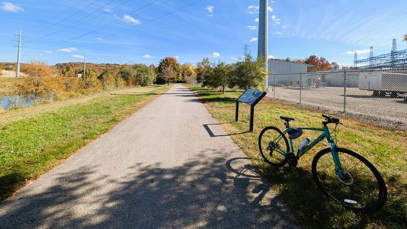
Location. 37° 15.079′ N, 79° 55.264′ W. Marker is in Roanoke, Virginia. It can be reached from the intersection of Riverland Road Southeast (Virginia Route 116) and Daeton Road SE, on the left when traveling east. Located along the Roanoke River Greenway. Touch for map. Marker is at or near this postal address: 1228 Riverland Rd SE, Roanoke VA 24013, United States of America. Touch for directions.

Regionally, this marker is in the Mountain Region and in Southwest Virginia. It is also in the American South and specifically in the Upper South. Globally, it is in North America, the Western Hemisphere, the Western World, and the Anglosphere. Historically, it finds itself in what was once the territory of the Mississippian Culture, one of the original Thirteen Colonies, one of the Confederate States of America, and the Antebellum South.
Other nearby markers. At least 8 other markers are within walking distance of this marker: The American Viscose Corp. (about 400 feet away, measured in a direct line); Endangered Species: The Roanoke Logperch (approx. half a mile away); M. Carl Andrews Overlook (approx. 0.6 miles away); The Roanoke Star (approx. 0.6 miles away); American Chestnut: Tree of Hope (approx. 0.8 miles away); In Honor and Remembrance (approx. 0.8 miles away); American Basswood (approx. 0.8 miles away); American Fringe (approx. 0.8 miles away). Touch for a list and map of all markers in Roanoke.
Also see . . .
1. Roanoke River Greenway. (Submitted on November 5, 2026.)
2. Roanoke Valley Greenways. (Submitted on November 5, 2026.)
Credits. This page was last revised on November 9, 2026. It was originally submitted on November 5, 2026, by Bernard Fisher of Richmond, Virginia. This page has been viewed 6 times since then. Photos: 1, 2. submitted on November 5, 2026, by Bernard Fisher of Richmond, Virginia.
