Macon in Bibb County, Georgia — The American South (South Atlantic)
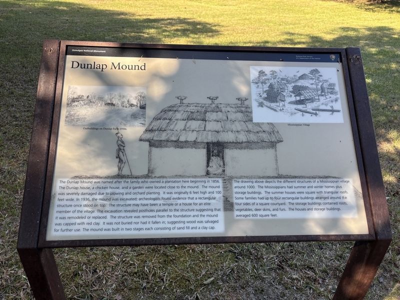
Dunlap Mound
| — | Ocmulgee National Monument | — |
Photographed by Benjamin Rubin, October 25, 2026
1. Dunlap Mound Marker
The drawing above depicts the different structures of a Mississippian village around 1000. The Mississippians had summer and winter homes plus storage buildings. The summer houses were square with triangular roofs. Some families had up to four rectangular buildings arranged around the four sides
this page online
(captions)
Outbuildings on Dunlap Farm 1930s
Mississippian Village
Erected by National Park Service, U.S. Department of the Interior.
Topics. This historical marker is listed in these topic lists: Anthropology & Archaeology • Indigenous Peoples and Communities • Parks & Recreational Areas.
Location. 32° 50.686′ N, 83° 36.185′ W. Marker is in Macon, Georgia, in Bibb County. It can be reached from Ocmulgee National Park Road south of Emery Highway (U.S. 23), on the left when traveling south. Touch for map. Marker is at or near this postal address: 1207 Emery Hwy, Macon GA 31217, United States of America. Touch for directions.

Regionally, this marker is in the Piedmont. It is also in the American South and specifically in the Deep South. Globally, it is in North America, the Western Hemisphere, the Western World, and the Anglosphere. Historically, it finds itself in what was once the territory of the Mississippian Culture, one of the original Thirteen Colonies, one of the Confederate States of America, and the Antebellum South.
Other nearby markers. At least 8 other markers are within walking distance of this marker: The Battle of Walnut Creek (about 300 feet away, measured in a direct line); Battles of Dunlap Farm (about 700 feet away); The Dunlap House (about 800 feet away); William Bartram Trail (approx. 0.2 miles away); Ocmulgee National Monument (approx. 0.2 miles away); Yaupon Holly (approx. 0.2 miles away); The Civilian Conservation Corps (CCC) 1933-1942 (approx. 0.2 miles away); 17,000 Years of Continuous Human Habitation (approx. 0.2 miles away). Touch for a list and map of all markers in Macon.
Also see . . . Ocmulgee Mounds National Historical Park. National Park Service (Submitted on November 11, 2026.)
Credits. This page was last revised on November 11, 2026. It was originally submitted on November 10, 2026, by Benjamin Rubin of Columbia, South Carolina. This page has been viewed 7 times since then. Photo 1. submitted on November 10, 2026, by Benjamin Rubin of Columbia, South Carolina. • Bernard Fisher was the editor who published this page.
