
Near Sylvania in Screven County, Georgia — The American South (South Atlantic)
Burton's Ferry
Photographed by Mike Stroud, March 2008
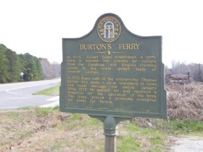
1. Burton's Ferry Marker
In 1765, Robert Dunn established a ferry here. It became the gateway for settlers from the Carolinas and Virginia claiming grants in the newly opened lands of interior Georgia.
In 1772 Dunn sold to the enterprising Thomas Burton who made a large investment in boats and roads through the swamp. January 20th, 1773 he applied for and received a franchise for the operation of the ferry. The ferry proved a profitable enterprise for years for Burton.
Erected 1953 by Georgia Historical Commission. (Marker Number 124-9.)
Topics and series. This historical marker is listed in these topic lists: Colonial Era • Roads & Vehicles • Settlements & Settlers • Waterways & Vessels. In addition, it is included in the Georgia Historical Society series list. A significant historical date for this entry is January 20, 1734.
Location. 32° 56.239′ N, 81° 30.698′ W. Marker is near Sylvania, Georgia, in Screven County. It is on Burtons Ferry Road (U.S. 301), on the left when traveling south. Marker Located approx. 200 yards on Georgia side of Savannah River. Touch for map. Marker is in this post office area: Sylvania GA 30467, United States
this page online

Regionally, this marker is on the Coastal Plain. It is also in the American South and specifically in the Deep South. Globally, it is in North America, the Western Hemisphere, the Western World, and the Anglosphere. Historically, it finds itself in what was once the territory of the Mississippian Culture, one of the original Thirteen Colonies, one of the Confederate States of America, and the Antebellum South.
Other nearby markers. At least 8 other markers are within 9 miles of this marker, measured as the crow flies: Burton’s Ferry Landing – Allendale, South Carolina (approx. 1½ miles away in South Carolina); Brick (Bethel) Church (approx. 2.6 miles away); Bethel United Methodist Church (approx. 2.6 miles away); Antioch Christian Church (approx. 5.6 miles away in South Carolina); Concord Baptist Church (approx. 6.4 miles away in South Carolina); Paris' Mill (approx. 8 miles away); British Army Crossing (approx. 8 miles away); Gilette Methodist Church (approx. 8.1 miles away in South Carolina).
Related markers. Click here for a list of markers that are related to this marker. To better
Photographed by Mike Stroud, 2008
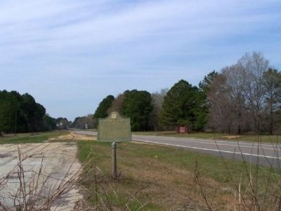
2. Burton's Ferry Marker looking south on US 301
Photographed by Mike Stroud, 2008
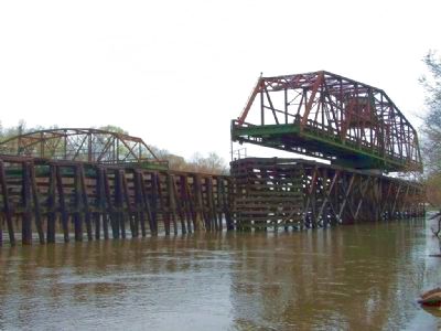
3. Ferry was replaced by highway with a " Swing Bridge " now also defunct.
Photographed by Mike Stroud, 2008
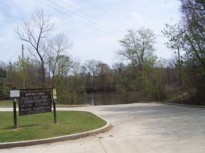
4. The Ferry site seen today
Now a two lane boat ramp. for recreational boaters
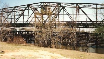
Photographed by Craig Swain, circa 1995
5. Close Up of the Piviot Span of the Bridge
Credits. This page was last revised on November 16, 2026. It was originally submitted on March 24, 2008, by Mike Stroud of Bluffton, South Carolina. This page has been viewed 3,565 times since then and 149 times this year. Last updated on November 15, 2026, by Tom Bosse of Jefferson City, Tennessee. Photos: 1, 2, 3, 4. submitted on March 24, 2008, by Mike Stroud of Bluffton, South Carolina. 5. submitted on March 24, 2008, by Craig Swain of Leesburg, Virginia. • Devry Becker Jones was the editor who published this page.
