
Spring Hill in Hernando County, Florida — The American South (South Atlantic)
Timucuan Indian Mound Discovery
Photographed by Cosmos Mariner, November 16, 2026
1. Timucuan Indian Mound Discovery Marker
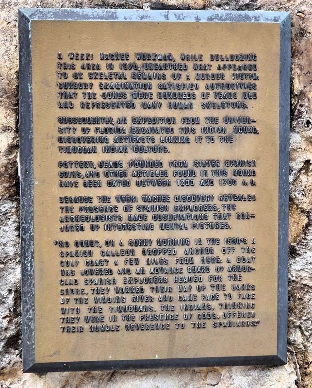
A Weeki Wachee workman, while bulldozing this area in 1970, unearthed what appeared to be skeletal remains of a murder victim. Cursory examination satisfied authorities that the bones were hundreds of years old and represented many human skeletons.
Subsequently, an expedition from the University of Florida excavated this Indian mound, discovering artifacts linking it to the Timucuan Indian culture.
Pottery, beads pounded from silver Spanish coins, and other articles found in this mound have been dated between 1200 and 1700 A.D.
Because the Weeki Wachee discovery revealed the presence of Spanish explorers, the archeologists made observations that conjured up interesting mental pictures.
“No doubt, on a sunny morning in the 1530’s a Spanish galleon dropped anchor off the Gulf Coast a few miles from here. A boat was lowered and an advance guard of armor-clad Spanish explorers headed for the shore. They worked their way up the banks of the winding river and came face to face with the Timucuans. The Indians, thinking there were in the presence of gods, offered their humble reverence to the Spaniards.”
Topics. This historical
this page online
Location. 28° 31.117′ N, 82° 34.463′ W. Marker is in Spring Hill, Florida, in Hernando County. It can be reached from Commercial Way (U.S. 19) just south of Cortez Boulevard (State Route 50), on the left when traveling north. The marker is near the grandstand in Weeki Wachee Springs State Park. Touch for map. Marker is at or near this postal address: 6131 Commercial Way, Spring Hill FL 34606, United States of America. Touch for directions.

Regionally, this marker is on the Gulf Coast and on Tampa Bay. It is also in the American South and on the Gulf Coast. Globally, it is in the North Atlantic Region, North America, a Gulf of Mexico state, the Western Hemisphere, the Western World, and the Anglosphere. Historically, it finds itself in what was once New Spain, the territory of the Mississippian Culture, one of the Confederate States of America, and the Antebellum South.
Other nearby markers. At least 8 other markers
Photographed by Cosmos Mariner, November 16, 2026
2. Timucuan Indian Mound Discovery Marker
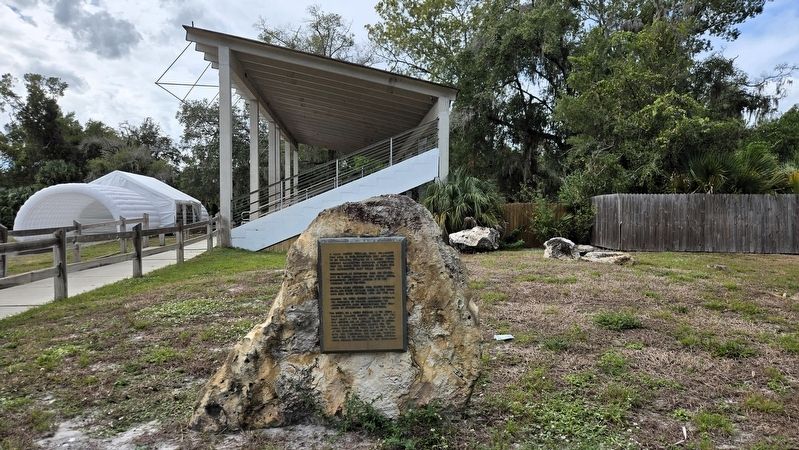
The Weeki Wachee Springs State Park grandstand is in the background.
More about this marker. There may be an entrance fee to get inside the gate at Weeki Wachee Springs State Park.
Also see . . . Timucua (Wikipedia).
Excerpt: The Timucua were a Native American people who lived in Northeast and North Central Florida and southeast Georgia. They were the largest indigenous group in that area and consisted of about 35 chiefdoms, many leading thousands of people. At the time of European contact, Timucuan speakers occupied about 19,200 square miles in the present-day states of Florida and Georgia, with an estimated population of 200,000.(Submitted on November 18, 2026, by Cosmos Mariner of Cape Canaveral, Florida.)
The Timucua may have been the first American natives to see the landing of Juan Ponce de León, if that landing was near St. Augustine in 1513. Later, in 1528, Pánfilo de Narváez's expedition passed along the western fringes of the Timucua territory. In 1539, Hernando de Soto led an army of more than 500 men through the western parts of Timucua territory. His army seized the food stored in the villages, forced women into concubinage, and forced men and boys to serve as guides and bearers.
The people suffered severely from the introduction of Eurasian infectious diseases. By 1595, their population was estimated to have been reduced from 200,000 to 50,000, and thirteen chiefdoms remained. By 1700, the population of the tribe had been reduced to an estimated 1,000 due to slave raids from Carolinian settlers and their Indian allies. The local slave trade completed their extinction as a tribe soon after the turn of the 18th century.
Credits. This page was last revised on November 18, 2026. It was originally submitted on November 17, 2026, by Cosmos Mariner of Cape Canaveral, Florida. This page has been viewed 6 times since then. Photos: 1, 2. submitted on November 18, 2026, by Cosmos Mariner of Cape Canaveral, Florida.
