
Mille Lacs Kathio State Park near Onamia in Mille Lacs County, Minnesota — The American Midwest (Upper Plains)
The Old Campground
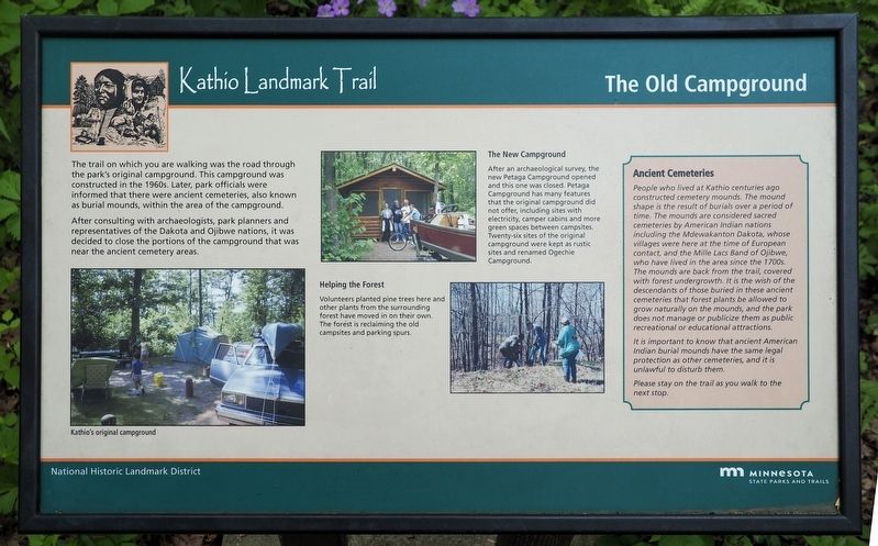
Kathio Landmark Trail
| — | National Historic Landmark District | — |
Photographed by McGhiever, May 29, 2025
1. The Old Campground Marker
The trail on which you are walking was the road through the park's original campground. This campground was constructed in the 1960s. Later, park officials were informed that there were ancient cemeteries, also known as burial mounds, within the area of the campground.
After consulting with archaeologists, park planners and representatives of the Dakota and Ojibwe nations, it was decided to close the portions of the campground that was near the ancient cemetery areas.
[Caption:] Kathio's original campground
The New Campground
After an archaeological survey, the new Petaga Campground opened and this one was closed. Petaga Campground has many features that the original campground did not offer, including sites with electricity, camper cabins and more green spaces between campsites. Twenty-six sites of the original campground were kept as rustic sites and renamed Ogechie Campground.
Helping the Forest
Volunteers planted pine trees here and other plants from the surrounding forest have moved in on their own. The forest is reclaiming the old campsites and parking spurs.
Ancient Cemeteries
People who lived at Kathio centuries ago constructed cemetery mounds. The mound shape is the result of burials over a period of time. The mounds are considered sacred cemeteries by American Indian nations including the Mdewakanton Dakota, whose villages were here at the time of European contact, and the Mille Lacs Band of Ojibwe, who have lived in the area since the 1700s. The mounds are back from the trail, covered with forest undergrowth. it is the wish of the descendants of those buried in these ancient cemeteries that forest plants be allowed to grow naturally on the mounds, and the park does not manage or publicize them as public recreational or educational attractions.
It is important to know that ancient American Indian burial mounds have the same legal protection as other cemeteries, and it is unlawful to disturb them.
Please stay on the trail as you walk to the next stop.
Erected by Minnesota
this page online
Topics. This historical marker is listed in these topic lists: Cemeteries & Burial Sites • Horticulture & Forestry • Indigenous Peoples and Communities • Parks & Recreational Areas. A significant historical year for this entry is 1960.
Location. 46° 8.628′ N, 93° 46.457′ W. Marker is near Onamia, Minnesota, in Mille Lacs County. It is in Mille Lacs Kathio State Park. It can be reached from the road to Ogechie Campground. The marker is near the beginning of the Kathio Landmark Trail. Touch for map. Marker is at or near this postal address: 15066 Kathio State Park Road, Onamia MN 56359, United States of America. Touch for directions.

Regionally, this marker is in Central Minnesota. It is also in the American Midwest and in the Corn Belt. Globally, it is in North America, the Western Hemisphere, the Western World, and the Anglosphere. Historically, it finds itself in what was once Rupert’s Land, the territory of the Mississippian Culture, and the Northwest Territory.
Other nearby markers. At least 8 other markers are within walking distance of this marker: Kathio Landmark Trail (about
Photographed by McGhiever, May 29, 2025
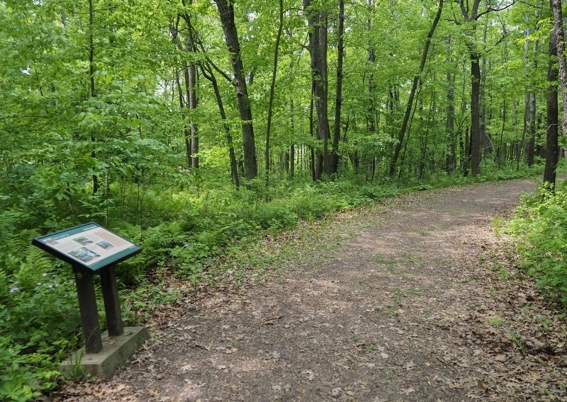
2. The Old Campground Marker on the Kathio Landmark Trail
Credits. This page was last revised on November 20, 2026. It was originally submitted on November 20, 2026, by McGhiever of Minneapolis, Minnesota. This page has been viewed 7 times since then. Photos: 1, 2. submitted on November 20, 2026, by McGhiever of Minneapolis, Minnesota.
