Lancaster in Worcester County, Massachusetts — The American Northeast (New England)
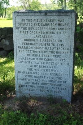
Site of Mary Rowlandson’s Capture
The minister’s wife immortalized her experiences in “The Narrative of the Captivity and Restoration of Mrs. Mary Rowlandson” first published at Cambridge, Massachusetts in 1682.
Topics. This historical marker is listed in these topic lists: Colonial Era • Native Americans • Wars, US Indian • Women. A significant historical month for this entry is February 1887.
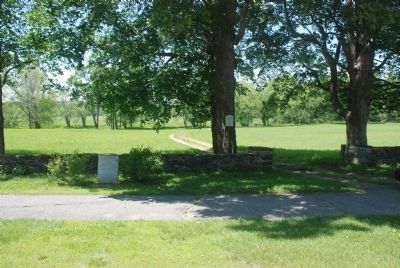
Location. 42° 26.993′ N, 71° 40.525′ W. Marker is in Lancaster, Massachusetts, in Worcester County. Marker is on Main Street (Massachusetts Route 70), on the left when traveling north. Touch for map. Marker is in this post office area: Lancaster MA 01523, United States of America. Touch for directions.
Other nearby markers. At least 8 other markers are within 4 miles of this marker, measured as the crow flies. Site of the Great Elm (approx. half a mile away); Neck Bridge (approx. 0.6 miles away); Rowlandson Rock (approx. 0.8 miles away); Sawyer-Carter Bridge (approx. 0.8 miles away); a different marker also named Rowlandson Rock (approx. 1.3 miles away); Prescott Grist Mill (approx. 2.1 miles away); Lancaster (approx. 2.3 miles away); Wickapickit Brook and Bridge (approx. 3.3 miles away). Touch for a list and map of all markers in Lancaster.
Regarding Site of Mary Rowlandson’s Capture. During King Philip’s War, one of the bloodiest conflicts in American history, Mary Rowlandson (c. 1637-1711) was captured with her three children and 20 other residents of Lancaster who were taking refuge in her house. Her husband had gone to Boston to plead for more troops to protect the town.
In an ordeal lasting almost 12 weeks she was separated from her children and moved “up and down the wilderness” (as she later wrote), through what is now central Massachusetts, southern Vermont, and New Hampshire. She escaped torture and death by knitting shirts, socks, caps, and similar garments in return for food.
Also see . . . More information. Includes additional links about Mary Rowlandson and her book. (Submitted on June 25, 2010, by Roger W. Sinnott of Chelmsford, Massachusetts.)
Credits. This page was last revised on April 20, 2018. It was originally submitted on June 25, 2010, by Roger W. Sinnott of Chelmsford, Massachusetts. This page has been viewed 2,861 times since then and 79 times this year. Photos: 1, 2. submitted on June 25, 2010, by Roger W. Sinnott of Chelmsford, Massachusetts. • Kevin W. was the editor who published this page.

