Near New Berlin in Sangamon County, Illinois — The American Midwest (Great Lakes)
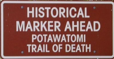
Potawatomi Trail of Death
McCoys Mill Encampment
— Sept 4 - Nov 4, 1838 —
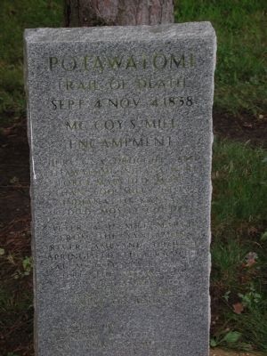
Inscription.
Trail of Death
Sept 4 - Nov 4, 1838
McCoys Mill
Encampment
During a drought, 850 Potawatomi Indians were force-marched more than 600 miles from Indiana to Kansas. 40 died, mostly children.
After a 17 mile march from the Sangamon River camp and through Springfield, they camped at McCoy's Mill near here.
The Potawatomi left Sept 29, 1838 for Island Grove 2 miles west of Berlin.
Erected by
Rainbow Dancers
Pow Wow Committee
Clayville Folk Arts Guild
1995
Erected 1995 by Rainbow Dancers, Pow Wow Committee, Clayville Folk Arts Guild.
Topics and series. This historical marker is listed in these topic lists: Native Americans • Notable Events • Wars, US Indian. In addition, it is included in the Potawatomi Trail of Death series list. A significant historical year for this entry is 1838.
Location. 39° 46.916′ N, 89° 46.766′ W. Marker is near New Berlin, Illinois, in Sangamon County. Marker is at the intersection of Old Jacksonville Road (County Highway 8) and New Salem Church Road, on the left when traveling west on Old Jacksonville Road. Touch for map. Marker is at or near this postal address: 6858 Old Jacksonville Road, New Berlin IL 62670, United States of America. Touch for directions.
Other nearby markers. At least 8 other markers are within 7 miles of this marker, measured as the crow flies. Colonel Ulysses S. Grant (here, next to this marker); Lindbergh Field (approx. 4.3 miles away); Site of Camp Yates (approx. 5.8 miles away); Camp Yates (approx. 5.8 miles away); Lincoln the Leader (approx. 6.4 miles away); Illinois State Military Museum (approx. 6.4 miles away); Our Fallen Illinois Service Members (approx. 6˝ miles away); Hutchinson Cemetery & Springfield High School (approx. 6˝ miles away).
More about this marker. This marker is located on the south side of Old Jacksonville Road, just west of the New Salem United Methodist Church at Riddle Hill. It denotes the camp site at 'McCoy's Mill', which must have been located east of the marker's location on the Little Spring Creek at Riddle Hill.
Also see . . .
1. New Berlin Area Historical Society. Organization website (archived). (Submitted on July 2, 2010, by New Berlin Area Historical Society of New Berlin, Illinois.)
2. Potawatomi Trail of Death map and additional information. "Kansas Heritage" entry (Submitted on July 2, 2010, by New Berlin Area Historical Society of New Berlin, Illinois.)
Credits. This page was last revised on December 12, 2020. It was originally submitted on July 2, 2010, by New Berlin Area Historical Society of New Berlin, Illinois. This page has been viewed 1,843 times since then and 30 times this year. Photos: 1, 2. submitted on July 2, 2010, by New Berlin Area Historical Society of New Berlin, Illinois. • Kevin W. was the editor who published this page.

