Seymour in Sevier County, Tennessee — The American South (East South Central)
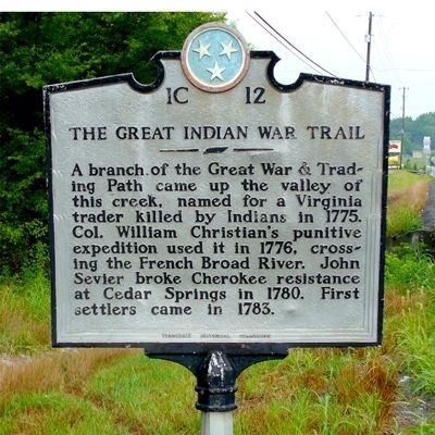
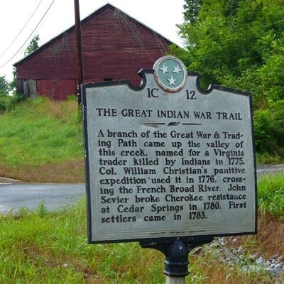
The Great Indian War Trail
Erected by Tennessee Historical Commission. (Marker Number 1C 12.)
Topics and series. This historical marker is listed in these topic lists: Exploration • Heroes • Native Americans • Natural Features • Roads & Vehicles • Settlements & Settlers. In addition, it is included in the Tennessee Historical Commission series list. A significant historical year for this entry is 1775.
Location. 35° 51.712′ N, 83° 44.569′ W. Marker is in Seymour, Tennessee, in Sevier County. Marker is on Chapman Highway (U.S. 441) 2 miles south of 411 and 441 (U.S. 411). Touch for map. Marker is at or near this postal address: 11804 Chapman Highway, Seymour TN 37865, United States of America. Touch for directions.
Other nearby markers. At least 8 other markers are within 5 miles of this marker, measured as the crow flies. Newell's Station (approx. 0.3 miles away); Keener-Johnson Farm (approx. 2 miles away); Knox County / Sevier County (approx. 3.3 miles away); Campbell Family Massacre (approx. 3.6 miles away); Eusebia Church (approx. 3.7 miles away); Greek Revival (approx. 3.8 miles away); McTeer's Fort (approx. 3.9 miles away); Battle of Boyd's Creek (approx. 5.1 miles away). Touch for a list and map of all markers in Seymour.
Credits. This page was last revised on June 16, 2016. It was originally submitted on July 5, 2010, by Donald Raby of Knoxville, Tennessee. This page has been viewed 2,032 times since then and 98 times this year. Photos: 1, 2. submitted on July 5, 2010, by Donald Raby of Knoxville, Tennessee. • Bill Pfingsten was the editor who published this page.

