Guntersville in Marshall County, Alabama — The American South (East South Central)
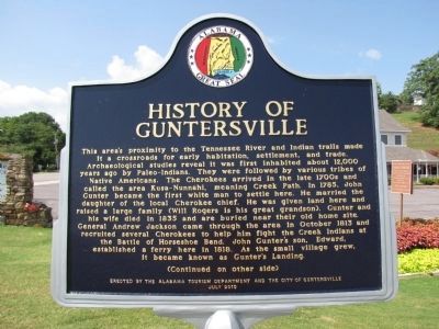
History of Guntersville
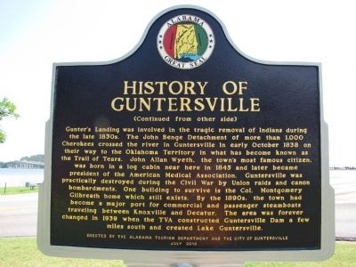
(Side B) (Continued from other side) Gunter's Landing was involved in the tragic removal of Indians during the late 1830. The John Benge Detachment of more than 1,000 Cherokees crossed the river in Guntersville in early October 1838 on their way to the Oklahoma Territory in what has become known as the Trail of Tears. John Allan Wyeth, the town's most famous citizen, was born in a log cabin near here in 1845 and later became president of the American Medical Association. Guntersville was practically destroyed during the Civil War by Union raids and cannon bombardments. One building to survive is the Col. Montgomery Gilbreath home which still exists. By the 1890s, the town had become a major port for commercial and passenger steamboats traveling between Knoxville and Decatur. The area was forever changed in 1939 when the TVA constructed Guntersville Dam a few miles south and created Lake Guntersville.
Erected 2010 by The Alabama Tourism Department and the City of Guntersville.
Topics and series. This historical marker is listed in these topic lists: Military • Native Americans • Notable Places • Settlements & Settlers • Wars, US Indian • Waterways & Vessels. In addition, it is included in the Former U.S. Presidents: #07 Andrew Jackson, and the Trail of Tears series lists. A significant historical month for this entry is October 1813.
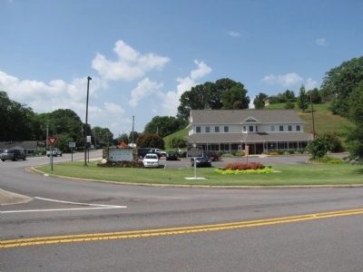
Location. 34° 21.822′ N, 86° 17.451′ W. Marker is in Guntersville, Alabama, in Marshall County. Marker is at the intersection of Florida Short Route/Gunter Avenue (U.S. 431) and Lurleen B Wallace Drive, on the right when traveling south on Florida Short Route/Gunter Avenue. Marker is located at the Guntersville Chamber of Commerce Visitor Center on the south end of the Tennessee River bridge. Touch for map. Marker is in this post office area: Guntersville AL 35976, United States of America. Touch for directions.
Other nearby markers. At least 8 other markers are within walking distance of this marker. Federal Troops Burn Guntersville During Civil War (here, next to this marker); John Gunter (here, next to this marker); Colonel Montgomery Gilbreath House (approx. 0.3 miles away); Errol Allan Park (approx. 0.3 miles away); Section of Core (approx. 0.4 miles away); Veterans of Foreign Wars Marshall County (approx. 0.4 miles away); Courthouse Well (approx. 0.4 miles away); Events in Marshall County (approx. 0.4 miles away). Touch for a list and map of all markers in Guntersville.
Also see . . . Trail of Tears National Historic Trail Lake Guntersville State Park.
Two detachment routes passed through today’s Lake Guntersville State Park. Several detachments of Cherokee on the water route used the Tennessee River, which was later dammed and is now Lake Guntersville. The Benge Route (a land route) left Fort Payne and crossed the river, heading west towards modern Huntsville, Alabama. The Benge Route traveled across Alabama, Tennessee, Kentucky, Missouri, and Arkansas to reach Indian Territory (today’s Oklahoma).(Submitted on March 31, 2023, by Sandra Hughes Tidwell of Killen, Alabama, USA.)
Additional commentary.
1. Edaward Gunter
I am the ggg-grandaushter of Edward Gunter. His daughter, Elizabeth Gunter-Rider was my grandmother Lydia Thomas Crockett's Grandma. Elizabeth Gunter married Alexander Mccoy Rider and they had my grandmother's mother, Catherine Rider-Thomas. My Grandmother was born and raised in the Talequah, OK area until she married my grandfather. I have a tin picture of Elizabetha and her brother Daniel Mccoy Gunter.
I was contacted years ago by a gentleman that lives in Guntersville and told me he lives on the reservation that was owned by Edward Gunter. He said he had duplicated the home that Edward owned on the reservation. He invited me to come and see the property however I don't remember his name. If anyone knows I would appreciate the information.
— Submitted November 10, 2010, by MaryAnn Bateman of Grand Rapids, Ohio.
Credits. This page was last revised on April 2, 2023. It was originally submitted on July 20, 2010, by Lee Hattabaugh of Capshaw, Alabama. This page has been viewed 4,834 times since then and 231 times this year. Photos: 1, 2, 3. submitted on July 20, 2010, by Lee Hattabaugh of Capshaw, Alabama. • Bill Pfingsten was the editor who published this page.


