Near Hilton Village in Fayette County, West Virginia — The American South (Appalachia)
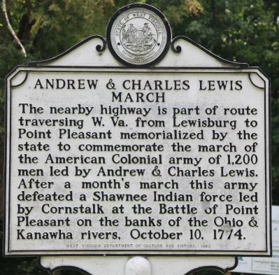
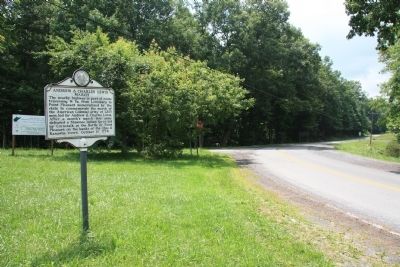
Andrew & Charles Lewis March
Erected 1982 by West Virginia Department of Culture and History.
Topics and series. This historical marker is listed in these topic lists: Colonial Era • Military • Native Americans • Wars, US Indian. In addition, it is included in the West Virginia Archives and History series list. A significant historical date for this entry is October 10, 1774.
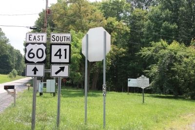
Location. 38° 1.216′ N, 80° 54.74′ W. Marker is near Hilton Village, West Virginia, in Fayette County. Marker is at the intersection of U.S. 60 and West Virginia Route 41, on the right when traveling east on U.S. 60. This historical marker is located near the center of a traffic island that is situated at the intersection where state route 41 joins from the south with US 60 which runs east to west. Touch for map. Marker is in this post office area: Fayetteville WV 25840, United States of America. Touch for directions.
Other nearby markers. At least 8 other markers are within 7 miles of this marker, measured as the crow flies. Old Stone House (approx. 2.1 miles away); Camp Washington Carver (approx. 3.2 miles away); Camp Washington-Carver (approx. 3.3 miles away); Spy Rock (approx. 4.9 miles away); Sewell Mountain Campaign (approx. 6 miles away); Gen. Robert E. Lee (approx. 6.1 miles away); Nallen / Wilderness Lumber Company (approx. 6.3 miles away); Visiting Nuttallburg (approx. 6.8 miles away).
More about this marker. This marker is one in a series of identical markers, regarding the march of the army led by Andrew & Charles Lewis, that are situated across the state of West Virginia, along the path that they marched on their way to wage war with the hostile Indians that lived just north of the Ohio River. The noteworthy result of this march was the lone major combative engagement of the Lord Dunmore's War, the Battle of Point Pleasant.
Regarding Andrew & Charles Lewis March. The army commanded by Andrew and Charles Lewis, that marched across the mountains of modern day West Virginia, was part of a planned two-pronged colonial Virginian invasion of the Ohio Country. The other army was led by the royal governor of colonial
Virginia, Lord Dunmore, and his army was marching west from Fort Pitt with the goal of linking up with the army of Andrew and Charles Lewis. Then, together, they planned to wage a military campaign against the Ohio Indians, seeking to force them to accept the Ohio River boundary which had been negotiated with the Iroquois in the 1768 Treaty of Fort Stanwix.
Also see . . .
1. Lord Dunmore's War and the Battle of Point Pleasant. This link is published and made available by, "Ohio History Central," an online encyclopedia of Ohio History. (Submitted on August 1, 2010, by Dale K. Benington of Toledo, Ohio.)
2. Battle of Point Pleasant. This link is published and made available by Absolute Astronomy. (Submitted on August 1, 2010, by Dale K. Benington of Toledo, Ohio.)
3. The Battle of Point Pleasant – October 10, 1774. This web link is published by the West Virginia, Department of Natural Resources, for any individuals that are interested in Tu-Endie-Wei, Point Pleasant Battle Monument State Park. (Submitted on August 1, 2010, by Dale K. Benington of Toledo, Ohio.)
4. Battle of Point Pleasant. This link is provided by Wikipedia, the free encyclopedia. (Submitted on August 1, 2010, by Dale K. Benington of Toledo, Ohio.)
Credits. This page was last revised on June 16, 2016. It was originally submitted on August 1, 2010, by Dale K. Benington of Toledo, Ohio. This page has been viewed 1,550 times since then and 32 times this year. Photos: 1, 2, 3. submitted on August 1, 2010, by Dale K. Benington of Toledo, Ohio.


