Savanna in Carroll County, Illinois — The American Midwest (Great Lakes)
Plum River Falls

Photographed By David Seibert, August 9, 2010
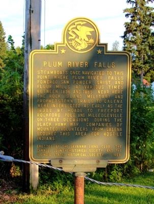
1. Plum River Falls Marker
Inscription. Plum River Falls. . Steamboats once navigated to this point, where Plum River Falls powered saw, powder, grist, and flour mills at various times between 1836 and 1885. Near here the Rock Island Military and Prophetstown Trails to Galena were intersected as early as the 1830's by roads to Freeport, Rockford, Polo, and Milledgeville. On three occasions during the Black Hawk War, companies of mounted volunteers from Galena scoured this area for hostile Indians. . This historical marker was erected in 1968 by Savanna Lions Club, Carroll County Historical Society, and The Illinois State Historical Society. It is in Savanna in Carroll County Illinois
Steamboats once navigated to this point, where Plum River Falls powered saw, powder, grist, and flour mills at various times between 1836 and 1885. Near here the Rock Island Military and Prophetstown Trails to Galena were intersected as early as the 1830's by roads to Freeport, Rockford, Polo, and Milledgeville. On three occasions during the Black Hawk War, companies of mounted volunteers from Galena scoured this area for hostile Indians.
Erected 1968 by Savanna Lions Club, Carroll County Historical Society, and The Illinois State Historical Society.
Topics and series. This historical marker is listed in these topic lists: Industry & Commerce • Roads & Vehicles • Wars, US Indian • Waterways & Vessels. In addition, it is included in the Black Hawk War, and the Illinois State Historical Society series lists. A significant historical year for this entry is 1836.
Location. 42° 5.972′ N, 90° 7.363′ W. Marker is in Savanna, Illinois, in Carroll County. Marker is on Unnamed Road in Old Mill Park, 0.1 miles east of Chicago Avenue (U.S. 
Photographed By David Seibert, August 9, 2010
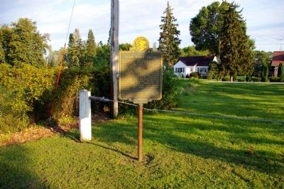
2. Plum River Falls Marker
The house in the background is on the other side of US Highway 52.
Click or scan to see
this page online
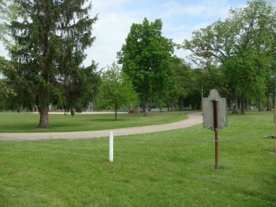
52), on the right when traveling east. The marker is located in the southeast corner of Old Mill Park, off US Highway 52 at the eastern edge of Savanna. Touch for map. Marker is in this post office area: Savanna IL 61074, United States of America. Touch for directions.
Other nearby markers. At least 8 other markers are within 8 miles of this marker, measured as the crow flies. Savanna Community Veterans Memorial (approx. 1½ miles away); Savanna Public Library (approx. 1.7 miles away); Savanna Community World War II Honor Roll (approx. 1.7 miles away); Gettysburg Address (approx. 1.7 miles away); Helen Scott Hay (approx. 1.7 miles away); Pierce Wigwam (approx. 1.8 miles away); Lewistown Trail (approx. 4.3 miles away); Shimer College (approx. 7½ miles away). Touch for a list and map of all markers in Savanna.

Photographed By David Seibert, August 9, 2010
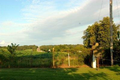
3. Plum River Falls Marker

Photographed By David Seibert, August 9, 2010
4. Plum River Falls Marker
The southeast corner of Old Mill Park

Photographed By David Seibert, August 9, 2010
5. Plum River Falls Marker
Looking east: the highway in the distance is US 52 toward Mount Carroll

Photographed By William J. Toman, May 22, 2011
6. Plum River Falls Marker
Looking west toward Savanna along U.S. Highway 52.

Photographed By William J. Toman, May 22, 2011
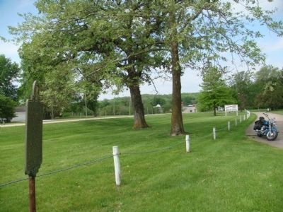
7. Plum River Falls Marker
Looking toward Old Mill Park from behind the marker.

Photographed By William J. Toman, May 22, 2011
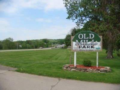
8. Sign at entrance to Old Mill Park
Credits. This page was last revised on June 16, 2016. It was originally submitted on August 10, 2010, by David Seibert of Sandy Springs, Georgia. This page has been viewed 1,450 times since then and 43 times this year. Photos: 1, 2, 3, 4, 5. submitted on August 10, 2010, by David Seibert of Sandy Springs, Georgia. 6, 7, 8. submitted on May 23, 2011, by William J. Toman of Green Lake, Wisconsin. • Craig Swain was the editor who published this page.