Seneca in Oconee County, South Carolina — The American South (South Atlantic)
Capt. Samuel Earle
Photographed by Brian Scott, November 28, 2008
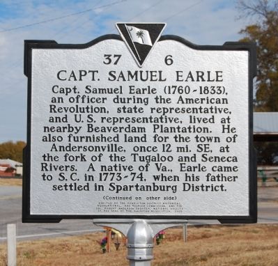
1. Capt. Samuel Earle Marker - Front
[Front]:
Capt. Samuel Earle (1760-1833), an officer during the American Revolution, state representative, and U.S. representative, lived at nearby Beaverdam Plantation. He also furnished land for the town of Andersonville, once 12 mi. SE. at the fork of the Tugaloo and Senece Rivers. A native of Va., Earle came to S.C. in 1773-74, when his father settled in Spartanburg District.
[Reverse]:
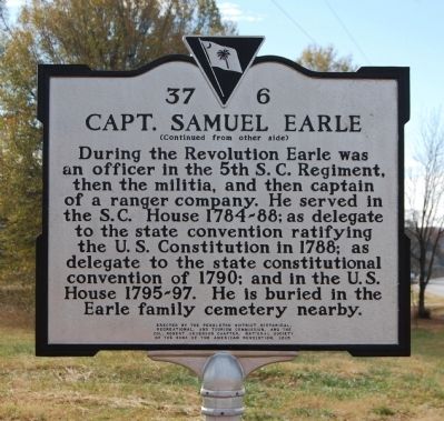
During the Revolution Earle was an officer in the 5th S.C. Regiment, then the militia, and then captain of a ranger company. He served in the S.C. House 1784-88; as delegate to the state convention ratifying the U.S. Constitution in 1788; as delegate to the state constitutional convention of 1790; and in the U.S. House 1795-97. He is buried in the Earle family cemetery nearby.
Erected 2005 by Pendleton District Historical, Recreational, and Tourism Commission, and the Col. Robert Anderson Chapter, National Society of the Sons of the American Revolution. (Marker Number 37-6.)
Topics and series. This historical marker is listed in these topic lists: Cemeteries & Burial Sites • Colonial Era • Settlements & Settlers
this page online
Location. 34° 33.967′ N, 82° 59.5′ W. Marker is in Seneca, South Carolina, in Oconee County. It is on SC Highway 59, on the left when traveling south. Marker is located at the intersection of SC Highway 59 and Earles Grove/Rodgers Roads. Touch for map. Marker is in this post office area: Seneca SC 29678, United States of America. Touch for directions.

Regionally, this marker is in andspecifically pstate, in the Foothills, in the Golden Corner. It is also in the American South, specifically in the Deep South, in Appalachia, and specifically in Southern Appalachia. Globally, it is in North America, the Western Hemisphere, the Western World, and the Anglosphere. Historically, it finds itself in what was once the original Cherokee Nation, the territory of the Mississippian Culture, one of the original Thirteen Colonies, one of the Confederate States of America, and the Antebellum South.
Other nearby markers. At least 8 other markers are
Photographed by Brian Scott, November 28, 2008
2. Capt. Samuel Earle Marker - Reverse
Other markers no longer nearby. Vandiver Bridge (was approx. 6 miles away but has been confirmed missing); Parkertown - 1832 (was approx. 7.9 miles away in Georgia but has been confirmed missing).
Also see . . .
1. Samuel Earle. Samuel Earle (November 28, 1760 – November 24, 1833) was a United States Representative from South Carolina. (Submitted on November 30, 2008, by Brian Scott of Anderson, South Carolina.)
2. The Capt. Samuel Earle Family Cemetery. (Submitted on August 18, 2010, by Preston Earle of Greensboro, North Carolina.)
Photographed by Brian Scott, November 28, 2008
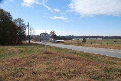
3. Capt. Samuel Earle Marker Looking South Along SC Highway 52
Photographed by Preston Earle, May 22, 2010
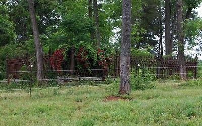
4. Capt. Samuel Earle Graveyard
Credits. This page was last revised on September 17, 2020. It was originally submitted on November 30, 2008, by Brian Scott of Anderson, South Carolina. This page has been viewed 2,555 times since then and 173 times this year. Last updated on August 18, 2010, by Preston Earle of Greensboro, North Carolina. Photos: 1, 2, 3. submitted on November 30, 2008, by Brian Scott of Anderson, South Carolina. 4. submitted on August 18, 2010, by Preston Earle of Greensboro, North Carolina. • Kevin W. was the editor who published this page.
