Osceola in St. Clair County, Missouri — The American Midwest (Upper Plains)
Osceola
Early thriving Osage River post. Osceola was settled during the mid-1830's largely by Southerners. The settlement and its first store were known as the "crossing of the Osage at Crow and Crutchfield's," until the name of the Indian warrior was adopted. In 1841 Osceola became the seat of newly organized St. Clair County, named for Gen. Aurthur St. Clair of the Revolutionary War.
In the Civil War, Osceola was the first town of wealth and consequence victimized in the atrocious raids characteristic of the war on the Missouri-Kansas border. Kansas troops under Gen. James H. Lane, on Sept. 23, 1861, looted and burned the defenseless town to ashes. Lane reported taking a vast amount of stores. $150,000 in bank deposits was saved, being removed before the raid.
In 1860, Osceola (inc. twp.) had a 2,077 pop. and was a trade center and a distribution point for goods shipped on the Osage River. In 1865, it was almost in ruins with a population of 183. Osceola did not enjoy renewed growth until the Kansas City, Osceola, and Southern R.R. (Frisco) was completed to this point, 1885.
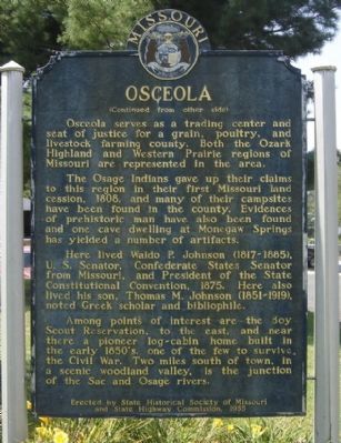
(Reverse):
The Osage Indians gave up their claims to this region in their first Missouri land cession, 1808, and many of their campsites have been found in the county. Evidences of prehistoric man have also been found and one cave dwelling at Monegaw Springs has yielded a number of artifacts.
Here lived Waldo P. Johnson (1817-1885), U.S. Senator, Confederate States Senator from Missouri, and President of the State Constitutional Convention, 1875. Here also lived his son, Thomas M. Johnson (1851-1919), noted Greek scholar and bibliophile.
Among points of interest are the Boy Scout Reservation, to the east, and near there a pioneer log-cabin home built in the early 1850's, one of the few to survive the Civil War. Two miles south of town, in a scenic woodland valley, is the junction of the Sac and Osage rivers.
Erected 1955 by State Historical Society of Missouri and State Highway Commission.
Topics and series. This historical marker is listed in these topic lists: Agriculture • Native Americans • Settlements & Settlers • War, US Civil. In addition, it is included in the Missouri, The State Historical Society of series list. A significant historical month for this entry is September 1830.
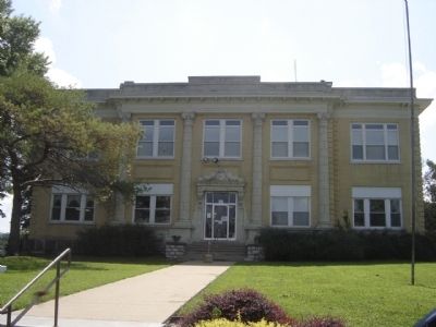
Location. 38° 2.825′ N, 93° 42.206′ W. Marker is in Osceola, Missouri, in St. Clair County. Marker is at the intersection of 2nd Street (State Highway WW) and Pine Street, on the right when traveling north on 2nd Street. Located in front of the St. Clair County Courthouse. Touch for map. Marker is in this post office area: Osceola MO 64776, United States of America. Touch for directions.
Other nearby markers. At least 6 other markers are within 14 miles of this marker, measured as the crow flies. Saint Clair County Veterans Memorial (a few steps from this marker); The Old Commercial Hotel (within shouting distance of this marker); Sacking of Osceola (approx. 0.6 miles away); Weaubleau Christian Institute and College (approx. 13.9 miles away); John Whitaker (approx. 13.9 miles away); Veterans Memorial (approx. 14 miles away).
Also see . . .
1. The Sacking of Osceola. Wikipedia article. The destruction of Osceola sparked a series of reprisals from both sides, including the destruction of Lawrence, Kansas. Lane's looting of Osceola also served as a basis for parts of the 1970s movie Outlaw Josey Wales. (Submitted on September 23, 2010, by Craig Swain of Leesburg, Virginia.)
2. Osceola in the Civil War. Video of historian Richard Sunderwith reading about the burning of Osceola. (Submitted on September 23, 2010, by Craig Swain of Leesburg, Virginia.)
Credits. This page was last revised on June 16, 2016. It was originally submitted on September 23, 2010, by Craig Swain of Leesburg, Virginia. This page has been viewed 1,767 times since then and 58 times this year. Photos: 1, 2, 3. submitted on September 23, 2010, by Craig Swain of Leesburg, Virginia.


