Vicksburg in Warren County, Mississippi — The American South (East South Central)
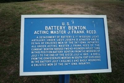
U.S. Battery Benton.
Acting Master J. Frank Reed.
Photographed by Richard E. Miller, August 7, 2010
1. U.S. Battery Benton Marker
Battery Benton.
Acting Master J. Frank Reed.
Erected by Vicksburg Battlefield Board - US War Department.
Topics. This historical marker is listed in these topic lists: War, US Civil • Waterways & Vessels. A significant historical date for this entry is July 1, 1929.
Location. 32° 18.761′ N, 90° 54.007′ W. Marker is in Vicksburg, Mississippi, in Warren County. It is on Navy Circle west of South Washington Street (U.S. 61). Marker is on the hill overlooking the Mississippi River, north of I-20 and the Mississippi State Visitor Center. Touch for map. Marker is in this post office area: Vicksburg MS 39183, United States of America. Touch for directions.

Regionally,
this page online
Other nearby markers. At least 8 other markers are within walking distance of this marker: Gibraltar of the Confederacy (a few steps from this marker); Vicksburg Siege (about 300 feet away, measured in a direct line); Mississippi (about 300 feet away); Iowa (approx. 0.2 miles away); C.S. Company G, (approx. ¼ mile away); C.S. Company A, (approx. ¼ mile away); C.S. Company C, (approx. ¼ mile away); C.S. Company I, (approx. ¼ mile away). Touch for a list and map of all markers in Vicksburg.
Additional keywords. U.S. Navy; Vicksburg Campaign;
Photographed by Richard E. Miller, August 7, 2010
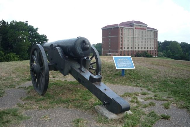
2. U.S. Battery Benton Marker
Photographed by Richard E. Miller, August 7, 2010
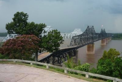
3. View toward Louisiana from "Navy Circle", north of the Mississippi Welcome Center
- Vicksburg Bridge, I-20/US80 at left; Old Vicksburg Bridge, Kansas City Southern Railway (National Register of Historic Places, 1989) at right.

Photographed by Richard E. Miller, August 7, 2010
4. View northward toward the Vicksburg riverfront and the Ameristar Casino Hotel
Credits. This page was last revised on August 1, 2023. It was originally submitted on January 8, 2011, by Richard E. Miller of Oxon Hill, Maryland. This page has been viewed 1,693 times since then and 35 times this year. Photos: 1, 2, 3, 4. submitted on January 8, 2011, by Richard E. Miller of Oxon Hill, Maryland. • Craig Swain was the editor who published this page.
