Near Sylvester in Worth County, Georgia — The American South (South Atlantic)
Thigpen Trail
Photographed by David Seibert, January 23, 2011
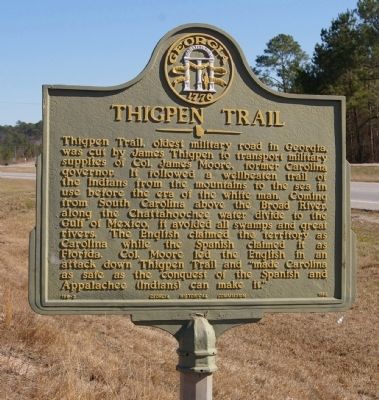
1. Thigpen Trail Marker
Thigpen Trail, oldest military road in Georgia, was cut by James Thigpen to transport military supplies of Col. James Moore, former Carolina governor. It followed a wellbeaten trail of the Indians from the mountains to the sea in use before the era of the white man. Coming from South Carolina above the Broad River, along the Chattahoochee water divide to the Gulf of Mexico, it avoided all swamps and great rivers. The English claimed the territory as Carolina while the Spanish claimed it as Florida. Col. Moore led the English in an attack down Thigpen Trail and “made Carolina as safe as the conquest of the Spanish and Appalachee (Indians) can make it.”
Erected 1956 by Georgia Historical Commission. (Marker Number 159-3.)
Topics and series. This historical marker is listed in these topic lists: Indigenous Peoples and Communities • Roads & Vehicles • Settlements & Settlers • Wars, US Indian. In addition, it is included in the Georgia Historical Society series list.
Location. 31° 32.989′ N, 83° 53.743′ W. Marker is near Sylvester, Georgia, in Worth County.
this page online

Regionally, this marker is on Georgia’s Coastal Plain. It is also in the American South and specifically in the Deep South. Globally, it is in North America, the Western Hemisphere, the Western World, and the Anglosphere. Historically, it finds itself in what was once the territory of the Mississippian Culture, one of the original Thirteen Colonies, one of the Confederate States of America, and the Antebellum South.
Other nearby markers. At least 3 other markers are within 4 miles of this marker, measured as the crow flies: 1703-’04 Thigpen Trail (a few steps from this marker); Historic Downtown Sylvester (approx. 3.8 miles away); Worth County (approx. 3.9 miles away).
Photographed by David Seibert, January 23, 2011
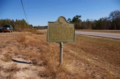
2. Thigpen Trail Marker
Looking east toward Sylvester, with US Highway 82/Georgia Highway 520 in the background
Photographed by David Seibert, January 2, 2011
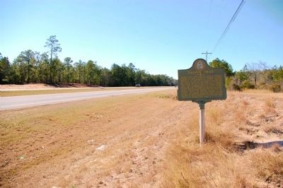
3. Thigpen Trail Marker
Looking west along US Highway 82/Georgia Highway 520 toward Albany.
Credits. This page was last revised on February 9, 2025. It was originally submitted on February 5, 2011, by David Seibert of Sandy Springs, Georgia. This page has been viewed 3,545 times since then and 123 times this year. Photos: 1, 2, 3. submitted on February 5, 2011, by David Seibert of Sandy Springs, Georgia. • Craig Swain was the editor who published this page.
