Manassas, Virginia — The American South (Mid-Atlantic)
Clover Hill Farm
February 12, 2011
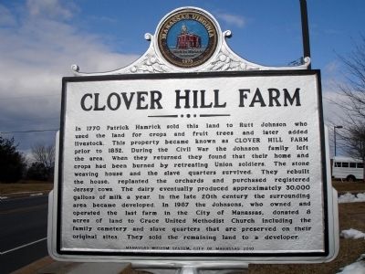
1. Clover Hill Farm Marker
In 1770 Patrick Hamrick sold this land to Rutt Johnson who used the land for crops and fruit trees and later added livestock. This property became known as CLOVER HILL FARM prior to 1852. During the Civil War the Johnson family left the area. When they returned they found that their home and crops had been burned by retreating Union soldiers. The stone weaving house and the slave quarters survived. They rebuilt the house, replanted the orchards and purchased registered Jersey cows. The dairy eventually produced approximately 30,000 gallons of milk a year. In the late 20th century the surrounding area became developed. In 1987 the Johnsons, who owned and operated the last farm in the City of Manassas, donated 8 acres of land to Grace United Methodist Church including the family cemetery and slave quarters that are preserved on their original sites. They sold the remaining land to a developer.
Erected 2010 by Manassas Museum System, City of Manassas.
Topics and series. This historical marker is listed in these topic lists: African Americans • Agriculture • War, US Civil. In addition, it is included
this page online
Location. 38° 44.264′ N, 77° 28.674′ W. Marker is in Manassas, Virginia. It is on Hendley Road south of Wellington Road, on the left when traveling south. Touch for map. Marker is at or near this postal address: 9316 Waterford Dr, Manassas VA 20110, United States of America. Touch for directions.

Regionally, this marker is in the Washington Metropolitan Area and in Northern Virginia. It is also in the American South, specifically in the Upper South, and in the Mid-Atlantic. Globally, it is in North America, the Western Hemisphere, the Western World, and the Anglosphere. Historically, it finds itself in what was once the territory of the Mississippian Culture, one of the original Thirteen Colonies, one of the Confederate States of America, and the Antebellum South.
Other nearby markers. At least 8 other markers are within walking distance of this marker: A New Brown School (approx. ¾ mile away); Jane Serepta Dean (approx. 0.8 miles away); The Brown School (approx. 0.8 miles away); Carnegie Building (approx. 0.8 miles away); The Museum Garden
February 12, 2011
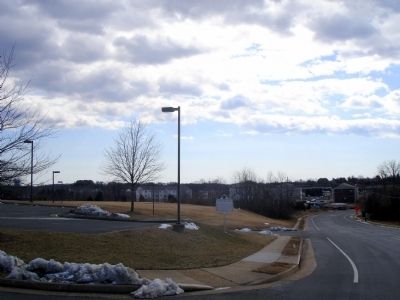
2. Clover Hill Farm Marker
Other markers no longer nearby. The Brown School (was approx. 0.8 miles away but has been replaced with another marker now near it); The Manassas Industrial School / Jennie Dean Memorial (was approx. 0.8 miles away but has been replaced with another marker now near it); a different marker also named The Manassas Industrial School / Jennie Dean Memorial (was approx. 0.8 miles away but has been replaced with another marker now near it).
Additional commentary.
1.
— Submitted February 12, 2011.
February 6, 2011
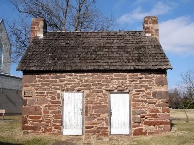
3. Clover Hill Farm Slave Quarters
February 12, 2011
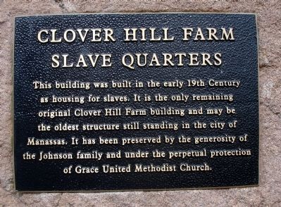
4. Plaque on the Historic Cabin:
This building was built in the early 19th century as housing for slaves. It is the only remaining original Clover Hill Farm building and may be the oldest structure still standing in the city of Manassas. It has been preserved by the generosity of the Johnson family and under the perpetual protection of Grace United Methodist Church.
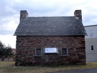
February 12, 2011
5. Clover Hill Farm Slave Quarters
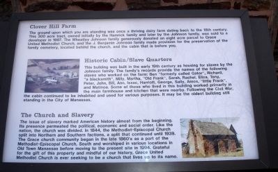
February 6, 2011
6. Interpretive Marker at the Historic Cabin
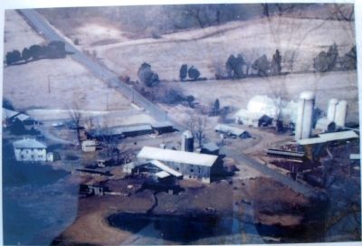
February 6, 2011
7. Close-up of Clover Hill Farm photo
Credits. This page was last revised on July 14, 2026. It was originally submitted on February 12, 2011. This page has been viewed 5,064 times since then and 206 times this year. Photos: 1, 2, 3, 4, 5, 6, 7. submitted on February 12, 2011. • Craig Swain was the editor who published this page.
