Montezuma Castle National Monument in Yavapai County, Arizona — The American Mountains (Southwest)
Lifeline
⎯⎯⎯
Prehistoric Produce
Photographed by William Fischer, Jr., November 7, 2010
1. Lifeline Marker
Lifeline
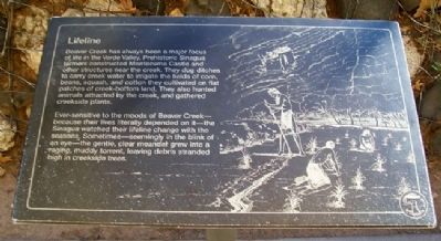
Beaver Creek has always been a major focus of life in the Verde Valley. Prehistoric Sinagua farmers constructed Montezuma Castle and other structures near the creek. They dug ditches to carry creek water to irrigate the fields of corn, beans, squash, and cotton they cultivated on flat patches of creek-bottom land. They also hunted animals attracted by the creek, and gathered creekside plants.
Ever-sensitive to the moods of Beaver Creek – because their lives literally depended on it – the Sinagua watched their lifeline change with the seasons. Sometimes – seemingly in the blink of an eye – the gentle, clear meander grew into a raging, muddy torrent, leaving debris stranded high in creekside trees.
Prehistoric Produce
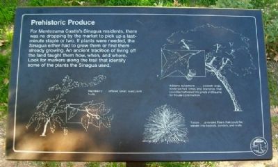
For Montezuma Castle's Sinagua residents, there was no dropping by the market to pickup a last-minute staple or two. If plants were needed, the Sinagua either had to grow them or find them already growing. An ancient tradition of living off the land taught them how, when, and where. Look for markers along the trail that identify some of the plants the Sinagua used. [Marker
this page online
Erected by National Park Service.
Topics. This historical marker is listed in these topic lists: Anthropology & Archaeology • Environment • Settlements & Settlers • Waterways & Vessels.
Location. 34° 36.688′ N, 111° 50.564′ W. Marker is in Montezuma Castle National Monument, Arizona, in Yavapai County. It can be reached from Montezuma Castle Road. Markers are along the walking trail leading from the visitor center. Touch for map. Marker is at or near this postal address: Montezuma Castle Road, Camp Verde AZ 86322, United States of America. Touch for directions.

Regionally, this marker is in Verde Valley and in the Yavapai-Apache Nation. It is also in the American Southwest and in the Mountain West. Globally, it is in North America, the Western Hemisphere, the Western World, and the Anglosphere. Historically, it finds itself in what was once New Spain and also Mexico’s Alta California.
Other nearby markers. At least 8 other markers are within walking distance of this marker: Growing a Livelihood (within shouting
Photographed by William Fischer, Jr., November 7, 2010
2. Prehistoric Produce Marker
Other markers no longer nearby. The Neighborhood / Mysterious Departures (was within shouting distance of this marker but has been permanently removed); The People Next Door (was within shouting distance of this marker but has been permanently removed); The Way Up / Construction Sequence (was about 300 feet away, measured in a direct line but has been permanently removed).
Also see . . . Montezuma Castle National Monument. (Submitted on March 13, 2011, by William Fischer, Jr. of Reynoldsburg, Ohio.)
Photographed by William Fischer, Jr., November 7, 2010
3. Lifeline Marker
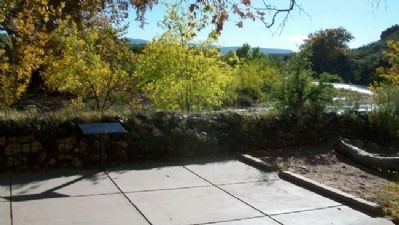
Beaver Creek in background, looking south.
Photographed by William Fischer, Jr., November 7, 2010
4. Beaver Creek View from Marker
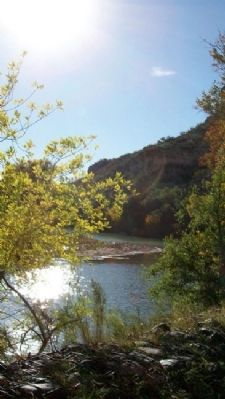
Looking southwest

Photographed by James Hulse, June 19, 2024
5. Lifeline / Prehistoric Produce Marker
The Lifeline marker
Credits. This page was last revised on July 18, 2024. It was originally submitted on March 13, 2011, by William Fischer, Jr. of Reynoldsburg, Ohio. This page has been viewed 1,093 times since then and 18 times this year. Photos: 1, 2, 3, 4. submitted on March 13, 2011, by William Fischer, Jr. of Reynoldsburg, Ohio. 5. submitted on July 18, 2024, by James Hulse of Medina, Texas.
