Greenbelt in Prince George's County, Maryland — The American Northeast (Mid-Atlantic)
Water
Greenbelt Park
— National Park Service, U.S. Department of the Interior —
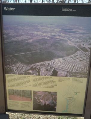
Greenbelt Park’s streams and wetlands vividly demonstrate that what goes on outside the boundary of a park can have a profound effect on the park itself. Streambeds within the park are deeply scoured and eroded. The water that courses through them is laden with silt, and carries nutrients, oil, and other pollutants. Why? The acres of pavement around the park absorb no water; fertilizers and lubricants know no boundaries.
Water running through Greenbelt Park eventually finds its way into the Anacostia River, the Potomac, the Chesapeake, and finally the Atlantic. The National Park Service is working to rehabilitate the water that flows through the park by constructing wetland buffer areas and installing “check dams” – barriers that help slow the flow of water and filter urban pollution caused by cars and development.
[Captions:]
The reason for excessive runoff into Greenbelt Park is apparent in this aerial view (above). The park is virtually surrounded by pavement. Greenbelt is within the Anacostia River drainage. The river has been plagued by sediment and pollution. Efforts like those at Greenbelt Park will eventually help the river recover.
[Map of the Anacostia River watershed – highlighting Greenbelt Park and the U.S. Capitol in Washington, D.C.]
Development around the park pre-dated modern storm water management methods; during storms, water levels in park streams far exceed what they would have been 60 years ago. Many streambeds in the park are badly eroded.
The park has one natural wetland, just off the Blueberry Trail (the trail begins about 25 yards from the ranger station). Wetlands provide habitat for many species, slow the flow of water during storms, and help filter silt and impurities.
Erected by National Park Service, U.S. Department of the Interior.
Topics. This historical marker is listed in these topic lists: Environment • Horticulture & Forestry • Parks & Recreational Areas • Waterways & Vessels.
Location. 38° 58.752′ N, 76° 53.86′ W. Marker is in Greenbelt, Maryland, in Prince George's County. Marker is on Campsite Drive east of Park Central Road, on the right when traveling west. Marker is in the parking lot at the southwest corner of the park ranger station. Touch for map. Marker is at or near this postal address: 6565 Greenbelt Road, Greenbelt MD 20770, United States of America. Touch for directions.
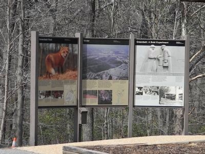
Other nearby markers. At least 8 other markers are within one mile of this marker, measured as the crow flies. Greenbelt Park (here, next to this marker); Greenbelt: A Bold Experiment (here, next to this marker); a different marker also named Greenbelt Park
(approx. 0.6 miles away); Carrington Avenue (approx. 0.9 miles away); Charlton Avenue (approx. 0.9 miles away); Town of Berwyn Heights (approx. 0.9 miles away); Edmonston Road (approx. one mile away); Time of Horror (approx. one mile away). Touch for a list and map of all markers in Greenbelt.
Also see . . . Greenbelt Park. National Park Service (Submitted on March 31, 2011, by Bernard Fisher of Richmond, Virginia.)
Credits. This page was last revised on June 21, 2023. It was originally submitted on March 28, 2011, by Richard E. Miller of Oxon Hill, Maryland. This page has been viewed 473 times since then and 7 times this year. Photos: 1, 2, 3. submitted on March 28, 2011, by Richard E. Miller of Oxon Hill, Maryland. • Bill Pfingsten was the editor who published this page.


