Murrysville in Westmoreland County, Pennsylvania — The American Northeast (Mid-Atlantic)
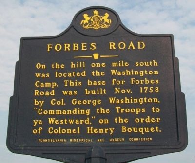
Forbes Road
On the hill one mile south was located the Washington Camp. This base for Forbes Road was built Nov. 1758 by Col. George Washington, "Commanding the Troops to ye Westward," on the order of Colonel Henry Bouquet.
Erected 1960 by Pennsylvania Historical and Museum Commission.
Topics and series. This historical marker is listed in these topic lists: Colonial Era • Man-Made Features • Patriots & Patriotism • War, French and Indian. In addition, it is included in the Forbes Road, and the Pennsylvania Historical and Museum Commission series lists. A significant historical year for this entry is 1758.
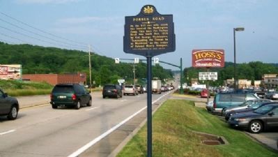
Location. 40° 25.385′ N, 79° 39.817′ W. Marker is in Murrysville, Pennsylvania, in Westmoreland County. Marker is on William Penn Highway (U.S. 22), on the right when traveling east. Marker is about 500 feet west of Cline Hollow Road. Touch for map. Marker is at or near this postal address: 4813 William Penn Highway, Murrysville PA 15668, United States of America. Touch for directions.
Other nearby markers. At least 8 other markers are within 5 miles of this marker, measured as the crow flies. A different marker also named Forbes Road (approx. 0.6 miles away); Haymaker Well (approx. 1.8 miles away); Murrysville Gas Well (approx. 1.8 miles away); a different marker also named Forbes Road (approx. 1.8 miles away); World Wars Honor Roll (approx. 1.8 miles away); Bushy Run (approx. 4.8 miles away); Pontiac's War (approx. 4.9 miles away); Delmont (approx. 4.9 miles away). Touch for a list and map of all markers in Murrysville.
Related marker. Click here for another marker that is related to this marker. Identical marker along the westbound lanes of US Route 22.
Also see . . .
1. Forbes Road (Washington Camp). Explore PA History website entry (Submitted on June 25, 2011, by William Fischer, Jr. of Scranton, Pennsylvania.)
2. Forbes Road, Pennsylvania. Legends of America website entry (Submitted on July 9, 2022, by Larry Gertner of New York, New York.)
Credits. This page was last revised on July 9, 2022. It was originally submitted on June 25, 2011, by William Fischer, Jr. of Scranton, Pennsylvania. This page has been viewed 1,175 times since then and 42 times this year. Photos: 1, 2. submitted on June 25, 2011, by William Fischer, Jr. of Scranton, Pennsylvania.

