Marker Logo HMdb.org THE HISTORICAL
MARKER DATABASE
“Bite-Size Bits of Local, National, and Global History”
Seneca Rocks in Pendleton County, West Virginia — The American South (Appalachia)
MISSING
SEE LOCATION SECTION
 

Seneca Rocks


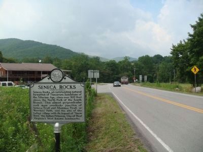
Seneca Rocks Marker image. Click for full size.
Photographed By William J. Toman, July 19, 2011
1. Seneca Rocks Marker
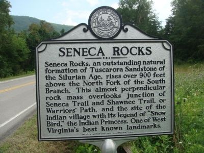
Inscription. Seneca Rocks, an outstanding natural formation of Tuscarora Sandstone of the Silurian Age, rises over 900 feet above the North Fork of the South Branch. This almost perpendicular rock mass overlooks junction of Seneca Trail and Shawnee Trail, or Warriors' Path, and the site of the Indian village with its legend of "Snow Bird," the Indian Princess. One of West Virginia's best known landmarks.
 
Erected 1963 by the West Virginia Historic Commission.
 
Topics and series. This historical marker is listed in these topic lists: EnvironmentNative AmericansNatural Features. In addition, it is included in the West Virginia Archives and History series list.
 
Location. Marker is missing. It was located near 38° 50.028′ N, 79° 22.577′ W. Marker was in Seneca Rocks, West Virginia, in Pendleton County. Marker was at the intersection of U.S. 33 and State Highway 55, on the left when traveling north on U.S. 33. Touch for map. Marker was in this post office area: Seneca Rocks WV 26884, United States of America. Touch for directions.
 
Other nearby markers. At least 8 other markers are within 6 miles of this location, measured as the crow flies. More Than One Way Up (about 600 feet away, measured in a direct line); 10th Mountain Division (about 700 feet away); An 1800’s Garden!
Paid Advertisement
Click on the ad for more information.
Please report objectionable advertising to the Editor.
Click or scan to see
this page online
(approx. 0.2 miles away); A Melting Pot House (approx. ¼ mile away); Sites Homestead (approx. ¼ mile away); Camp Luther (approx. 1.3 miles away); Eagle Rocks (approx. 4½ miles away); St. George’s Church (approx. 5½ miles away). Touch for a list and map of all markers in Seneca Rocks.
 
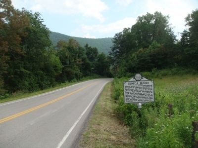
Seneca Rocks Marker image. Click for full size.
Photographed By William J. Toman, July 19, 2011
2. Seneca Rocks Marker
The view looking north on U.S. Highway 33. Seneca Rocks is to the right.
Seneca Rocks Marker image. Click for full size.
Photographed By William J. Toman, July 19, 2011
3. Seneca Rocks Marker
The view looking south on U.S. Highway 33.
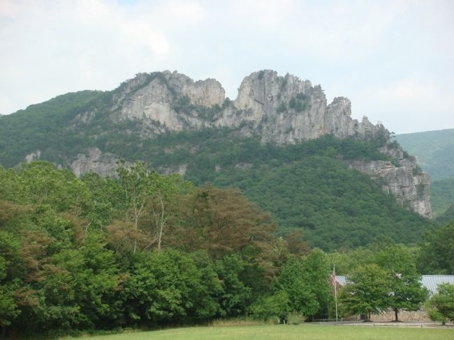
Seneca Rocks image. Click for full size.
Photographed By William J. Toman, July 19, 2011
4. Seneca Rocks
 
 
Credits. This page was last revised on May 12, 2022. It was originally submitted on July 25, 2011, by William J. Toman of Green Lake, Wisconsin. This page has been viewed 1,063 times since then and 20 times this year. Photos:   1, 2, 3, 4. submitted on July 25, 2011, by William J. Toman of Green Lake, Wisconsin.
Share this page.  
Share on Tumblr
m=45033

CeraNet Cloud Computing sponsors the Historical Marker Database.
This website earns income from purchases you make after using our links to Amazon.com. We appreciate your support.
Paid Advertisement
Apr. 25, 2024