Shockoe Bottom in Richmond, Virginia — The American South (Mid-Atlantic)
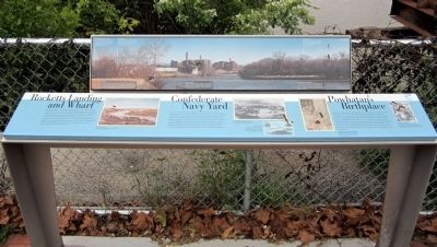
Rocketts Landing and Wharf / Confederate Navy Yard / Powhatan’s Birthplace
Inscription.
(bottom panel)
Rocketts Landing and Wharf
Rocketts is the river frontage and community named for Robert Rockett, who operated a ferry across the James River beginning in the 1730s. Over the years, tenant laborers and merchants filled the floodplain with clusters of small houses and commercial establishments. Between 1790 and 1830 free black residents and immigrants from Germany, Scotland and Ireland also settled here. Growing opportunities in trade gradually made Rocketts a prosperous world seaport. Shipping lines connected Rocketts to Philadelphia, New York, Charleston and various South American and European ports. Tobacco and flour were the main exports.
Confederate Navy Yard
Begun in 1862, the Confederate Navy Yard occupied both sides of the James River, including the community and port of Rocketts on the north bank. The Yard was the base, construction site and headquarters for Admiral Raphael Semmes’s James River Squadron. The Squadron included the ironclad CSS Virginia II, which was built here. It was the successor to the first CSS Virginia, which fought with the USS Monitor. The Confederate Navy Yard also produced prototype artillery mounted on a railroad car for General Robert F. Lee’s use at the Battle of Savage’s Station on June 29, 1862. On April 3, 1865, Confederate troops burned the yard and destroyed vessels as a part of the evacuation of Richmond.
Powhatan’s Birthplace
Powhatan, paramount chief of Algonquian-speaking Indians of Virginia’s coastal plain, was born in a town east of here. Powhatan’s supremacy in this region provided order and protection for the tribes in his chiefdom. Virginia’s Indians lived in towns, sore protected by wooden palisades, and surrounded by fields for growing vegetables, grain and corn. In 1607, when Jamestown’s colonists were foraging for food north of the settlement, Captain John Smith was captured and brought before Powhatan at his center of power on the York River. Smith later claimed that Pocahontas, Powhatan’s favorite daughter, intervened to save Smith. Powhatan “adopted” Smith into the chiefdom and allowed him to return to Jamestown.
(top panel)
Riverfront
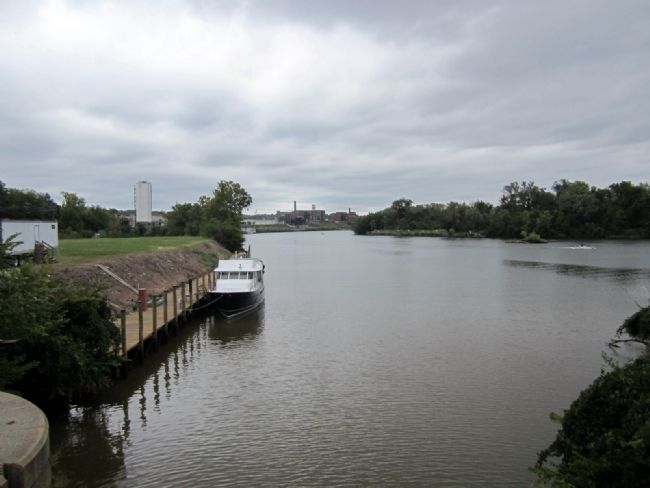
Immediately beyond the Great Ship Lock was the S.H. Hawes and Co. coal yard (ca. 1880-1925). After 1925 it was used as a sand and gravel yard and concrete plant until the 1990s. Beyond the yard were wharves for passenger steamships, first the Old Dominion Steam Ship Co. for eservice to New York (ca. 1875-1935), and beyond that the Buxton Line. Distance: 0.1-0.2 mile
Rocketts Landing
Rocketts Landing is a modern residential area. Previously it was the site of the Yuengling James River Steam Brewery (1870s), the Richmond Cedar Works (1880s-1950s) and the Virginia-Carolina Chemical Works. Distance: 0.6-0.9 mile
Confederate Navy Yard — South
The main Confederate Navy Yard (burned April 1865) was located on the south bank of the river. Later the site was occupied by the Allison & Addison fertilizer plant and by wharves for the Richmond & Danville and Southern railroads. Distance: 0.2-0.3 mile
Confederate Navy Yard — North
The north bank section of the Confederate Navy Yard (burned April 1865) is today occupied by the silos and plant built by the Lehigh Portland Cement Co. in the late 1940s. Distance: 0.25 miles
Rockets Wharf
The north bank area has served a s a public wharf since the 18th century. In 1933, it became the City of Richmond Intermediate Terminal. Distance: 0.3 mile
Powhatan Town
This site was occupied by the Algonquin in 1607-1609 and then traded to the English. The site is at Tree Hill, on the north bank, off Route 5 beyond Almond Creek. Distance: 1.7 miles
Erected 2011 by Virginia Capital Trail.
Topics. This historical marker is listed in these topic lists: Industry & Commerce
• Native Americans • War, US Civil • Waterways & Vessels. A significant historical date for this entry is April 3, 1865.
Location. 37° 31.522′ N, 77° 25.24′ W. Marker is in Richmond, Virginia. It is in Shockoe Bottom. Marker can be reached from the intersection of Dock Street and Pear Street, on the right when traveling east. Touch for map. Marker is at or near this postal address: 2803 Dock Street, Richmond VA 23223, United States of America. Touch for directions.
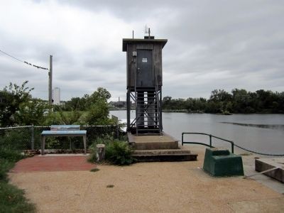
Other nearby markers. At least 8 other markers are within walking distance of this marker. City Locks River Gauge (here, next to this marker); Coffer Dams (within shouting distance of this marker); Great Ship Lock (within shouting distance of this marker); Rocketts Landing (within shouting distance of this marker); Confederate Navy Yard (within shouting distance of this marker); a different marker also named Great Ship Lock (within shouting distance of this marker); a different marker also named Great Ship Lock (within shouting distance of this marker); 17 Feet (about 300 feet away, measured in a direct line). Touch for a list and map of all markers in Richmond.
More about this marker. Photo captions:
Rocketts Landing
Oil on canvas by George Bacon Wood, 1860 Valentine Richmond History Center
The Confederate Navy Yard at Rocketts
Frank Leslie’s Illustrated Newspaper, July 1, 1865. Valentine Richmond History Center
CSS Virginia II
Harper’s Weekly, July 26, 1862. The 197-foot-long ironclad ram was built at the Confederate Navy Yard at Rocketts and completed in 1864. Valentine Richmond History Center
Virginia, Discovered and Discribed by Captayn John Smith (detail), 1625
Note the James River with the “Fales” (falls) and “Powhatan” marked there. Valentine Richmond History Center
Captain John Smith
Smith’s leadership saved the Jamestown settlement. In 1609, he returned to England, after being wounded in a gunpowder accident. Cook Collection, Valentine Richmond History Center
Photo: March 2009
Credits. This page was last revised on February 1, 2023. It was originally submitted on September 22, 2011, by Bernard Fisher of Richmond, Virginia. This page has been viewed 1,747 times since then and 92 times this year. Photos: 1, 2, 3, 4. submitted on September 22, 2011, by Bernard Fisher of Richmond, Virginia.


