Near Deerfield in Franklin County, Massachusetts — The American Northeast (New England)
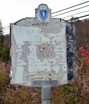
Old Deerfield
1630 - 1930
Indian land called Pocomtuck, settled by men from Dedham in 1671. Attacked by Indians, burnt, and abandoned in 1675. Reoccupied and attacked in 1704 by French and Indians, who took 47 lives, and carried off 112 captives to Canada, of whom 60 were later redeemed.
Erected 1930 by Massachusetts Bay Colony-Tercentenary Commission.
Topics and series. This historical marker is listed in these topic lists: Colonial Era • Native Americans • Settlements & Settlers • War, French and Indian. In addition, it is included in the Massachusetts Bay Colony—Tercentenary Commission Markers series list. A significant historical year for this entry is 1671.
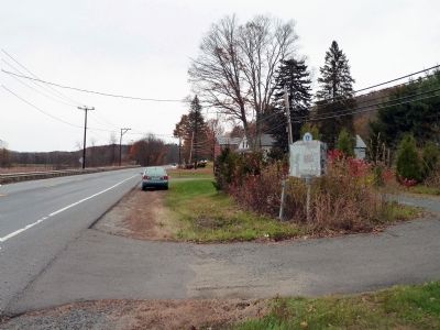
Location. 42° 33.193′ N, 72° 35.969′ W. Marker is near Deerfield, Massachusetts, in Franklin County. Marker is on Greenfield Road (U.S. 5) north of Main Street, on the right when traveling north. Touch for map. Marker is in this post office area: Deerfield MA 01342, United States of America. Touch for directions.
Other nearby markers. At least 8 other markers are within walking distance of this marker. Thomas W. Johnson / Allan J. Johnson (about 300 feet away, measured in a direct line); Furniture Gallery / Wright House (approx. 0.2 miles away); Deerfield (approx. 0.2 miles away); Ashley House (approx. 0.2 miles away); Cato / Jin Cole / Titus (approx. 0.2 miles away); Williams House (approx. ¼ mile away); Sheldon House (approx. ¼ mile away); Sheldon Homestead (approx. ¼ mile away). Touch for a list and map of all markers in Deerfield.
More about this marker. The marker appears to consist of lettering painted on plywood, and it is extremely dilapidated. It may an attempted reproduction of an earlier metal one at the same site. Possibly replaced by the Massachusetts Department of Transportation.
Regarding Old Deerfield. For more about Old Deerfield, see the links to other markers nearby. The contents of this marker is the same as the marker at the southern entrance to Old Deerfield according to the online reference of "Massachusetts. Special Commission on the Celebration of the Tercentenary of the Founding of the Massachusetts Bay Colony; Morison, Samuel Eliot, 1887-1976"
http://www.archive.org/details/historicalmarker00mass
Related marker. Click here for another marker that is related to this marker. Similar marker south of town
Credits. This page was last revised on June 16, 2016. It was originally submitted on May 11, 2011, by Roger W. Sinnott of Chelmsford, Massachusetts. This page has been viewed 1,051 times since then and 31 times this year. Last updated on October 9, 2011, by Michael Tiernan of Danvers, Massachusetts. Photos: 1, 2. submitted on May 11, 2011, by Roger W. Sinnott of Chelmsford, Massachusetts. • Bill Pfingsten was the editor who published this page.

