Topeka in Shawnee County, Kansas — The American Midwest (Upper Plains)
Trails across Kansas
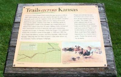
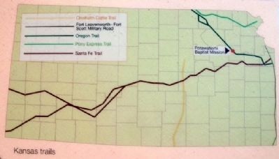
Kansas is a land of trails. Even before Kansas became a state in 1861, many people and animals traveled through the area. It is the north-south route for migratory birds. Elk and bison cut paths looking for rivers and other water sources. Native Americans followed the game, creating more trails. In 1821 the Santa Fe Trail established a trade route between the United States and Mexico that lasted more than 50 years. Military roads connected Fort Leavenworth to forts in the south and west transporting supplies and troops. In the early 1840s the Oregon Trail extended across the northeast corner of the state. In 1859 and 1860 the short-lived mail delivery service, the Pony Express, rode through Kansas. Following the Civil War, longhorn cattle were driven up the Chisholm Trail to railheads in Kansas.
People and animals traveled the flattest and easiest routes. Both always needed a source of water. The Oregon Trail, which passed west of the Potawatomi Mission, paralled rivers across the West. Travelers waiting to cross at Pappan's or Smith's ferries on the Kansas River could have their wagons repaired by the mission blacksmith, Robert Simerwell, and his students.
Erected by Kansas Historical Society.
Topics. This historical marker is listed in these topic lists: Animals • Native Americans • Roads & Vehicles • Waterways & Vessels. A significant historical year for this entry is 1861.
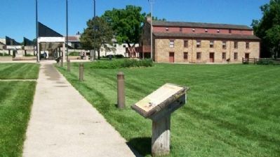
Location. 39° 3.357′ N, 95° 46.451′ W. Marker is in Topeka, Kansas, in Shawnee County. Marker is along the walk leading from the parking lot to the Kansas Museum of History. Touch for map. Marker is at or near this postal address: 6425 SW 6th Avenue, Topeka KS 66615, United States of America. Touch for directions.
Other nearby markers. At least 8 other markers are within 3 miles of this marker, measured as the crow flies. Potawatomie Baptist Manual Labor Training School (within shouting distance of this marker); Mission Kitchen Garden (within shouting distance of this marker); Sioux Quartzite Boulder (within shouting distance of this marker); Gettysburg Address (approx. 2.1 miles away); Veterans Memorial (approx. 2.3 miles away); Martin Luther (approx. 2.4 miles away); The Munn Pioneer Memorial (approx. 2˝ miles away); V. F. W. Lawn (approx. 2.6 miles away). Touch for a list and map of all markers in Topeka.
Also see . . .
1. Santa Fe Trail. (Submitted on October 23, 2011, by William Fischer, Jr. of Scranton, Pennsylvania.)
2. Oregon-California Trail. (Submitted on October 23, 2011, by William Fischer, Jr. of Scranton, Pennsylvania.)
3. Chisholm Trail
. (Submitted on October 23, 2011, by William Fischer, Jr. of Scranton, Pennsylvania.)
4. Frontier Forts. (Submitted on October 23, 2011, by William Fischer, Jr. of Scranton, Pennsylvania.)
Credits. This page was last revised on June 16, 2016. It was originally submitted on October 23, 2011, by William Fischer, Jr. of Scranton, Pennsylvania. This page has been viewed 694 times since then and 9 times this year. Photos: 1, 2, 3. submitted on October 23, 2011, by William Fischer, Jr. of Scranton, Pennsylvania.


