Near Triangle in Prince William County, Virginia — The American South (Mid-Atlantic)
The Potomac Path
The King’s Highway
Photographed by Kevin W., January 21, 2008
1. The King's Highway ~ The Potomac Path Marker
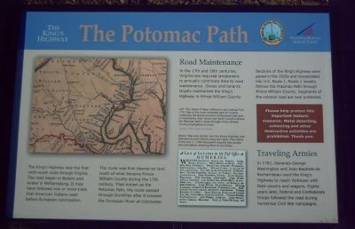
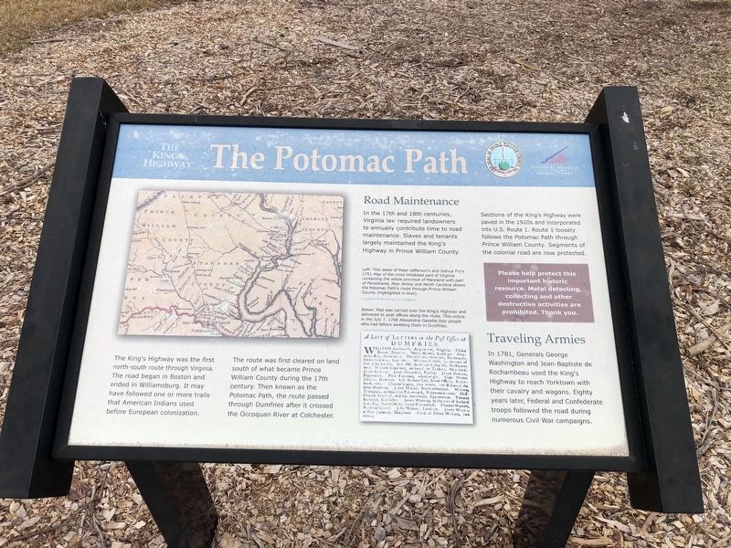
The route was first cleared on land south of what became Prince William County during the 17th century. Then known as the Potomac Path, the route passed through Dumfries after it crossed the Occoquan River at Colchester.
Road Maintenance
In the 17th and 18th centuries, Virginia law required landowners to annually contribute time to road maintenance. Slaves and tenants largely maintained the King’s Highway in Prince William County.
Sections of the King’s Highway were paved in the 1920s and incorporated into U.S. Route 1. Route 1 loosely follows the Potomac Path through Prince William County. Segments of the colonial road are now protected.
Traveling Armies
In 1781, Generals George Washington and Jean-Baptiste de Rochambeau used the King’s Highway
this page online
Erected 2007 by the National Museum of the Marine Corps and Prince William County.
Topics and series. This historical marker is listed in these topic lists: Colonial Era • Military • Roads & Vehicles • War, US Civil • War, US Revolutionary. In addition, it is included in the Former U.S. Presidents: #01 George Washington, and the The Washington-Rochambeau Route series lists. A significant historical year for this entry is 1781.
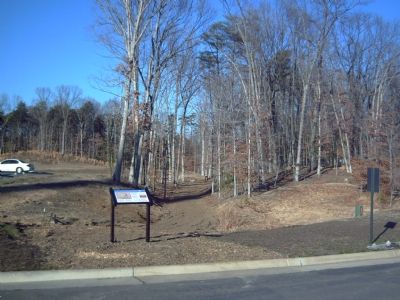
Location. This marker has been replaced by another marker nearby. It was located near 38° 32.71′ N, 77° 20.537′ W. Marker was near Triangle, Virginia, in Prince William County. It could be reached from Richmond Highway (U.S. 1). Marker is located on the grounds of the National Museum of the Marine Corps, to the right of the main entrance. Touch for map. Marker was at or near this postal
Photographed by Devry Becker Jones (CC0), March 12, 2021
2. The Potomac Path Marker
The marker has weathered some.

Regionally, this marker was in the Washington Metropolitan Area, in Northern Virginia, and in the Piedmont. It was also in the American South, specifically in the Upper South, in the Mid-Atlantic, and on the Eastern Seaboard. Globally, it was in the North Atlantic Region, North America, the Western Hemisphere, the Western World, and the Anglosphere. Historically, it found itself in what was once the territory of the Mississippian Culture, one of the original Thirteen Colonies, one of the Confederate States of America, and the Antebellum South.
Other nearby markers. At least 8 other markers are within walking distance of this location: The Return from Yorktown (here, next to this marker); TBS Class 4-69 KIA (within shouting distance of this marker); 22nd Marines WWII (within shouting distance of this marker); LtCol Lew Dement USMC (within shouting distance of this marker);
Photographed by Kevin W., January 21, 2008
3. The King's Highway ~ The Potomac Path Marker
More about this marker. On the left is a map detailing the route then known as the Potomac Path. The map carries the caption, "This detail of Peter Jefferson’s and Joshua Fry’s 1751 Map of the most inhabited part of Virginia containing the whole province of Maryland with part of Pensilvania, New Jersey, and North Carolina shows the Potomac Path’s route through Prince William County (highlighted in blue)." The marker identifies the source as Courtesy of the Library of Congress.
The lower center of the marker displays a 1768 newspaper article. It carries the caption, “Mail was carried over the King’s Highway and delivered to post offices along the route. This notice in the July 7, 1768 Alexandria Gazette lists people who had letters awaiting them in Dumfries.”
Also see . . . Virtual Tour of The King's Highway. (Submitted on January 22, 2008, by Kevin W. of Stafford, Virginia.)
Credits. This page was last revised on January 31, 2025. It was originally submitted on January 22, 2008, by Kevin W. of Stafford, Virginia. This page has been viewed 2,005 times since then and 52 times this year. Photos: 1. submitted on January 22, 2008, by Kevin W. of Stafford, Virginia. 2. submitted on March 12, 2021, by Devry Becker Jones of Washington, District of Columbia. 3. submitted on January 22, 2008, by Kevin W. of Stafford, Virginia.
