Sandy Hook in Washington County, Maryland — The American Northeast (Mid-Atlantic)
Maryland Heights - Mountain Fortress of Harpers Ferry
Inscription.
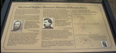
You are standing on the border between North and South during the Civil War. As the highest ridge surrounding Harpers Ferry, Maryland Heights played a prominent role in the strategic operations of both the Union and Confederacy.
Southern forces under Col. Thomas J. Jackson first occupied this ground in early May 1861, violating Maryland's neutrality. Confederates remained here until they abandoned Harpers Ferry on June 15, 1861.
"I have finished reconnoitering the Maryland Heights, and have determined to fortify them at once, and hold them...be the cost what it may."
Col. Thomas J Jackson
May 7, 1861
Jackson returned fifteen months later, during the Confederacy's first major invasion of the North. "Stonewall" Jackson, as he was now called, directed a three-pronged siege of the Union garrison at Harpers Ferry, seizing Maryland Heights from the north on September 13, 1862. Two days later Federal commander Dixon Miles surrendered, allowing Jackson to rush his forces to Sharpsburg to join Gen. Robert E. Lee.
On September 22, 1862, five days after the Battle of Antietam and Confederate withdrawal from Maryland, Union troops once again occupied the Heights. Federal Commander George B. McClellan ordered fortifications built to deter future invasion, protect the B&O Railroad, and guard the U.S. supply depot at Harpers Ferry. By the end of 1863, Union troops had built eight fortifications, at times defended by 10,000 soldiers.
"I have determined to fortify [Maryland Heights] in order to avoid a similar catastrophe to the one which happened to Colonel Miles."
Maj. Gen. George B. McClellan
September 26, 1862
Despite this mountain fortress, Confederate invasion continued. During the Gettysburg Campaign, General Lee sidestepped the Heights position, crossing the Potomac 12 miles northwest near Shepherdstown. In July 1864, Jubal Early's 14,000 Rebels demonstrated against these defenses, but left them behind en route to Washington, D.C.
Federal soldiers and their cannon finally departed Maryland Heights in July 1865, three months after Lee's surrender. Behind them they left their forts and campgrounds - reminders of America's bloodiest war.
Topics. This historical marker is listed in this topic list: War, US Civil. A significant historical year for this entry is 1861.
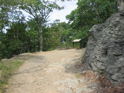
Location. 39° 19.958′ N, 77° 43.913′ W. Marker is in Sandy Hook, Maryland, in Washington County. Marker can be reached from Sandy Hook Road. Located on the hiking trail of Maryland Heights, at the first trail wayside, overlooking the Potomac River. Touch for map. Marker is in this post office area: Knoxville MD 21758, United States of America. Touch for directions.
Other nearby markers. At least 8 other markers are within walking distance of this marker. Naval Battery (approx. 0.2 miles away); Hiking Maryland Heights
(approx. ¼ mile away); Making a Mountain Citadel (approx. 0.4 miles away); 30-Pounder Battery (approx. 0.4 miles away); Charcoal Making on Maryland Heights (approx. 0.4 miles away); Branding the B&O (approx. 0.6 miles away in West Virginia); Pvt Luke Quinn (approx. 0.6 miles away in West Virginia); Warehouse (approx. 0.6 miles away in West Virginia). Touch for a list and map of all markers in Sandy Hook.
More about this marker. The marker displays portraits of Jackson, McClellan, and Early (on the lower right).
On the right side of the marker are maps depicting the three Confederate invasions mentioned in the text, titled "Attacks on Maryland Heights." "Because of its strategic location, Maryland Heights remained a target for control throughout the Civil War." The three maps illustrate invasions in September 1862, June-July 1863, and July 1864.
The enemy "had taken refuge in his strongly fortified works ... and an attempt to carry them by assault would have resulted in greater loss than the advantage gained..."
-Lt. Jubal A. Early, commander of the Second Corps, in his
Photographed By Craig Swain, September 22, 2007
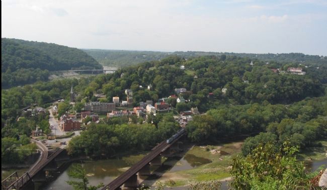
3. Overlook of Harpers Ferry from Maryland Heights
Heavy artillery at this point could command the river, road, rail and canal approaches to Harpers Ferry. This not only protected (or threatened depending on the side possessing the heights) Harpers Ferry but also the Potomac water gap through the Blue Ridge, South Mountain, and Catoctin ranges.
Regarding Maryland Heights - Mountain Fortress of Harpers Ferry. This marker is one of a set along the National Park Service's trail to the top of Maryland Heights.
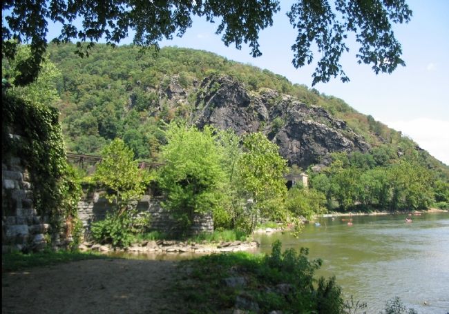
Photographed By Craig Swain, August 12, 2007
4. Maryland Heights from Waterlevel
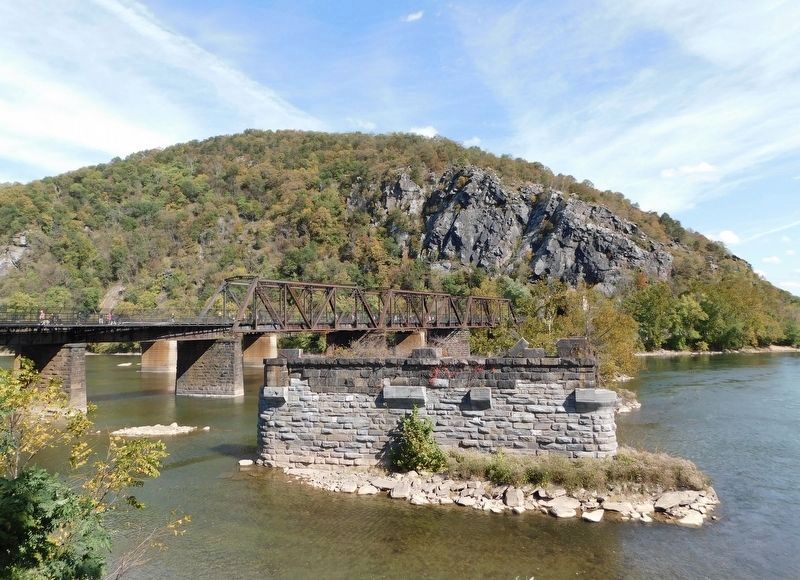
From the banks at the confluence of the Potomac and Shenandoah looking up at Maryland Heights. The trail ascends the mountain and affords a view of the town from the top of the cliffs, from which the photo above was taken. The ruins of old railroad bridges still stand in the Potomac River on the right side of the photo. Visible just over the trees at the base of the mountain is the Harpers Ferry tunnel, passing through about 1000 feet of the southern tip of Maryland Heights.
Credits. This page was last revised on March 19, 2022. It was originally submitted on January 27, 2008, by Craig Swain of Leesburg, Virginia. This page has been viewed 3,277 times since then and 51 times this year. Photos: 1, 2, 3, 4. submitted on January 27, 2008, by Craig Swain of Leesburg, Virginia. 5. submitted on May 9, 2021, by Bradley Owen of Morgantown, West Virginia.
