Pinson in Madison County, Tennessee — The American South (East South Central)
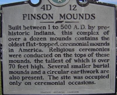
Pinson Mounds
Erected by Tennessee Historical Commission. (Marker Number 4D 12.)
Topics and series. This historical marker is listed in these topic lists: Anthropology & Archaeology • Cemeteries & Burial Sites • Man-Made Features • Native Americans. In addition, it is included in the Tennessee Historical Commission series list.
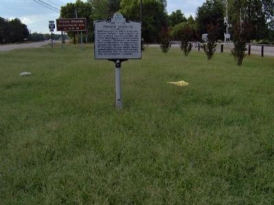
Location. 35° 29.422′ N, 88° 43.194′ W. Marker is in Pinson, Tennessee, in Madison County. Marker is at the intersection of U.S. 45 and Bear Creek Road, on the right when traveling north on U.S. 45. Touch for map. Marker is at or near this postal address: 4005 US 45 South, Pinson TN 38366, United States of America. Touch for directions.
Other nearby markers. At least 8 other markers are within 3 miles of this marker, measured as the crow flies. Mound 15 (approx. 1.9 miles away); Latter Mississippian Presence (approx. 1.9 miles away); Mound 14 Sector (approx. 1.9 miles away); Mound 12 (approx. 2 miles away); Sauls Mound (approx. 2.1 miles away); a different marker also named Sauls Mound (approx. 2.1 miles away); The Barrow Pit (approx. 2.2 miles away); The Barrow Pit and Mound 12 (approx. 2.2 miles away). Touch for a list and map of all markers in Pinson.
Also see . . . Pinson Mounds. Wikipedia (Submitted on February 14, 2012, by Bernard Fisher of Richmond, Virginia.)
Credits. This page was last revised on September 10, 2020. It was originally submitted on February 12, 2012, by Ken Smith of Milan, Tennessee. This page has been viewed 894 times since then and 34 times this year. Photos: 1, 2. submitted on February 12, 2012, by Ken Smith of Milan, Tennessee. • Bernard Fisher was the editor who published this page.

