Arlington in Arlington County, Virginia — The American South (Mid-Atlantic)
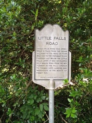
Little Falls Road
Photographed by Kevin Vincent, June 17, 2012
1. Little Falls Road Marker
Erected by Arlington County, Virginia.
Topics. This historical marker is listed in these topic lists: Colonial Era • Indigenous Peoples and Communities • Roads & Vehicles.
Location. 38° 54.41′ N, 77° 8.32′ W. Marker is in Arlington, Virginia, in Arlington County. It is at the intersection of Little Falls Road and North George Mason Drive on Little Falls Road. Touch for map. Marker is in this post office area: Arlington VA 22207, United States of America. Touch for directions.

Regionally, this marker is in the Washington Metropolitan Area and in Northern Virginia. It is also in the American South, specifically in the Upper South, in the Mid-Atlantic, and on the Eastern Seaboard. Globally, it is in the North Atlantic Region, North America, the Western
this page online
Other nearby markers. At least 8 other markers are within one mile of this marker, measured as the crow flies: John Saegmuller House (about 300 feet away, measured in a direct line); George Nicholas Saegmuller (about 800 feet away); Original Federal Boundary Stone, District of Columbia, Northwest 2 (approx. 0.6 miles away); Birchwood (approx. 0.9 miles away); Wunder's Crossroads (approx. one mile away); RADM Paul A. Holmberg (approx. 1.1 miles away); Minor's Hill (approx. 1.1 miles away); Mt. Salvation Baptist Church (approx. 1.1 miles away). Touch for a list and map of all markers in Arlington.
Photographed by Kevin Vincent, June 17, 2012
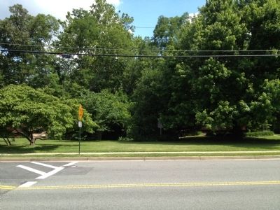
2. looking south across Little Falls Road
The marker is barely visible in the trees in the park
Photographed by Kevin Vincent, June 17, 2012
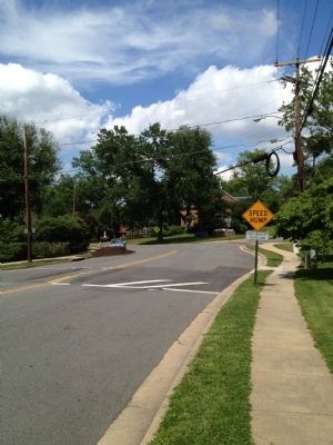
3. Looking east on Little Falls Road from marker
Rock Springs Congregational Church is visible in the distance
Credits. This page was last revised on September 20, 2026. It was originally submitted on May 30, 2012, by Kevin Vincent of Arlington, Virginia. This page has been viewed 1,411 times since then and 66 times this year. Photos: 1, 2, 3. submitted on June 18, 2012, by Kevin Vincent of Arlington, Virginia. • Bill Pfingsten was the editor who published this page.
