Eastport in Anne Arundel County, Maryland — The American Northeast (Mid-Atlantic)
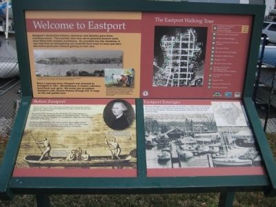
Welcome to Eastport
Once a separate town, Eastport was annexed to Annapolis in 1951. Nevertheless, it retains a distinct local flavor and spirit. We invite you to explore Eastport's rich, diverse history through the 14 stops on this self-guided tour.
Text with lower-left photo: The popular yellow flags with the motto "We like it this way" flew first in 1998. To offset the potential loss to businesses from a temporary bridge closure, the community created the mock "Maritime Republic of Eastport" and declared independence from Annapolis.
Before Eastport
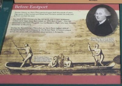
Human history on Horn Point peninsula goes back thousands of years. Algonquin tribes hunted and fished here, Puritans settled the area, and farmers worked the land.
For much of the colonial era, the Hill family was a major landowner. Indeed, early maps show Back Creek as "Hill's Back Creek." One Hill descendant, Henrietta Margaret, married Benjamin Ogle, who later became Governor of Maryland.
During the Revolutionary War, a fort on Horn Point helped defend Annapolis Harbor from invasion by the British Fleet. A historic plaque across the street tells of Lafayette's encampment in Annapolis.
Text with upper-left photo: Benjamin Ogle, Governor of Maryland from 1798 to 1801, found the pastures of Horn Point ideal for raising some of the state's first racehorses.
Text with main photo: For thousands of years, Algonquin Indians used dugout canoes to harvest fish and oysters on these creeks.
Eastport Emerges
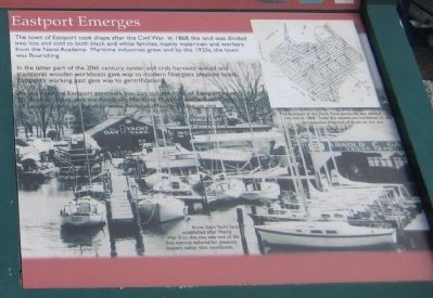
The town of Eastport took shape after the Civil War. In 1868, the land was divided into lots and sold to both black and white families, mainly watermen and workers from the Naval Academy. Maritime industries grew, and by the 1920s, the town was flourishing.
In the latter part of the 20th century, oyster and crab harvests waned and the traditional wooden workboats gave way to modern fiberglass pleasure boats. Eastport's working past gave way to gentrification.
As you tour the Eastport peninsula, you can still see hints of Eastport's past. To discover more, visit the Annapolis Maritime Museum at the Back Creek end of Second Street, or log onto www.AnnapolisMaritimeMuseum.org.
Text with upper left photo: The farmland of the Horn Point peninsula was divided into lots in 1868. Today the streets are numbered in the opposite
direction of those on this plat.
Text with main photo: Arnie Gay's Yacht Yard, established after World War II on this site, was one of the first marinas tailored for pleasure boaters rather than workboats.
Erected by Chesapeake Bay Gateways Network, Annapolis Maritime Museum, Four Rivers Garden Club.
Topics. This historical marker is listed in these topic lists: African Americans • Agriculture • Animals • Industry & Commerce • Native Americans • Settlements & Settlers • War, US Revolutionary • Waterways & Vessels. A significant historical year for this entry is 1951.
Location. 38° 58.282′ N, 76° 29.11′ W. Marker is in Eastport, Maryland, in Anne Arundel County. Marker is on 6th Street, 0.1 miles north of Severn Avenue, on the right when traveling north. Touch for map. Marker is in this post office area: Annapolis MD 21403, United States of America. Touch for directions.
Other nearby markers. At least 8 other markers are within walking distance of this marker. On to Yorktown (here, next to this marker); Lafayette’s Encampment (within shouting distance of this marker); Eastport Veterans Park (about 400 feet away, measured in a direct line); A Tale of Three Bridges (about 600 feet away); Eastport's Old "Main Street" (about 600 feet away); Arnold C. Gay
(about 600 feet away); The Old Farmhouse (about 800 feet away); Three Great Boat Yards, One Location (approx. ¼ mile away). Touch for a list and map of all markers in Eastport.
Also see . . . Annapolis Maritime Museum. Museum website homepage (Submitted on March 2, 2008, by F. Robby of Baltimore, Maryland.)
Credits. This page was last revised on February 13, 2022. It was originally submitted on March 2, 2008, by F. Robby of Baltimore, Maryland. This page has been viewed 1,668 times since then and 50 times this year. Photos: 1, 2, 3. submitted on March 2, 2008, by F. Robby of Baltimore, Maryland. 4. submitted on April 5, 2020, by Devry Becker Jones of Washington, District of Columbia.


