
Charles City in Charles City County, Virginia — The American South (Mid-Atlantic)
Kittiewan Plantation
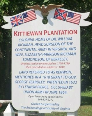
Photographed by Don Morfe, June 23, 2012
1. Kittiewan Plantation Marker
Colonial home of Dr. William Rickman, Head Surgeon of the Continental Army of Virginia, and wife Elizabeth Harrison Rickman Edmondson, of Berkeley.
Original section constructed ca. 1770-1790, shed roof addition added ca. 1840.
Land referred to as Kenwon, mentioned in a 1618 grant to Gov. George Yeardley. Patented in 1632 by Lennon Pierce. Occupied by Union Army in June 1864.
Topics. This historical marker is listed in these topic lists: Colonial Era • Science & Medicine • Settlements & Settlers • War, US Civil. A significant historical month for this entry is June 1864.
Location. 37° 18.348′ N, 77° 2.898′ W. Marker is in Charles City, Virginia, in Charles City County. It is on Weyanoke Road. Touch for map. Marker is at or near this postal address: 12104 Weyanoke Road, Charles City VA 23030, United States of America. Touch for directions.

Regionally, this marker is in Coastal Virginia. It is also in the American South, specifically in the Upper South, and in the Tidewater. Globally, it is in the North Atlantic Region, North America, the Western Hemisphere, the Western World, and the Anglosphere.
this page online
Other nearby markers. At least 8 other markers are within 3 miles of this marker, measured as the crow flies: North Bend (approx. 0.6 miles away); Kittiewan and Doctor Rickman (approx. 2.1 miles away); Weyanoke & Parrish Hill (approx. 2.1 miles away); Upper Weyanoke (approx. 2.1 miles away); a different marker also named North Bend (approx. 2.1 miles away); Sherwood Forest (approx. 2.6 miles away); President Tyler's Home (approx. 2.7 miles away); New Hope & Court House (approx. 2.8 miles away). Touch for a list and map of all markers in Charles City.
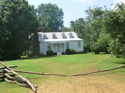
Photographed by Don Morfe, June 23, 2012
2. Kittiewan Plantation Marker
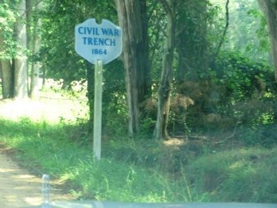
Photographed by Don Morfe, June 23, 2012
3. Kittiewan Plantation Marker
Credits. This page was last revised on August 6, 2020. It was originally submitted on September 19, 2012, by Don Morfe of Baltimore, Maryland. This page has been viewed 762 times since then and 34 times this year. Photos: 1, 2, 3. submitted on September 19, 2012, by Don Morfe of Baltimore, Maryland. • Craig Swain was the editor who published this page.
