Near Merino in Logan County, Colorado — The American Mountains (Southwest)
Fort Wicked
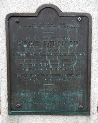
“Fort Wicked"
Originally Godfrey’s Ranch
Named from the bitter defence make by Holon Godfrey.
Erected 1929 by State Historical Society of Colorado-J.N. Hall Foundation & Sterling Chamber of Commerce. (Marker Number 2.)
Topics and series. This historical marker is listed in these topic lists: Forts and Castles • Native Americans • Roads & Vehicles • Wars, US Indian. In addition, it is included in the Colorado - History Colorado series list. A significant historical year for this entry is 1864.
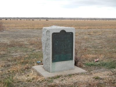
Location. 40° 26.64′ N, 103° 22.739′ W. Marker is near Merino, Colorado, in Logan County. Marker is at the intersection of Grand Army of the Republic Highway (State Highway 6) and County Road 2.5, on the right when traveling east on Grand Army of the Republic Highway. This marker is approximately 3.3 miles southeast of Merino, CO. Touch for map. Marker is at or near this postal address: 1144 Grand Army of the Republic Highway, Merino CO 80741, United States of America. Touch for directions.
Other nearby markers. At least 8 other markers are within 16 miles of this marker, measured as the crow flies . Battle of Summit Springs (approx. 8.7 miles away); William Shaw Hadfield (approx. 12.1 miles away); "Dinkey Engine" (approx. 14.9 miles away); Replica of the Statue of Liberty (approx. 15.3 miles away); Valley Station (approx. 15.9 miles away); Old Sterling (approx. 15.9 miles away); Original Building (approx. 15.9 miles away); The Overland Trail (approx. 16.1 miles away).
Also see . . . Fort Wicked - Fort Morgan, Colorado. …we halted at a singular station. A wall of adobes three feet thick and six in height, pierced with loop-holes for musketry, confronted us. The top was rudely machicolated, and over the main entrance was the inscription, “Fort Wicked.” (Submitted on December 20, 2012, by Barry Swackhamer of Brentwood, California.)
Credits. This page was last revised on June 16, 2016. It was originally submitted on December 20, 2012, by Barry Swackhamer of Brentwood, California. This page has been viewed 1,556 times since then and 52 times this year. Photos: 1, 2. submitted on December 20, 2012, by Barry Swackhamer of Brentwood, California. • Syd Whittle was the editor who published this page.

