Near Sunbury in Liberty County, Georgia — The American South (South Atlantic)
Colonel's Island
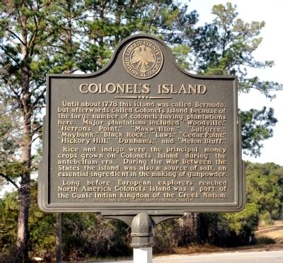
Photographed by David Seibert, January 21, 2013
1. Colonel's Island Marker
Rice and indigo were the principal money crops grown on Colonel’s Island during the antebellum era. During the War Between the States the island was also a source of salt, an essential ingredient in the making of gunpowder.
Long before European explorers reached North America Colonel’s Island was a part of the Guale Indian kingdom of the Creek Nation.
Erected 1996 by Liberty County Historical Society.
Topics. This historical marker is listed in these topic lists: Colonial Era • Indigenous Peoples and Communities • Settlements & Settlers • War, US Civil. A significant historical year for this entry is 1778.
Location. 31° 42.612′ N, 81° 16.972′ W.
this page online

Regionally, this marker is on the Coastal Plain and on the Georgia Coast and the Golden Isles. It is also in the American South, specifically in the Deep South, and on the Eastern Seaboard. Globally, it is in the North Atlantic Region, North America, the Western Hemisphere, the Western World, and the Anglosphere. Historically, it finds itself in what was once New Spain, the territory of the Mississippian Culture, one of the original Thirteen Colonies, one of the Confederate States of America, and the Antebellum South.
Other nearby markers. At least 8 other markers are within 5 miles of this marker, measured as the crow flies: Fort Morris (approx. 3½ miles away); The Famous Sunbury "Masonic" Oak (approx. 3.6 miles away); The Old Sunbury Road (approx. 4 miles away); Sunbury Cemetery (approx. 4.1 miles away); a different
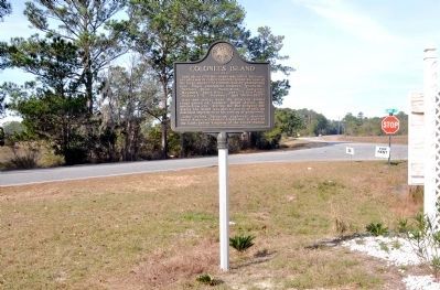
Photographed by David Seibert, January 21, 2013
2. Colonel's Island Marker
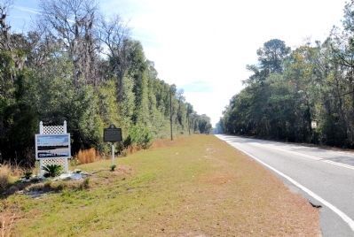
Photographed by David Seibert, January 21, 2013
3. Colonel's Island Marker
Looking southeast on Kings Road
Credits. This page was last revised on June 16, 2016. It was originally submitted on January 30, 2013, by David Seibert of Sandy Springs, Georgia. This page has been viewed 1,837 times since then and 83 times this year. Photos: 1. submitted on January 30, 2013, by David Seibert of Sandy Springs, Georgia. 2, 3. submitted on February 1, 2013, by David Seibert of Sandy Springs, Georgia. • Bill Pfingsten was the editor who published this page.
