Grant Park in Atlanta in Fulton County, Georgia — The American South (South Atlantic)
Slave Square
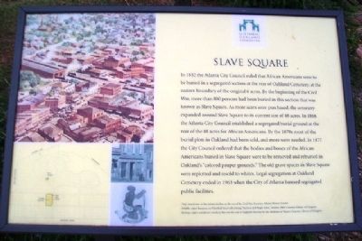
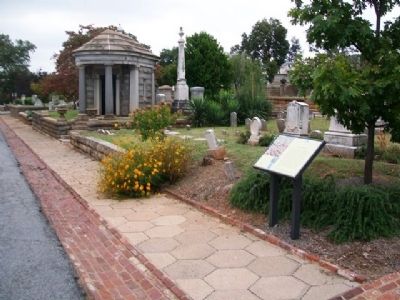
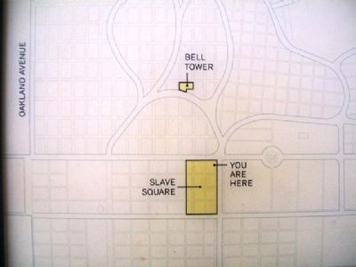
In 1852 the Atlanta City Council ruled that African Americans were to be buried in a segregated section at the rear of Oakland Cemetery, at the eastern boundary of the original 6 acres. By the beginning of the Civil war, more than 800 persons had been buried in this section that was known as Slave Square. As more acres were purchased, the cemetery expanded around Slave Square to its current size of 48 acres. In 1866 the Atlanta City Council established a segregated burial ground at the rear of the 48 acres for African Americans. By the 1870s most of the burial plots in Oakland had been sold, and more were needed. In 1877 the City Council ordered that the bodies and bones of the African Americans buried in Slave Square were to be removed and reburied in Oakland's "colored pauper grounds." The old grave spaces in Slave Square were replotted and resold to whites. Legal segregation at Oakland Cemetery ended in 1963 when the City of Atlanta banned segregated public facilities.
[Photo captions read]
(Top) Aerial view of the Atlanta skyline on the eve of the Civil War. Courtesy Atlanta History Center
(Middle, right) Business on Whitehall Street advertising "Auction and Negro Sales," Atlanta, 1864. Courtesy Library of Congress
(Bottom, right) Antislavery woodcut that was the seal of England's Society for the Abolition of Slavery. Courtesy Library of Congress
Erected by Historic Oakland Foundation.
Topics. This historical marker is listed in these topic lists: African Americans • Cemeteries & Burial Sites • Civil Rights • Settlements & Settlers. A significant historical year for this entry is 1852.
Location. 33° 44.879′ N, 84° 22.365′ W. Marker is in Atlanta, Georgia, in Fulton County. It is in Grant Park. Marker is in Oakland Cemetery. Touch for map. Marker is at or near this postal address: 248 Oakland Avenue SE, Atlanta GA 30312, United States of America. Touch for directions.
Other nearby markers. At least 8 other markers are within walking distance of this marker. Confederate Soldiers Plot (a few steps from this marker); Confederate Memorial Grounds (a few steps from this marker); Dr. Noel d'Alvigny (a few steps from this marker); Dr. Charles d'Alvigny (a few steps from this marker); John Brown Gordon (a few steps from this marker); Alfred Iverson, Jr. (within shouting distance of this marker); Moses W. Formwalt (within shouting distance of this marker); Clement Anselm Evans (within shouting distance of this marker). Touch for a list and map of all markers in Atlanta.
Also see . . . Historic Oakland Cemetery, Atlanta. (Submitted on April 27, 2013, by William Fischer, Jr. of Scranton, Pennsylvania.)
Credits. This page was last revised on February 8, 2023. It was originally submitted on April 27, 2013, by William Fischer, Jr. of Scranton, Pennsylvania. This page has been viewed 795 times since then and 26 times this year. Photos: 1, 2, 3. submitted on April 27, 2013, by William Fischer, Jr. of Scranton, Pennsylvania.


