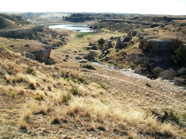
Near Scott State Park in Scott County, Kansas — The American Midwest (Upper Plains)
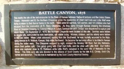
Battle Canyon, 1878
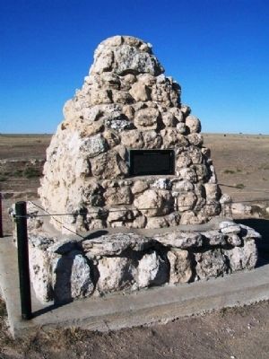
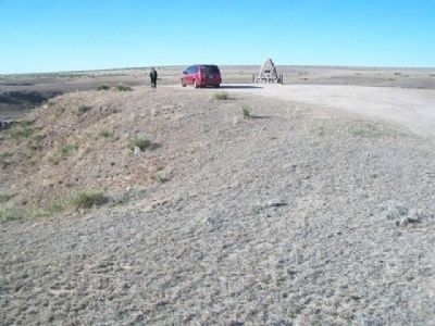
This marks the site of the last encounter in the State of Kansas between Native Americans and the United States Troops. Homesick and ill, the Northern Cheyenne under the leadership of Chief Dull Knife and Little Wolf were trying to return to their former home in the north. There were 92 warriors, 120 women, and 141 children who had escaped from the reservation at Ft. Reno, Oklahoma. As they came through Kansas crossing the Arkansas River at Cimarron Crossing, Lt. Colonel William H. Lewis, commander at Ft. Dodge, was dispatched to capture and return them. On September 27, 1878, the Northern Cheyenne were located at this site. Sentries were hidden in circular pits, surrounded by rock barricades, still visible today. Women, children, and the elderly were hidden in the Den below. When Lewis advanced, coming from the Southwest, he was mortally wounded in the thigh, dying enroute to Ft. Wallace, Kansas, forty miles Northwest. He became the last army officer to be killed in Kansas during the Indian wars. The Cheyenne escaped by night, crossed the Smokey [sic] Hill River, fled into Nebraska, where their parties split. One group going with Chief Dull Knife, and the other with Little Wolf. Dull Knife's group was captured close to Ft. Robinson while Little Wolf remained in the sand hills of Nebraska for the Winter. This thirty acre site was donated to the citizens of Scott County by the late R.B. Christy, Scott City banker and stockman. The site now is maintained by the Scott County Historical Society.
Topics. This historical marker is listed in these topic lists: Environment • Native Americans • Wars, US Indian. A significant historical date for this entry is September 27, 1878.
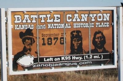
Location. 38° 38.613′ N, 100° 55.676′ W. Marker is near Scott State Park, Kansas, in Scott County. Monument is on a cattle ranch, on a gravel road about a mile WNW off Kansas Route 96, and about 2 miles WNW of the intersection of Kansas Route 96 and US Highway 83. Touch for map. Marker is in this post office area: Scott City KS 67871, United States of America. Touch for directions.
Other nearby markers. At least 8 other markers are within 12 miles of this marker, measured as the crow flies. El Quartelejo (approx. 1.7 miles away); Steele Memorial (approx. 2.2 miles away); a different marker also named El Quartelejo (approx. 2.4 miles away); Plains Apache at El Cuartelejo (approx. 2.4 miles away); Pueblo Floor Plan (approx. 2.4 miles away); El Cuartelejo Archeology (approx. 2.4 miles away); El Cuartelejo (approx. 2.4 miles away); War Memorial (approx. 11.1 miles away). Touch for a list and map of all markers in Scott State Park.
Also see . . .
1. Spend The Day Exploring Battle Canyon, The Location Of the Last Indian Battle In Kansas. Only In Your State website entry (Submitted on October 4, 2022, by Larry Gertner of New York, New York.)
2. Battle Canyon, 1878 Tour. YouTube video (17m 38s) (Submitted on June 14, 2013, by William Fischer, Jr. of Scranton, Pennsylvania.)
Credits. This page was last revised on October 4, 2022. It was originally submitted on June 14, 2013, by William Fischer, Jr. of Scranton, Pennsylvania. This page has been viewed 973 times since then and 47 times this year. Photos: 1, 2, 3, 4, 5. submitted on June 14, 2013, by William Fischer, Jr. of Scranton, Pennsylvania.
