
Riverfront in Chattanooga in Hamilton County, Tennessee — The American South (East South Central)
Hazen's Raid at Brown's Ferry
Breaking the Siege

Photographed by David Rozzelle, August 5, 2025
1. Hazen's Raid at Brown's Ferry Marker
First Insert:
After the Battle of Chickamauga in September 1863, Union Gen. William S. Rosecrans retreated to Federal-occupied Chattanooga, a strategically vital rail center, where Confederate Gen. Braxton Bragg laid siege from Lookout Mountain and Missionary Ridge. Union Gen. Ulysses S. Grant took command in October and began his efforts to break the siege. Bragg detached forces under Gen. James Longstreet to attack Knoxville as a diversion. After Gen. William T. Sherman reinforced Grant in November, the Federals attacked the heights and Bragg retreated. The Union army held the city for the rest of the war.
Main marker text:
During the siege of Chattanooga, Confederate forces controlled the two most reliable supply routes available to the Union garrison there. Only a rickety road across Walden’s Ridge was accessible to Federal wagon trains carrying food, clothing, and ammunition. Late in October, to improve the flow of supplies, Union Gen. Ulysses S. Grant ordered troops stationed in Bridgeport, Alabama, to march north and seize the valley west of Lookout Mountain. At the same time, he ordered forces from Chattanooga
this page online
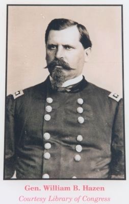
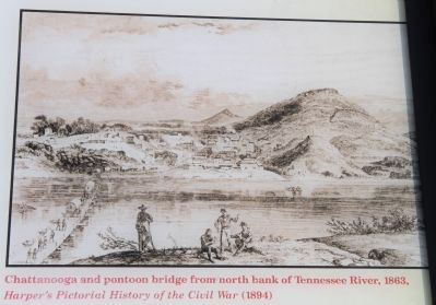
In the early morning of October 27, 1,150 soldiers under Gen. William B. Hazen boarded pontoons near where you now stand and set out for Brown’s Ferry. One soldier remembered: “The night was clear. A bright moon hung in the west and we could see the rebel pickets standing on their bank of the river. They could not see us. The vapor that rises from a river on clear autumn nights effectually hid us from their sight. When we rounded Moccasin Point the current threw the boats toward them, but by quietly rowing all regained the north bank without an alarm.” A few minutes later, they landed on the south bank, surprising the Confederate guards at Brown’s Ferry. By sunrise, they had secured the area and began laying the pontoon bridge. Soon, wagons rolled to Chattanooga by the safer route called the Cracker Line (for the wagonloads of hardtack) and eased the supply crisis in Chattanooga.
Second Insert:
The Tennessee

Photographed by Austin Menzmer, May 26, 2013
2. Hazen's Raid at Brown's Ferry Marker - previous marker
Erected by Tennessee Civil War Trails.
Topics. This historical marker is listed in these topic lists: Bridges & Viaducts • War, US Civil • Waterways & Vessels. A significant historical month for this entry is September 1863.
Location. 35° 3.369′ N, 85° 18.784′ W. Marker is in Chattanooga, Tennessee, in Hamilton County. It is in Riverfront. It is on Riverfront Parkway 0.1 miles north of Power Alley, on the left when traveling east. Touch for map. Marker is in this post office area: Chattanooga TN 37402, United States of America. Touch for directions.

Regionally, this marker is in the American South, specifically in the Upper South, in Appalachia, and specifically in Southern Appalachia. Globally, it is in North America, the Western Hemisphere, the Western World, and the Anglosphere. Historically, it finds itself in what was once the original Cherokee Nation,
Photographed by Dale K. Benington, August 6, 2014
3. Hazen's Raid at Brown's Ferry Marker
Close-up view, that is displayed on the marker, of a Civil War era photograph showing General William B. Hazen.
Other nearby markers. At least 8 other markers are within walking distance of this marker: Ross's Landing (about 400 feet away, measured in a direct line); Flooding Along the Tennessee River (about 400 feet away); "Cherokee" (about 500 feet away); Chattanooga's First Citizens (about 500 feet away); Tennessee Valley Authority (about 500 feet away); a different marker also named Ross's Landing (approx. 0.2 miles away); Welcome to Chattanooga (approx. 0.2 miles away); Trail of Tears (approx. 0.2 miles away). Touch for a list and map of all markers in Chattanooga.
Another marker is no longer nearby. 1790 John Ross 1866 (was about 500 feet away but has been confirmed missing).
More about this marker. Very nice historical marker right near the Chattanooga Pier, right in downtown Chattanooga and in the Ross's Landing Park.
Additional keywords. Chattanooga, Ross's Landing, Hazen, Brown's Ferry, pontoon boats, Civil War, Chattanooga Campaign
Photographed by Dale K. Benington, August 6, 2014
4. Hazen's Raid at Brown's Ferry Marker
Close-up view, that is displayed on the marker, of an image from, Harper's Pictorial History of the Civil War (1894), showing Chattanooga and a pontoon bridge from the north bank.
Photographed by Dale K. Benington, August 6, 2014
5. Hazen's Raid at Brown's Ferry Marker
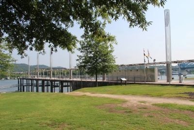
A distant view, looking northeast, of the marker situated in a riverfront public park, next to a public pier.
Photographed by Dale K. Benington, August 6, 2014
6. Hazen's Raid at Brown's Ferry Marker
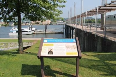
View. looking north across the Tennessee River, of the marker, next to a public pier.
Photographed by Dale K. Benington, August 6, 2014
7. Hazen's Raid at Brown's Ferry Marker
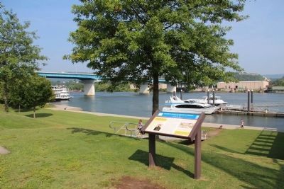
View, looking northwest, of the marker situated in a riverfront public park.
Credits. This page was last revised on August 12, 2025. It was originally submitted on June 25, 2013, by Austin Menzmer of Chattanooga, Tennessee. This page has been viewed 1,681 times since then and 57 times this year. Photos: 1. submitted on August 8, 2025, by David Rozzelle of Knoxville, Tennessee. 2. submitted on June 25, 2013, by Austin Menzmer of Chattanooga, Tennessee. 3, 4, 5, 6, 7. submitted on June 10, 2015, by Dale K. Benington of Toledo, Ohio. • Bill Pfingsten was the editor who published this page.
