New London in New London County, Connecticut — The American Northeast (New England)
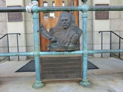
First Step to Freedom
This first step to freedom revealed resources which ultimately through trials in Hartford and New Haven and an appeal to the U.S. Supreme Court by former President John Quincy Adams won their liberty as persons to return home by missionary ship to Sierra Leone in 1841.
Thames River waves lapped against the white-striped loft black hull of Amistad for 14 months until it was refurbished and sold for salvage nearby at Joseph Lawrence’s dock. The cargo of silks, satins and other treasures were auctioned off at this Custom House on these front steps.
Amistad had unjustly held leader Joseph Cinque and his people as slaves in its hold before it became the vehicle for their passage to freedom. Never before, or since, has there been record of such freedom won!
Topics and series. This historical marker is listed in these topic lists: Abolition & Underground RR • African Americans • Industry & Commerce • Law Enforcement • Waterways & Vessels. In addition, it is included in the Former U.S. Presidents: #06 John Quincy Adams series list. A significant historical year for this entry is 1839.
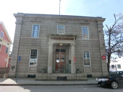
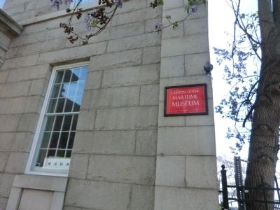
Location. 41° 21.133′ N, 72° 5.75′ W. Marker is in New London, Connecticut, in New London County. Marker is on Bank Street just east of Pearl Street. The plaque is at the base of the steps of the Custom House which is now the New London Maritime Museum. Touch for map. Marker is in this post office area: New London CT 06320, United States of America. Touch for directions.
Other nearby markers. At least 8 other markers are within walking distance of this marker. 181 Bank Street (a few steps from this marker); "Do you want to be slave or free?" (a few steps from this marker); 194 Bank Street (within shouting distance of this marker); 133 Bank Street (within shouting distance of this marker); 138 Bank Street (within shouting distance of this marker); Athena Stands Watch (about 300 feet away, measured in a direct line); Changing Shoreline (about 300 feet away); The Hotel Bristol (about 400 feet away). Touch for a list and map of all markers in New London.
Credits. This page was last revised on May 6, 2023. It was originally submitted on July 3, 2013, by Don Morfe of Baltimore, Maryland. This page has been viewed 556 times since then and 13 times this year. Photos: 1, 2, 3. submitted on July 3, 2013, by Don Morfe of Baltimore, Maryland. 4. submitted on September 25, 2020, by Allen C. Browne of Silver Spring, Maryland. • Bill Pfingsten was the editor who published this page.


